Tama River
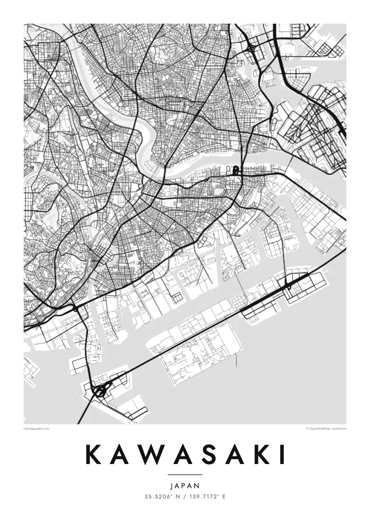
The wide river forming the northern boundary with Tokyo. Its long, gently curving course and the many bridges across it give the poster a strong diagonal edge.
Minimalist map poster · Japan
35.5206° N / 139.7172° E
A long, narrow city running from Tokyo Bay's industrial landfill up the Tama River to wooded hills.
One city, five moods
Tap a style to see it on the wall. Every style costs the same — printed, framed or as HD files.
 Actual pixels · 24 × 36″ print file
Print-sharp
This is a 100% crop of the real print file. Every poster — printed, framed or downloaded — is rendered on our servers at 300 DPI, up to 7,200 × 10,800 pixels, so even the smallest lanes stay crisp on a 24 × 36″ print.
On the wall


The map
Kawasaki is shaped like a ribbon. It runs northwest in a long band along the southern bank of the Tama River, which separates it from Tokyo, while Yokohama borders it to the south. At the bay end, rectangular landfill islands, docks and canals make a hard-edged pattern of heavy industry; inland, the street network softens into residential neighbourhoods and eventually into the Tama Hills.
The city is divided into seven wards, each occupying a slice of that band. Near the coast, Kawasaki Daishi, a large Buddhist temple, draws millions of visitors at New Year. Farther upstream, Musashi-Kosugi has become a cluster of high-rise towers around a busy rail junction, one of many places where train lines cross the river toward central Tokyo.
A Kawasaki map poster shows a city that is rarely seen as a single shape. From the geometric reclaimed land of the waterfront to the curving roads of the hills, its whole length is framed by the broad line of the Tama River, making for a composition that feels both industrial and surprisingly green.
The wide river forming the northern boundary with Tokyo. Its long, gently curving course and the many bridges across it give the poster a strong diagonal edge.
Rectangular artificial islands and docks along Tokyo Bay, part of the Keihin industrial zone. Their straight edges and canals form the most geometric section of the map.
The hilly northwest of the city, where roads follow valleys and ridges. Here the pattern turns loose and organic, a clear contrast to the waterfront.
Make it yours
Add a date, a name or a line of your own, switch style, size or orientation.
The free preview is low-resolution with a watermark. Prints and HD files are rendered at 300 DPI, up to 7,200 × 10,800 px, without a watermark.
Why Kawasaki
Kawasaki is home to many people who commute into Tokyo or Yokohama but think of this city as their own. A poster of its full length, from bay to hills, shows how a single ward fits into the whole, and makes a thoughtful gift for a new home or a move away.
Set your own title, add a subtitle and a date, and choose one of five styles, from Classic black & white to Blueprint. The HD files cost $9 and include 300 DPI PNGs and print-ready PDFs, so a local print shop can produce an A2 or A3 copy without fuss.
Order the Kawasaki poster| Print size | Resolution | Files |
|---|---|---|
| 30 × 40 cm11.8 × 15.7″ | 3,543 × 4,724 px | PNG · PDF |
| 29.7 × 42 cm (A3)11.7 × 16.5″ | 3,508 × 4,961 px | PNG · PDF |
| 42 × 59.4 cm (A2)16.5 × 23.4″ | 4,961 × 7,016 px | PNG · PDF |
| 45.7 × 61 cm18 × 24″ | 5,400 × 7,200 px | PNG · PDF |
| 50 × 70 cm19.7 × 27.6″ | 5,906 × 8,268 px | PNG · PDF |
| 61 × 91.4 cm24 × 36″ | 7,200 × 10,800 px | PNG · PDF |
For comparison, the free preview is 900 px wide, watermarked and meant for screens. The HD files have up to 8× the resolution in each direction and print cleanly at full poster size.
Pick a style at the top of the page, then choose Printed Poster — a size and, if you like, a frame — or Digital HD Files. Checkout takes one step, and your order page updates as soon as the payment goes through.
It is printed on premium 200 gsm matte paper in one of six sizes, from 30 × 40 cm to 24 × 36″. Printed posters start at $39, shipping included.
Yes. Choose a solid wood frame in black, white, natural oak or dark wood. It comes with shatterproof glazing and is ready to hang. Framed posters start at $99, shipping included.
Shipping is free to 60+ countries. Each poster is printed by the nearest of our print partners in 30+ countries and usually arrives in 3–7 business days. You can follow the status and tracking under My Orders. A few countries take 2–5 weeks, and where we don't ship yet, the site tells you before you pay.
Send us a photo within 14 days of delivery and we will reprint it for free or refund you.
Yes. In the editor on this page, change the title, the subtitle and the coordinates line to anything you like, and pick a style and size. Printed, framed and digital orders all use exactly your design.
For $9 you get 300 DPI PNG and print-ready PDF files in all six sizes, without a watermark, to print anywhere. Not sure yet? Download a free watermarked preview first.
Nearby
