Peacock River
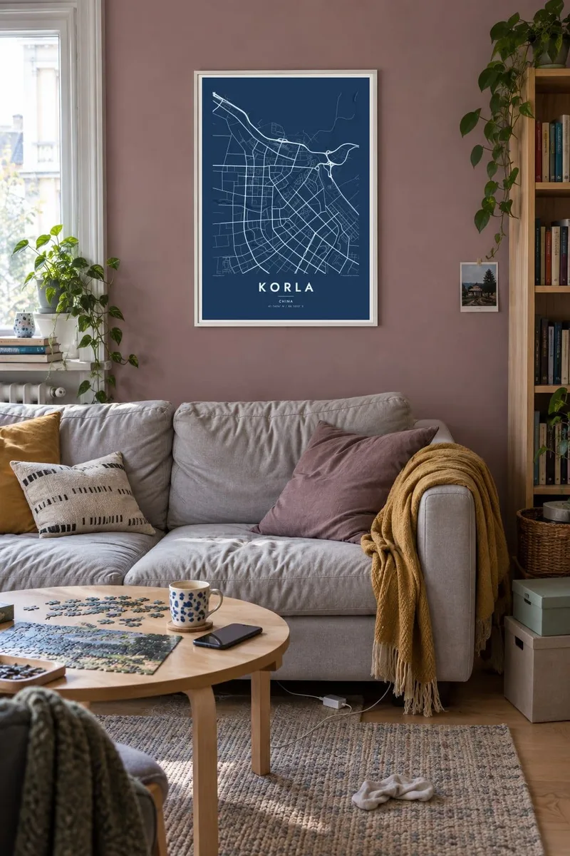
The Kongque River runs through the centre between landscaped banks. On the map it forms a continuous ribbon separating the northern and southern parts of the city.
Minimalist map poster · China
41.7606° N / 86.1523° E
An oasis city divided by the Peacock River, its green grid set against the open desert edge of the Tarim Basin.

One city, five moods
Tap a style to see it on the wall. Every style costs the same — printed, framed or as HD files.
 Actual pixels · 24 × 36″ print file
Print-sharp
This is a 100% crop of the real print file. Every poster — printed, framed or downloaded — is rendered on our servers at 300 DPI, up to 7,200 × 10,800 pixels, so even the smallest lanes stay crisp on a 24 × 36″ print.
On the wall


The map
Korla sits on the northern rim of the Tarim Basin in Xinjiang, where the foothills of the Tianshan meet the desert. From above, the city looks like a green, irrigated island. The Kongque, or Peacock River, flows out of Bosten Lake and crosses the city. Parks and embankments line its course, and the river divides the urban area into two halves.
Korla is the seat of the Bayingolin Mongol Autonomous Prefecture, one of the largest prefecture-level divisions in China by area. The city is known throughout the country for Korla fragrant pears, which are grown in the surrounding orchards. It is also a base for the oil and gas industry of the Tarim Basin.
A Korla map poster shows how a city grows around water in dry country. It has broad, well-spaced avenues, a river corridor through the middle, and a street network that thins out suddenly where irrigation ends. It is a graphic portrait of an oasis, drawn in clean lines that make the boundary between city and desert easy to see.
The Kongque River runs through the centre between landscaped banks. On the map it forms a continuous ribbon separating the northern and southern parts of the city.
Much of the city was laid out in recent decades. Its broad, regularly spaced roads form a spacious grid that stays clear even at small print sizes.
To the north, the foothills of the Tianshan rise close to the city, and the Iron Gate Pass leads through them toward Bosten Lake.
Make it yours
Add a date, a name or a line of your own, switch style, size or orientation.
The free preview is low-resolution with a watermark. Prints and HD files are rendered at 300 DPI, up to 7,200 × 10,800 px, without a watermark.
Why Korla
For someone from Korla, or someone who spent years in the region's oil fields and orchards, the map is a quiet reminder of a very particular landscape. You can personalise the title and subtitle with a name or a meaningful date, and keep or edit the coordinates line.
Five styles let the poster fit different rooms: Classic black and white, Noir, Paper, Blueprint and Sand. You can order it printed on matte paper, framed or unframed, or buy the $9 digital set, which has 300 DPI PNG and PDF files in six sizes.
Order the Korla poster| Print size | Resolution | Files |
|---|---|---|
| 30 × 40 cm11.8 × 15.7″ | 3,543 × 4,724 px | PNG · PDF |
| 29.7 × 42 cm (A3)11.7 × 16.5″ | 3,508 × 4,961 px | PNG · PDF |
| 42 × 59.4 cm (A2)16.5 × 23.4″ | 4,961 × 7,016 px | PNG · PDF |
| 45.7 × 61 cm18 × 24″ | 5,400 × 7,200 px | PNG · PDF |
| 50 × 70 cm19.7 × 27.6″ | 5,906 × 8,268 px | PNG · PDF |
| 61 × 91.4 cm24 × 36″ | 7,200 × 10,800 px | PNG · PDF |
For comparison, the free preview is 900 px wide, watermarked and meant for screens. The HD files have up to 8× the resolution in each direction and print cleanly at full poster size.
Pick a style at the top of the page, then choose Printed Poster — a size and, if you like, a frame — or Digital HD Files. Checkout takes one step, and your order page updates as soon as the payment goes through.
It is printed on premium 200 gsm matte paper in one of six sizes, from 30 × 40 cm to 24 × 36″. Printed posters start at $39, shipping included.
Yes. Choose a solid wood frame in black, white, natural oak or dark wood. It comes with shatterproof glazing and is ready to hang. Framed posters start at $99, shipping included.
Shipping is free to 60+ countries. Each poster is printed by the nearest of our print partners in 30+ countries and usually arrives in 3–7 business days. You can follow the status and tracking under My Orders. A few countries take 2–5 weeks, and where we don't ship yet, the site tells you before you pay.
Send us a photo within 14 days of delivery and we will reprint it for free or refund you.
Yes. In the editor on this page, change the title, the subtitle and the coordinates line to anything you like, and pick a style and size. Printed, framed and digital orders all use exactly your design.
For $9 you get 300 DPI PNG and print-ready PDF files in all six sizes, without a watermark, to print anywhere. Not sure yet? Download a free watermarked preview first.
Nearby
