Kvitøyjøkulen
The ice cap covers nearly the whole island, so the interior prints as a clean, unbroken field bounded by a single smooth line.
Minimalist map poster · Norway
80.1765° N / 32.4700° E
An almost perfectly smooth dome of ice at the far eastern edge of Svalbard, with only slivers of bare shore.

One city, five moods
Tap a style to see it on the wall. Every style costs the same — printed, framed or as HD files.
 Actual pixels · 24 × 36″ print file
Print-sharp
This is a 100% crop of the real print file. Every poster — printed, framed or downloaded — is rendered on our servers at 300 DPI, up to 7,200 × 10,800 pixels, so even the smallest lanes stay crisp on a 24 × 36″ print.
On the wall

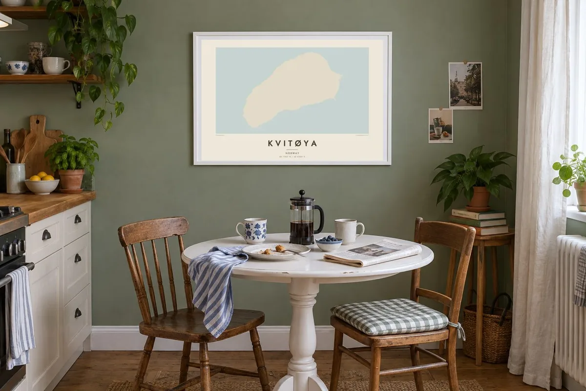

The island
Kvitøya, the White Island, is the easternmost island of Svalbard and one of the most isolated places in the Norwegian Arctic. Nearly its whole surface is covered by a single ice cap, Kvitøyjøkulen, which gives the island a rounded, elongated outline with few bays or inlets. Only small areas of ice-free land appear at its edges, mainly on low headlands where the ice gives way to gravel and rock.
There are no roads, buildings or permanent settlements. A map of Kvitøya is therefore a study in outline: one smooth, continuous coastline enclosing an almost uniform interior. The surrounding sea is ice-covered for much of the year, and the island lies well east of the rest of the archipelago, looking out across the Barents Sea toward Franz Josef Land.
Kvitøya is best known as the place where the remains of S. A. Andrée's 1897 balloon expedition to the North Pole were found in 1930, at a point now called Andréeneset. A Kvitøya map poster suits those drawn to polar history and to the stark simplicity of a place defined almost entirely by ice and sea.
The ice cap covers nearly the whole island, so the interior prints as a clean, unbroken field bounded by a single smooth line.
A low headland at the island's southwestern tip, where the Andrée expedition's last camp was discovered more than thirty years after the balloon disappeared.
Kvitøya lies apart from the rest of Svalbard, so on the map it floats alone in open water, an isolated form with nothing nearby.
Make it yours
Add a date, a name or a line of your own, switch style, size or orientation.
The free preview is low-resolution with a watermark. Prints and HD files are rendered at 300 DPI, up to 7,200 × 10,800 px, without a watermark.
Why Kvitøya
This is a map for readers of polar exploration, for expedition cruise passengers who have seen the island from the deck, and for anyone who likes minimal art. Its outline is so simple it reads almost like an abstract shape.
Personalise the title, subtitle and coordinates line, for example with the year of an Arctic voyage, and choose from five styles. Noir and Blueprint both give the ice a cold, graphic presence, while Paper keeps it soft.
Order the Kvitøya poster| Print size | Resolution | Files |
|---|---|---|
| 30 × 40 cm11.8 × 15.7″ | 3,543 × 4,724 px | PNG · PDF |
| 29.7 × 42 cm (A3)11.7 × 16.5″ | 3,508 × 4,961 px | PNG · PDF |
| 42 × 59.4 cm (A2)16.5 × 23.4″ | 4,961 × 7,016 px | PNG · PDF |
| 45.7 × 61 cm18 × 24″ | 5,400 × 7,200 px | PNG · PDF |
| 50 × 70 cm19.7 × 27.6″ | 5,906 × 8,268 px | PNG · PDF |
| 61 × 91.4 cm24 × 36″ | 7,200 × 10,800 px | PNG · PDF |
For comparison, the free preview is 900 px wide, watermarked and meant for screens. The HD files have up to 8× the resolution in each direction and print cleanly at full poster size.
Pick a style at the top of the page, then choose Printed Poster — a size and, if you like, a frame — or Digital HD Files. Checkout takes one step, and your order page updates as soon as the payment goes through.
It is printed on premium 200 gsm matte paper in one of six sizes, from 30 × 40 cm to 24 × 36″. Printed posters start at $39, shipping included.
Yes. Choose a solid wood frame in black, white, natural oak or dark wood. It comes with shatterproof glazing and is ready to hang. Framed posters start at $99, shipping included.
Shipping is free to 60+ countries. Each poster is printed by the nearest of our print partners in 30+ countries and usually arrives in 3–7 business days. You can follow the status and tracking under My Orders. A few countries take 2–5 weeks, and where we don't ship yet, the site tells you before you pay.
Send us a photo within 14 days of delivery and we will reprint it for free or refund you.
Yes. In the editor on this page, change the title, the subtitle and the coordinates line to anything you like, and pick a style and size. Printed, framed and digital orders all use exactly your design.
For $9 you get 300 DPI PNG and print-ready PDF files in all six sizes, without a watermark, to print anywhere. Not sure yet? Download a free watermarked preview first.
Nearby
