Überlinger See
The long, narrow northwestern arm reaches deep into the German shore. This slender finger of water gives the lake its distinctive asymmetric outline.
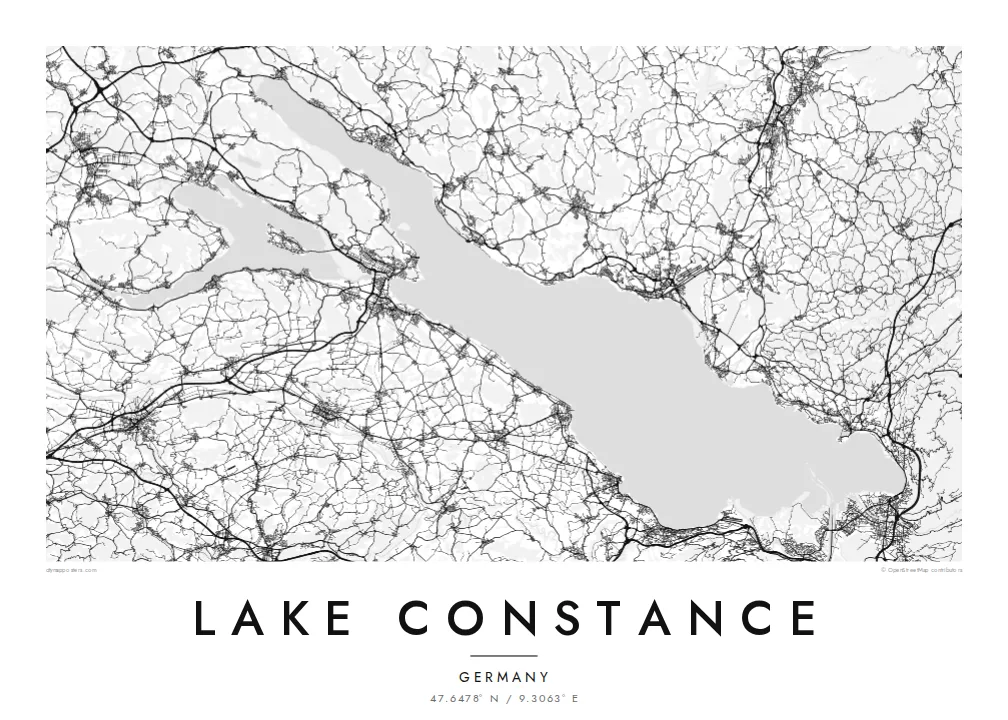
Minimalist map poster · Germany
47.6478° N / 9.3063° E
A broad lake shared by Germany, Austria and Switzerland, branching at its western end into slender arms and islands.


One city, five moods
Tap a style to see it on the wall. Every style costs the same — printed, framed or as HD files.
 Actual pixels · 24 × 36″ print file
Print-sharp
This is a 100% crop of the real print file. Every poster — printed, framed or downloaded — is rendered on our servers at 300 DPI, up to 7,200 × 10,800 pixels, so even the smallest lanes stay crisp on a 24 × 36″ print.
On the wall


The lake
Lake Constance, the Bodensee, lies at the northern edge of the Alps where Germany, Austria and Switzerland meet. Its main body, the Obersee, is a wide basin running from Bregenz in the southeast to the Überlinger See in the northwest. A separate lower lake, the Untersee, lies beyond the city of Konstanz, with a short stretch of the Rhine between the two.
The Rhine enters the lake near Bregenz and leaves at the western end, continuing toward the Rhine Falls. Unusually, the three countries have never agreed on a precise border through the Obersee, so much of the open water has no fixed dividing line. Around the shore, Lindau, Friedrichshafen, Meersburg, Konstanz and Bregenz form a ring of harbour towns.
The islands add detail to the outline. Lindau's old town sits on an island linked to the shore, Mainau is known for its gardens, and Reichenau, with its early medieval monasteries, is a UNESCO World Heritage site. A Lake Constance map poster shows the shores of all three countries together, framed around a single body of water.
The long, narrow northwestern arm reaches deep into the German shore. This slender finger of water gives the lake its distinctive asymmetric outline.
At the eastern end, Lindau's historic centre occupies a small island joined to the mainland by a road bridge and a railway embankment.
Konstanz sits where the Obersee narrows into the Rhine, which flows briefly as a river before widening into the Untersee around the island of Reichenau.
Make it yours
Add a date, a name or a line of your own, switch style, size or orientation.
The free preview is low-resolution with a watermark. Prints and HD files are rendered at 300 DPI, up to 7,200 × 10,800 px, without a watermark.
Why Lake Constance
Lake Constance is a shared home for people in three countries and a regular destination for cycling tours, sailing and summer holidays. A map of the whole lake connects every harbour, which makes it a fitting gift for anyone who knows its shores.
Personalise the title and subtitle, perhaps with Bodensee or a town name and a date, and choose from Classic black & white, Noir, Paper, Blueprint and Sand. The HD files cost $9 for all six sizes, and printed posters ship from partners in more than 30 countries.
Order the Lake Constance poster| Print size | Resolution | Files |
|---|---|---|
| 30 × 40 cm11.8 × 15.7″ | 3,543 × 4,724 px | PNG · PDF |
| 29.7 × 42 cm (A3)11.7 × 16.5″ | 3,508 × 4,961 px | PNG · PDF |
| 42 × 59.4 cm (A2)16.5 × 23.4″ | 4,961 × 7,016 px | PNG · PDF |
| 45.7 × 61 cm18 × 24″ | 5,400 × 7,200 px | PNG · PDF |
| 50 × 70 cm19.7 × 27.6″ | 5,906 × 8,268 px | PNG · PDF |
| 61 × 91.4 cm24 × 36″ | 7,200 × 10,800 px | PNG · PDF |
For comparison, the free preview is 900 px wide, watermarked and meant for screens. The HD files have up to 8× the resolution in each direction and print cleanly at full poster size.
Pick a style at the top of the page, then choose Printed Poster — a size and, if you like, a frame — or Digital HD Files. Checkout takes one step, and your order page updates as soon as the payment goes through.
It is printed on premium 200 gsm matte paper in one of six sizes, from 30 × 40 cm to 24 × 36″. Printed posters start at $39, shipping included.
Yes. Choose a solid wood frame in black, white, natural oak or dark wood. It comes with shatterproof glazing and is ready to hang. Framed posters start at $99, shipping included.
Shipping is free to 60+ countries. Each poster is printed by the nearest of our print partners in 30+ countries and usually arrives in 3–7 business days. You can follow the status and tracking under My Orders. A few countries take 2–5 weeks, and where we don't ship yet, the site tells you before you pay.
Send us a photo within 14 days of delivery and we will reprint it for free or refund you.
Yes. In the editor on this page, change the title, the subtitle and the coordinates line to anything you like, and pick a style and size. Printed, framed and digital orders all use exactly your design.
For $9 you get 300 DPI PNG and print-ready PDF files in all six sizes, without a watermark, to print anywhere. Not sure yet? Download a free watermarked preview first.
Nearby
