Glacial outline
The lake forms a narrow, slightly tapering shape in a steep valley, with its far end pointing toward the Victoria Glacier and the peaks above it.
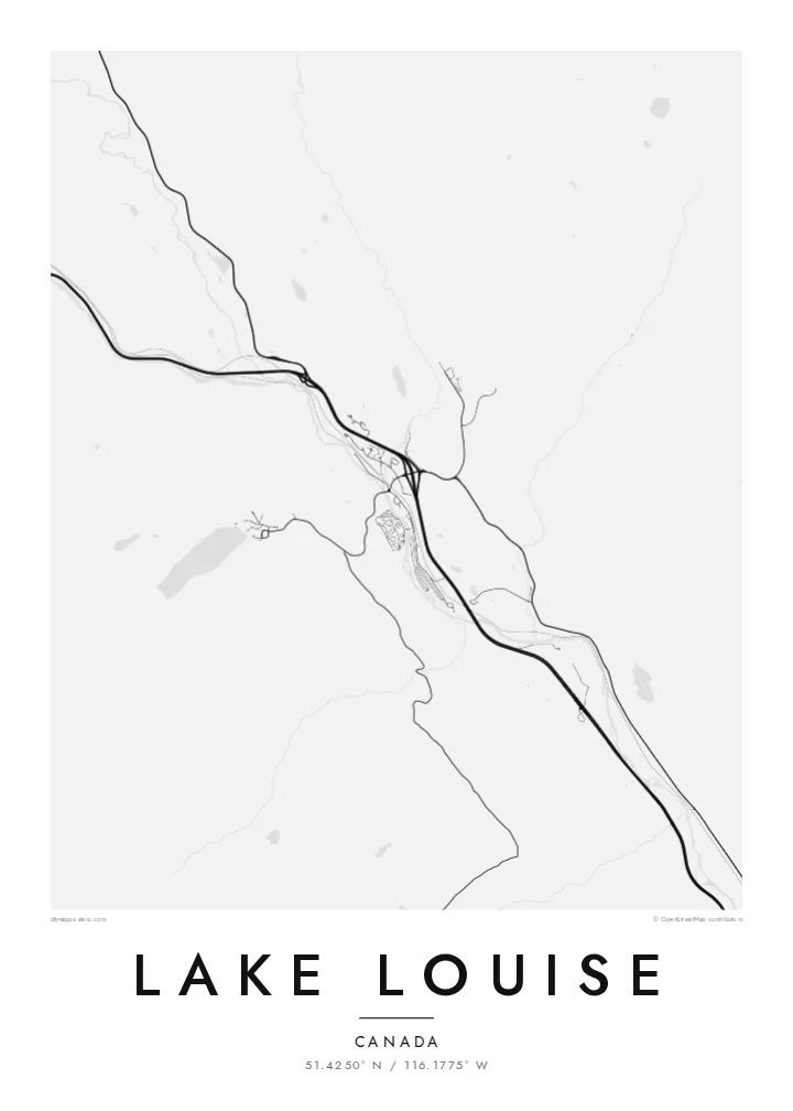
Minimalist map poster · Canada
51.4250° N / 116.1775° W
A small glacial lake in Banff National Park, set in a narrow valley below Mount Victoria and its glacier.
One city, five moods
Tap a style to see it on the wall. Every style costs the same — printed, framed or as HD files.
 Actual pixels · 24 × 36″ print file
Print-sharp
This is a 100% crop of the real print file. Every poster — printed, framed or downloaded — is rendered on our servers at 300 DPI, up to 7,200 × 10,800 pixels, so even the smallest lanes stay crisp on a 24 × 36″ print.
On the wall


The lake
Lake Louise lies in Banff National Park in the Canadian Rockies of Alberta. It is a compact lake, roughly two kilometres long, at the head of a steep-sided valley. On a map it is a simple elongated shape that runs from the hotel at its northeastern end toward the glaciers at the far southwestern end, with mountains rising almost straight from the water.
Meltwater from the Victoria Glacier feeds the lake, and fine rock flour suspended in the water gives it the colour it is known for. It was named after Princess Louise Caroline Alberta, a daughter of Queen Victoria, whose name was also given to the province. Trails follow the shoreline and climb to teahouses higher in the valley.
The Fairmont Chateau Lake Louise stands at the lake's northeastern end, and the village of Lake Louise is a short drive away in the Bow Valley. A Lake Louise map poster draws the lake, the surrounding peaks and the trails as fine lines, a clear and restrained picture of one of the best-known landscapes in Canada.
The lake forms a narrow, slightly tapering shape in a steep valley, with its far end pointing toward the Victoria Glacier and the peaks above it.
The northeastern shore holds the large hotel and its grounds. It is the only built-up area on the lake and the starting point for most trails.
Paths run along the lakeshore and switchback up to the teahouses at Lake Agnes and the Plain of Six Glaciers, showing as thin lines on the slopes.
Make it yours
Add a date, a name or a line of your own, switch style, size or orientation.
The free preview is low-resolution with a watermark. Prints and HD files are rendered at 300 DPI, up to 7,200 × 10,800 px, without a watermark.
Why Lake Louise
Lake Louise is often the high point of a trip through the Rockies and a frequent choice for weddings and anniversaries. The map is a calm, graphic alternative to the photographs people usually bring home, and it keeps the whole valley in one quiet frame.
Add names, a date or a short line in the title and subtitle, and edit the coordinates line if you wish. Choose Classic black & white, Noir, Paper, Blueprint or Sand, then download 300 DPI PNG and PDF files for $9 or order a printed poster.
Order the Lake Louise poster| Print size | Resolution | Files |
|---|---|---|
| 30 × 40 cm11.8 × 15.7″ | 3,543 × 4,724 px | PNG · PDF |
| 29.7 × 42 cm (A3)11.7 × 16.5″ | 3,508 × 4,961 px | PNG · PDF |
| 42 × 59.4 cm (A2)16.5 × 23.4″ | 4,961 × 7,016 px | PNG · PDF |
| 45.7 × 61 cm18 × 24″ | 5,400 × 7,200 px | PNG · PDF |
| 50 × 70 cm19.7 × 27.6″ | 5,906 × 8,268 px | PNG · PDF |
| 61 × 91.4 cm24 × 36″ | 7,200 × 10,800 px | PNG · PDF |
For comparison, the free preview is 900 px wide, watermarked and meant for screens. The HD files have up to 8× the resolution in each direction and print cleanly at full poster size.
Pick a style at the top of the page, then choose Printed Poster — a size and, if you like, a frame — or Digital HD Files. Checkout takes one step, and your order page updates as soon as the payment goes through.
It is printed on premium 200 gsm matte paper in one of six sizes, from 30 × 40 cm to 24 × 36″. Printed posters start at $39, shipping included.
Yes. Choose a solid wood frame in black, white, natural oak or dark wood. It comes with shatterproof glazing and is ready to hang. Framed posters start at $99, shipping included.
Shipping is free to 60+ countries. Each poster is printed by the nearest of our print partners in 30+ countries and usually arrives in 3–7 business days. You can follow the status and tracking under My Orders. A few countries take 2–5 weeks, and where we don't ship yet, the site tells you before you pay.
Send us a photo within 14 days of delivery and we will reprint it for free or refund you.
Yes. In the editor on this page, change the title, the subtitle and the coordinates line to anything you like, and pick a style and size. Printed, framed and digital orders all use exactly your design.
For $9 you get 300 DPI PNG and print-ready PDF files in all six sizes, without a watermark, to print anywhere. Not sure yet? Download a free watermarked preview first.
Nearby
