Emerald Bay
This narrow inlet on the southwest shore is almost closed off from the main lake. Tiny Fannette Island sits in its centre, with steep slopes rising on both sides.
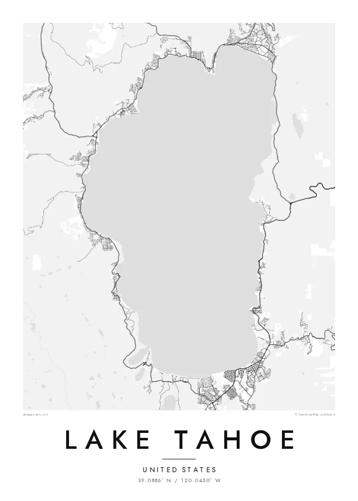
Minimalist map poster · United States
39.0886° N / 120.0450° W
A large, deep alpine lake crossed by the California–Nevada line, its oval shoreline broken only by Emerald Bay.
One city, five moods
Tap a style to see it on the wall. Every style costs the same — printed, framed or as HD files.
 Actual pixels · 24 × 36″ print file
Print-sharp
This is a 100% crop of the real print file. Every poster — printed, framed or downloaded — is rendered on our servers at 300 DPI, up to 7,200 × 10,800 pixels, so even the smallest lanes stay crisp on a 24 × 36″ print.
On the wall


The lake
Lake Tahoe lies high in the Sierra Nevada at around 1,900 metres and straddles the border between California and Nevada. It is the largest alpine lake in North America and, at about 500 metres deep, the second-deepest lake in the United States after Crater Lake. On a map it is a broad, simple oval about 35 kilometres from north to south.
The state line runs through the water at an angle, and roughly two-thirds of the lake lies in California. Towns such as South Lake Tahoe, Tahoe City and Incline Village sit at intervals around the shore, linked by highways that circle the lake, while the surrounding mountains hold ski resorts and hiking trails.
The best-known detail is Emerald Bay on the southwest shore, a narrow inlet holding Fannette Island, the lake's only island. On the northwest side, the Truckee River carries water out toward Reno. A Lake Tahoe map poster pairs this clean outline with the finer street patterns of the shoreline towns.
This narrow inlet on the southwest shore is almost closed off from the main lake. Tiny Fannette Island sits in its centre, with steep slopes rising on both sides.
The California–Nevada border crosses the lake at an angle and divides its waters between two states, with the larger share in California.
South Lake Tahoe on the southern shore and Tahoe City and Incline Village in the north add clusters of streets around an otherwise unbroken oval of water.
Make it yours
Add a date, a name or a line of your own, switch style, size or orientation.
The free preview is low-resolution with a watermark. Prints and HD files are rendered at 300 DPI, up to 7,200 × 10,800 px, without a watermark.
Why Lake Tahoe
For many people in California and Nevada, Lake Tahoe holds years of ski weekends, summer cabins and family trips. A map of the whole lake keeps every shore in view, from the cabin you rent to the beach you keep coming back to.
Personalise the title and subtitle with a cabin name, a family name or the year of your first visit, and pick one of five styles. Blueprint and Sand both suit the lake's simple shape. The HD files cost $9, or you can order a matte print with an optional wooden frame.
Order the Lake Tahoe poster| Print size | Resolution | Files |
|---|---|---|
| 30 × 40 cm11.8 × 15.7″ | 3,543 × 4,724 px | PNG · PDF |
| 29.7 × 42 cm (A3)11.7 × 16.5″ | 3,508 × 4,961 px | PNG · PDF |
| 42 × 59.4 cm (A2)16.5 × 23.4″ | 4,961 × 7,016 px | PNG · PDF |
| 45.7 × 61 cm18 × 24″ | 5,400 × 7,200 px | PNG · PDF |
| 50 × 70 cm19.7 × 27.6″ | 5,906 × 8,268 px | PNG · PDF |
| 61 × 91.4 cm24 × 36″ | 7,200 × 10,800 px | PNG · PDF |
For comparison, the free preview is 900 px wide, watermarked and meant for screens. The HD files have up to 8× the resolution in each direction and print cleanly at full poster size.
Pick a style at the top of the page, then choose Printed Poster — a size and, if you like, a frame — or Digital HD Files. Checkout takes one step, and your order page updates as soon as the payment goes through.
It is printed on premium 200 gsm matte paper in one of six sizes, from 30 × 40 cm to 24 × 36″. Printed posters start at $39, shipping included.
Yes. Choose a solid wood frame in black, white, natural oak or dark wood. It comes with shatterproof glazing and is ready to hang. Framed posters start at $99, shipping included.
Shipping is free to 60+ countries. Each poster is printed by the nearest of our print partners in 30+ countries and usually arrives in 3–7 business days. You can follow the status and tracking under My Orders. A few countries take 2–5 weeks, and where we don't ship yet, the site tells you before you pay.
Send us a photo within 14 days of delivery and we will reprint it for free or refund you.
Yes. In the editor on this page, change the title, the subtitle and the coordinates line to anything you like, and pick a style and size. Printed, framed and digital orders all use exactly your design.
For $9 you get 300 DPI PNG and print-ready PDF files in all six sizes, without a watermark, to print anywhere. Not sure yet? Download a free watermarked preview first.
Nearby
