Curving avenues
Streets wind and branch in soft curves across the town, following a landscape design rather than a grid, which makes the map instantly recognisable.
Minimalist map poster · France
48.8928° N / 2.1331° E
A nineteenth-century garden town in a loop of the Seine, winding avenues curling around artificial lakes, streams and lawns

One city, five moods
Tap a style to see it on the wall. Every style costs the same — printed, framed or as HD files.
 Actual pixels · 24 × 36″ print file
Print-sharp
This is a 100% crop of the real print file. Every poster — printed, framed or downloaded — is rendered on our servers at 300 DPI, up to 7,200 × 10,800 pixels, so even the smallest lanes stay crisp on a 24 × 36″ print.
On the wall


The map
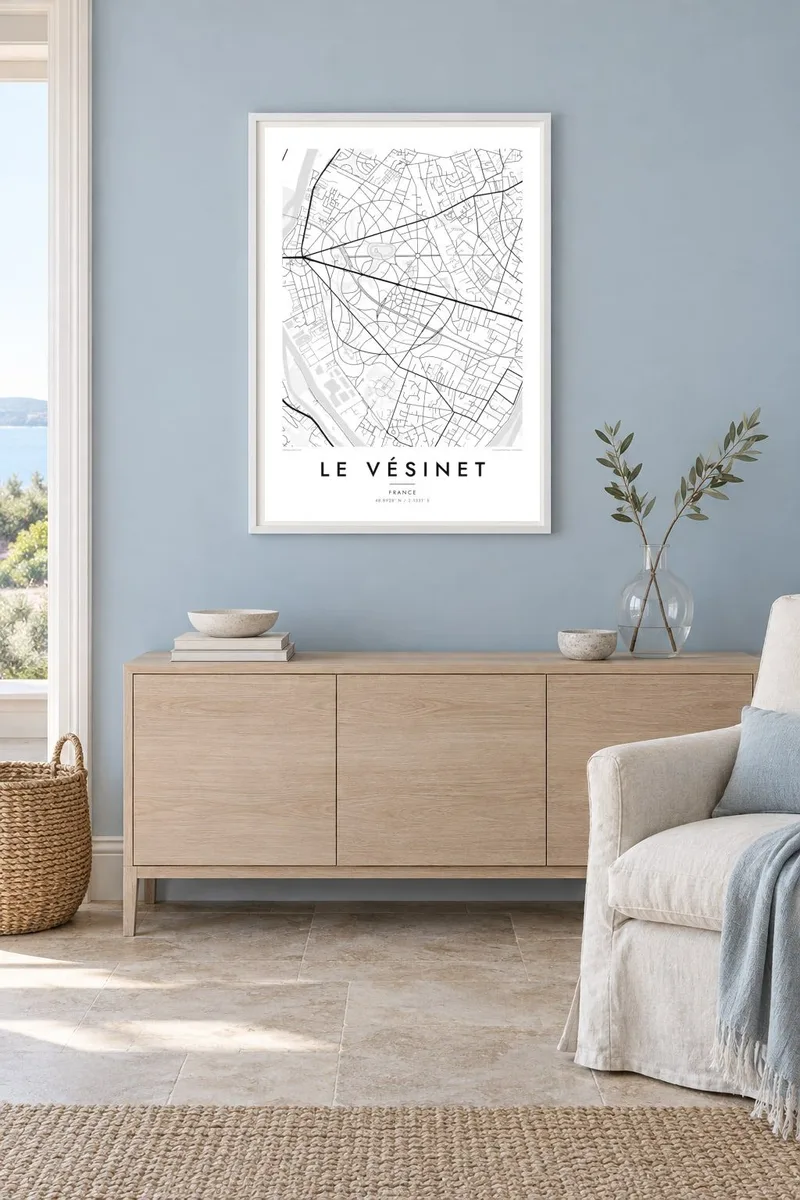
Le Vésinet lies west of Paris in a loop of the Seine, between Chatou and Saint-Germain-en-Laye. On a map it is immediately recognisable. Instead of a grid, the town is laid out as a landscape park, with avenues that curve and branch around lawns, lakes and narrow streams. Very few streets run straight for long.
That pattern dates from the 1850s, when the old forest of Le Vésinet was developed as a planned residential park. Alphonse Pallu led the project and the landscape architect Count Paul de Choulot designed its layout, with lakes and watercourses created artificially and large strips of green reserved as public lawns. The design is still protected today.
A Le Vésinet map poster is a print for lovers of urban design as well as residents. The flowing avenues, the chain of lakes and the green belts make an unusually elegant composition, almost like a drawing of a garden plan. In black and white, the structure becomes even more readable, and the town's distinctive character comes through clearly.
Streets wind and branch in soft curves across the town, following a landscape design rather than a grid, which makes the map instantly recognisable.
Artificial lakes and narrow watercourses run through the town, linked by the park plan. They add organic, flowing shapes to the composition.
The Seine curves around this part of the western suburbs. Nearby, its loops frame the town and connect it visually with Chatou and Croissy.
Make it yours
Add a date, a name or a line of your own, switch style, size or orientation.
The free preview is low-resolution with a watermark. Prints and HD files are rendered at 300 DPI, up to 7,200 × 10,800 px, without a watermark.
Why Le Vésinet
For residents of Le Vésinet, and for anyone interested in garden cities and landscape design, this map is both a portrait of home and a document of urban planning. It looks elegant in a study, a library or a living room.
Add your own title, subtitle and coordinates line, with French accents preserved. Choose from five styles: Classic black & white, Noir, Paper, Blueprint and Sand. Paper suits the nineteenth-century character of the town.
Order the Le Vésinet poster| Print size | Resolution | Files |
|---|---|---|
| 30 × 40 cm11.8 × 15.7″ | 3,543 × 4,724 px | PNG · PDF |
| 29.7 × 42 cm (A3)11.7 × 16.5″ | 3,508 × 4,961 px | PNG · PDF |
| 42 × 59.4 cm (A2)16.5 × 23.4″ | 4,961 × 7,016 px | PNG · PDF |
| 45.7 × 61 cm18 × 24″ | 5,400 × 7,200 px | PNG · PDF |
| 50 × 70 cm19.7 × 27.6″ | 5,906 × 8,268 px | PNG · PDF |
| 61 × 91.4 cm24 × 36″ | 7,200 × 10,800 px | PNG · PDF |
For comparison, the free preview is 900 px wide, watermarked and meant for screens. The HD files have up to 8× the resolution in each direction and print cleanly at full poster size.
Pick a style at the top of the page, then choose Printed Poster — a size and, if you like, a frame — or Digital HD Files. Checkout takes one step, and your order page updates as soon as the payment goes through.
It is printed on premium 200 gsm matte paper in one of six sizes, from 30 × 40 cm to 24 × 36″. Printed posters start at $39, shipping included.
Yes. Choose a solid wood frame in black, white, natural oak or dark wood. It comes with shatterproof glazing and is ready to hang. Framed posters start at $99, shipping included.
Shipping is free to 60+ countries. Each poster is printed by the nearest of our print partners in 30+ countries and usually arrives in 3–7 business days. You can follow the status and tracking under My Orders. A few countries take 2–5 weeks, and where we don't ship yet, the site tells you before you pay.
Send us a photo within 14 days of delivery and we will reprint it for free or refund you.
Yes. In the editor on this page, change the title, the subtitle and the coordinates line to anything you like, and pick a style and size. Printed, framed and digital orders all use exactly your design.
For $9 you get 300 DPI PNG and print-ready PDF files in all six sizes, without a watermark, to print anywhere. Not sure yet? Download a free watermarked preview first.
Nearby
