Sacré-Cœur and the steps
The basilica crowns the butte. Below it, terraced gardens, a funicular and long stairways cut straight down a slope that ordinary streets can only climb in curves.
Minimalist map poster · France
48.8855° N / 2.3390° E
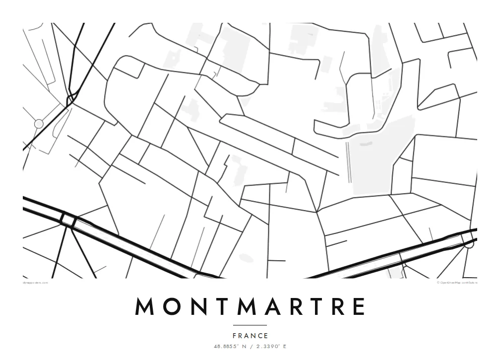
A rounded hill in northern Paris, its streets spiralling up to Sacré-Cœur and stairways cutting straight down the slopes
One city, five moods
Tap a style to see it on the wall. Every style costs the same — printed, framed or as HD files.
 Actual pixels · 24 × 36″ print file
Print-sharp
This is a 100% crop of the real print file. Every poster — printed, framed or downloaded — is rendered on our servers at 300 DPI, up to 7,200 × 10,800 pixels, so even the smallest lanes stay crisp on a 24 × 36″ print.
On the wall


The district
Montmartre is a hill, and the map makes that clear even without contour lines. Streets wrap around the butte in loose rings and zigzags. The steepest slopes are crossed only by long flights of steps. At the summit, the white basilica of Sacré-Cœur looks south over the city, with a formal terraced garden and a funicular running down its face.
Around the top, the old village survives in miniature: Place du Tertre, small squares, crooked lanes and a working vineyard, the Clos Montmartre. In the late nineteenth and early twentieth centuries, the hill's cheap rents drew painters such as Renoir, Toulouse-Lautrec and Picasso, who worked at the Bateau-Lavoir studios on its western slope.
At the foot of the hill, Boulevard de Clichy and Boulevard de Rochechouart trace a straight line along the former city wall, with the Moulin Rouge on the corner at Place Blanche. To the west lies the large Montmartre Cemetery. A Montmartre map poster sets the hill's circular streets against this hard southern edge, showing Paris at its most village-like.
The basilica crowns the butte. Below it, terraced gardens, a funicular and long stairways cut straight down a slope that ordinary streets can only climb in curves.
This straight boulevard runs along the foot of the hill, following the line of an old tax wall. It forms a sharp southern border to the district's tangle of streets.
A large walled cemetery sits in a former quarry on the western side of the hill. On the map it appears as a distinct block with its own internal paths.
Make it yours
Add a date, a name or a line of your own, switch style, size or orientation.
The free preview is low-resolution with a watermark. Prints and HD files are rendered at 300 DPI, up to 7,200 × 10,800 px, without a watermark.
Why Montmartre
Montmartre is where many people first felt they had arrived in Paris, whether by climbing the steps, sketching on the square or living in a small flat under the roofs. A map of the hill quietly holds on to that feeling.
Personalise the title and subtitle. A date, a street name or a short line all fit well. Choose Paper for a sketchbook tone or Classic black & white for a crisp, graphic look. Five styles are available in total.
Order the Montmartre poster| Print size | Resolution | Files |
|---|---|---|
| 30 × 40 cm11.8 × 15.7″ | 3,543 × 4,724 px | PNG · PDF |
| 29.7 × 42 cm (A3)11.7 × 16.5″ | 3,508 × 4,961 px | PNG · PDF |
| 42 × 59.4 cm (A2)16.5 × 23.4″ | 4,961 × 7,016 px | PNG · PDF |
| 45.7 × 61 cm18 × 24″ | 5,400 × 7,200 px | PNG · PDF |
| 50 × 70 cm19.7 × 27.6″ | 5,906 × 8,268 px | PNG · PDF |
| 61 × 91.4 cm24 × 36″ | 7,200 × 10,800 px | PNG · PDF |
For comparison, the free preview is 900 px wide, watermarked and meant for screens. The HD files have up to 8× the resolution in each direction and print cleanly at full poster size.
Pick a style at the top of the page, then choose Printed Poster — a size and, if you like, a frame — or Digital HD Files. Checkout takes one step, and your order page updates as soon as the payment goes through.
It is printed on premium 200 gsm matte paper in one of six sizes, from 30 × 40 cm to 24 × 36″. Printed posters start at $39, shipping included.
Yes. Choose a solid wood frame in black, white, natural oak or dark wood. It comes with shatterproof glazing and is ready to hang. Framed posters start at $99, shipping included.
Shipping is free to 60+ countries. Each poster is printed by the nearest of our print partners in 30+ countries and usually arrives in 3–7 business days. You can follow the status and tracking under My Orders. A few countries take 2–5 weeks, and where we don't ship yet, the site tells you before you pay.
Send us a photo within 14 days of delivery and we will reprint it for free or refund you.
Yes. In the editor on this page, change the title, the subtitle and the coordinates line to anything you like, and pick a style and size. Printed, framed and digital orders all use exactly your design.
For $9 you get 300 DPI PNG and print-ready PDF files in all six sizes, without a watermark, to print anywhere. Not sure yet? Download a free watermarked preview first.
Nearby
