Route 22 corridor
The William Penn Highway runs through the town as its main commercial spine, lined with large lots and shopping centres. On the map it is a clear, continuous line that organises the town.
Minimalist map poster · United States
40.4212° N / 79.7881° W
A hilly suburb east of Pittsburgh, threaded by the Turnpike and Route 22, with ridges and hollows shaping every curving street
One city, five moods
Tap a style to see it on the wall. Every style costs the same — printed, framed or as HD files.
 Actual pixels · 24 × 36″ print file
Print-sharp
This is a 100% crop of the real print file. Every poster — printed, framed or downloaded — is rendered on our servers at 300 DPI, up to 7,200 × 10,800 pixels, so even the smallest lanes stay crisp on a 24 × 36″ print.
On the wall


The map
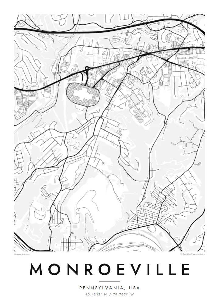
Monroeville is a municipality in Allegheny County on the eastern side of Pittsburgh, set in the steep, folded terrain typical of western Pennsylvania. Few streets here run straight for long. Roads follow ridgelines and drop into hollows, subdivisions curve around slopes, and wooded ravines break the built-up area into separate pockets.
Two major routes shape the town. The Pennsylvania Turnpike has an interchange here, and the William Penn Highway, part of the Route 22 corridor, carries most of the town's commercial strip. Monroeville Mall is known well beyond the region: George A. Romero used it as the main setting for his 1978 film Dawn of the Dead.
A Monroeville map poster shows a suburb shaped by topography as much as planning. The highways form strong, sweeping lines, the commercial corridor appears as a band of large parcels, and the residential streets wind through the hills in dense, looping patterns. It is intricate and restless, much like the landscape of the Pittsburgh region.
The William Penn Highway runs through the town as its main commercial spine, lined with large lots and shopping centres. On the map it is a clear, continuous line that organises the town.
The Pennsylvania Turnpike crosses the municipality, and its interchange adds curving ramps to the composition. It marks Monroeville's role as the eastern gateway to Pittsburgh.
Residential roads bend around hillsides and follow the valleys between them. This creates a dense, meandering pattern that shows the hilly terrain even in flat black lines.
Make it yours
Add a date, a name or a line of your own, switch style, size or orientation.
The free preview is low-resolution with a watermark. Prints and HD files are rendered at 300 DPI, up to 7,200 × 10,800 px, without a watermark.
Why Monroeville
Monroeville is home for many Pittsburgh-area families and a landmark for film fans who know the mall. A map of its winding streets suits a first home, a childhood neighbourhood or a movie-themed room, and it rewards a close look.
Set your own title, subtitle and coordinates, adding a street name, a date or a line of your own. Choose from Classic black & white, Noir, Paper, Blueprint and Sand. Order a matte print with a wooden frame, or download the HD files for $9.
Order the Monroeville poster| Print size | Resolution | Files |
|---|---|---|
| 30 × 40 cm11.8 × 15.7″ | 3,543 × 4,724 px | PNG · PDF |
| 29.7 × 42 cm (A3)11.7 × 16.5″ | 3,508 × 4,961 px | PNG · PDF |
| 42 × 59.4 cm (A2)16.5 × 23.4″ | 4,961 × 7,016 px | PNG · PDF |
| 45.7 × 61 cm18 × 24″ | 5,400 × 7,200 px | PNG · PDF |
| 50 × 70 cm19.7 × 27.6″ | 5,906 × 8,268 px | PNG · PDF |
| 61 × 91.4 cm24 × 36″ | 7,200 × 10,800 px | PNG · PDF |
For comparison, the free preview is 900 px wide, watermarked and meant for screens. The HD files have up to 8× the resolution in each direction and print cleanly at full poster size.
Pick a style at the top of the page, then choose Printed Poster — a size and, if you like, a frame — or Digital HD Files. Checkout takes one step, and your order page updates as soon as the payment goes through.
It is printed on premium 200 gsm matte paper in one of six sizes, from 30 × 40 cm to 24 × 36″. Printed posters start at $39, shipping included.
Yes. Choose a solid wood frame in black, white, natural oak or dark wood. It comes with shatterproof glazing and is ready to hang. Framed posters start at $99, shipping included.
Shipping is free to 60+ countries. Each poster is printed by the nearest of our print partners in 30+ countries and usually arrives in 3–7 business days. You can follow the status and tracking under My Orders. A few countries take 2–5 weeks, and where we don't ship yet, the site tells you before you pay.
Send us a photo within 14 days of delivery and we will reprint it for free or refund you.
Yes. In the editor on this page, change the title, the subtitle and the coordinates line to anything you like, and pick a style and size. Printed, framed and digital orders all use exactly your design.
For $9 you get 300 DPI PNG and print-ready PDF files in all six sizes, without a watermark, to print anywhere. Not sure yet? Download a free watermarked preview first.
Nearby
