Cape Mesurado
The headland at the tip of the peninsula, where the city was first settled. Its curved shoreline anchors the whole composition and frames the old downtown ridge.
Minimalist map poster · Liberia
6.3005° N / 10.7969° W
A narrow cape between the Atlantic and the Mesurado River, with creeks, islands and a long coastal strip.

One city, five moods
Tap a style to see it on the wall. Every style costs the same — printed, framed or as HD files.
 Actual pixels · 24 × 36″ print file
Print-sharp
This is a 100% crop of the real print file. Every poster — printed, framed or downloaded — is rendered on our servers at 300 DPI, up to 7,200 × 10,800 pixels, so even the smallest lanes stay crisp on a 24 × 36″ print.
On the wall

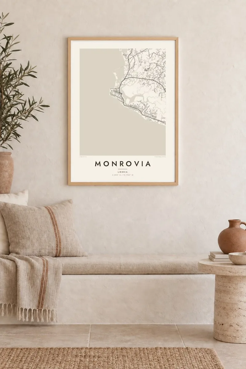
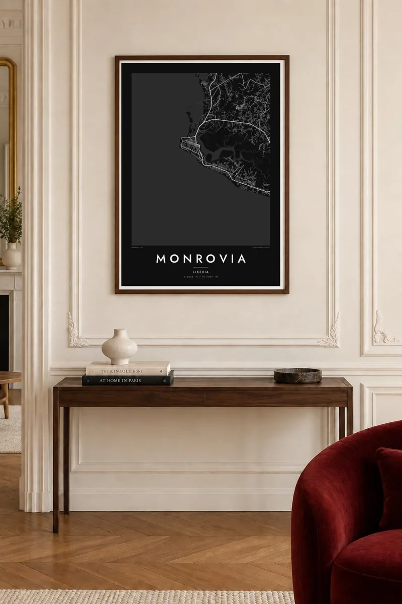
The map
Monrovia occupies Cape Mesurado, a slender peninsula where the Atlantic coast meets the mouth of the Mesurado River. The oldest part of the city climbs the ridge of the cape, with Broad Street and the downtown blocks set along its spine. Behind it, mangrove-lined creeks and wetlands divide the land into irregular pieces, so the map reads as a patchwork of solid ground and water.
Founded in 1822 and named after US President James Monroe, the city later spread southeast along the shore through Sinkor and beyond, following a long corridor parallel to the beach. To the north, Bushrod Island holds the Freeport and sits between the Mesurado and the Saint Paul River, linked to the centre by bridges across the water.
Because so much of Monrovia is defined by coastline and estuary, a Monrovia map poster is as much about water as about streets. The clean sweep of the ocean edge, the tangle of creeks and the narrow built-up strips between them give the design an almost nautical quality, one that stays legible even at the smallest print size.
The headland at the tip of the peninsula, where the city was first settled. Its curved shoreline anchors the whole composition and frames the old downtown ridge.
A low island north of the centre, bounded by the Mesurado and Saint Paul rivers. Its port basin and industrial blocks form a distinct cluster connected by bridges.
The main road running southeast from downtown through Sinkor, roughly parallel to the Atlantic shore. It traces the long, thin growth of the city along the coast.
Make it yours
Add a date, a name or a line of your own, switch style, size or orientation.
The free preview is low-resolution with a watermark. Prints and HD files are rendered at 300 DPI, up to 7,200 × 10,800 px, without a watermark.
Why Monrovia
For Liberians abroad, aid workers, diplomats and families with roots in the city, Monrovia is a place defined by its shoreline and its neighbourhoods. A framed map is a calm way to keep that geography close, whether it marks a birthplace, a posting or a return.
Personalise the title and subtitle, add a date or keep the coordinates line as it is, then pick one of five styles; Blueprint and Noir suit the strong coastline especially well. Choose a $9 set of HD files for home printing, or order a matte print with an optional wooden frame.
Order the Monrovia poster| Print size | Resolution | Files |
|---|---|---|
| 30 × 40 cm11.8 × 15.7″ | 3,543 × 4,724 px | PNG · PDF |
| 29.7 × 42 cm (A3)11.7 × 16.5″ | 3,508 × 4,961 px | PNG · PDF |
| 42 × 59.4 cm (A2)16.5 × 23.4″ | 4,961 × 7,016 px | PNG · PDF |
| 45.7 × 61 cm18 × 24″ | 5,400 × 7,200 px | PNG · PDF |
| 50 × 70 cm19.7 × 27.6″ | 5,906 × 8,268 px | PNG · PDF |
| 61 × 91.4 cm24 × 36″ | 7,200 × 10,800 px | PNG · PDF |
For comparison, the free preview is 900 px wide, watermarked and meant for screens. The HD files have up to 8× the resolution in each direction and print cleanly at full poster size.
Pick a style at the top of the page, then choose Printed Poster — a size and, if you like, a frame — or Digital HD Files. Checkout takes one step, and your order page updates as soon as the payment goes through.
It is printed on premium 200 gsm matte paper in one of six sizes, from 30 × 40 cm to 24 × 36″. Printed posters start at $39, shipping included.
Yes. Choose a solid wood frame in black, white, natural oak or dark wood. It comes with shatterproof glazing and is ready to hang. Framed posters start at $99, shipping included.
Shipping is free to 60+ countries. Each poster is printed by the nearest of our print partners in 30+ countries and usually arrives in 3–7 business days. You can follow the status and tracking under My Orders. A few countries take 2–5 weeks, and where we don't ship yet, the site tells you before you pay.
Send us a photo within 14 days of delivery and we will reprint it for free or refund you.
Yes. In the editor on this page, change the title, the subtitle and the coordinates line to anything you like, and pick a style and size. Printed, framed and digital orders all use exactly your design.
For $9 you get 300 DPI PNG and print-ready PDF files in all six sizes, without a watermark, to print anywhere. Not sure yet? Download a free watermarked preview first.
Nearby
