The Kniepsand
A huge sand plain along the western shore, over a kilometre wide in places. On the map it forms a broad pale margin between the dunes and the open North Sea.
Poster minimalist tal-mappa · il-Ġermanja
54.6601° N / 8.3502° E
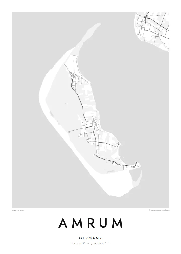
A slim North Frisian island edged on its seaward side by a vast plain of sand, with dunes and villages behind


Belt waħda, ħames atmosferi
Agħfas fuq stil biex tarah fuq il-ħajt. Kull stil jiswa l-istess — stampat, inkurnat jew bħala fajls HD.
 Pixels reali · fajl tal-istampar 24 × 36″
Preċiż għall-istampar
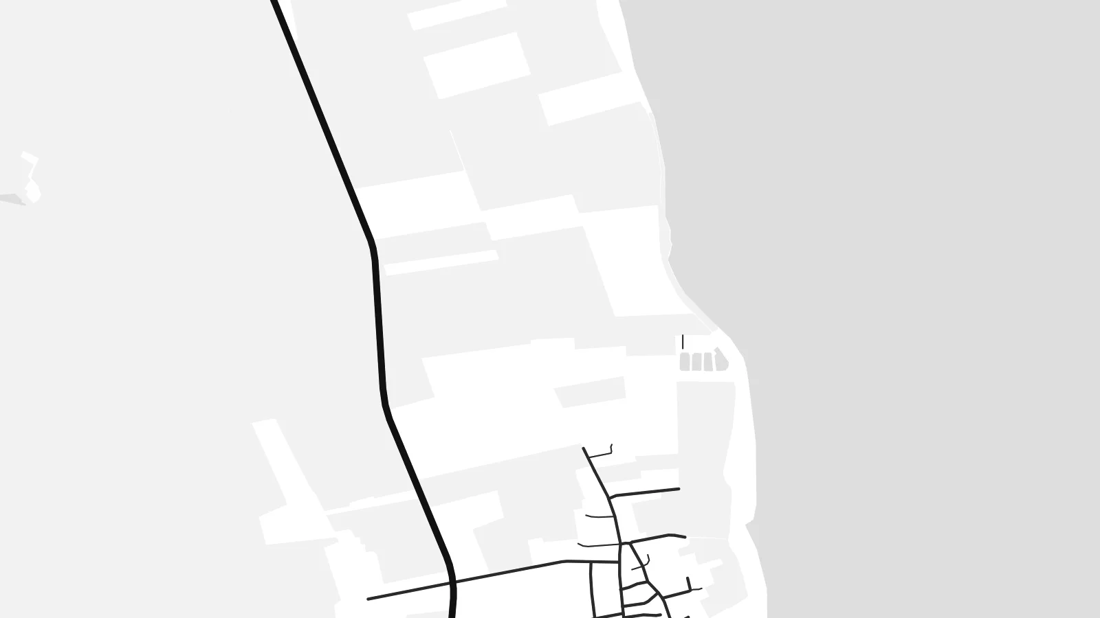
Dan huwa qtugħ ta' 100% mill-fajl tal-istampar reali. Kull poster — stampat, inkurnat jew iddawnlowdjat — jiġi ġġenerat fuq is-servers tagħna b'300 DPI, sa 7,200 × 10,800 pixel, biex saħansitra l-iżgħar toroq jibqgħu ċari fuq stampa ta' 24 × 36″.
Fuq il-ħajt


Il-mappa
Amrum lies in the Wadden Sea off Germany's North Sea coast, between the larger islands of Sylt and Föhr. It is long and narrow, running north to south. From above it divides clearly into bands: on the west a very wide sand flat, then a belt of dunes, then woodland and heath, and finally the eastern side where the villages and harbour face the tidal flats.
The Kniepsand, the broad sand bank along the west coast, is the island's defining feature and one of the widest beaches in Europe. Amrum's tall lighthouse stands among the dunes in the south. The island's villages, among them Wittdün, Nebel and Norddorf, line up along a single road that runs almost the full length of the island.
An Amrum map poster shows these layers as distinct textures: the empty sweep of the Kniepsand, the tangled paths of the dunes, and the neat street patterns of the villages. The surrounding Wadden Sea, part of a UNESCO World Heritage site, frames the island with shallows and tidal channels that shift in outline from year to year.
A huge sand plain along the western shore, over a kilometre wide in places. On the map it forms a broad pale margin between the dunes and the open North Sea.
Behind the beach, a band of high dunes runs most of the island's length. Footpaths and boardwalks thread through it, drawing fine, meandering lines on the map.
The island's small villages sit along a single north–south road on the eastern side. Each appears as a compact cluster of streets facing the tidal flats.
Agħmlu tiegħek
Żid data, isem jew sentenza tiegħek, ibdel l-istil, id-daqs jew l-orjentazzjoni.
Il-preview b'xejn hija b'riżoluzzjoni baxxa u bil-watermark. L-istampi u l-fajls HD jiġu ġġenerati b'300 DPI, sa 7,200 × 10,800 px, mingħajr watermark.
Għaliex Amrum
Amrum is a family island for many Germans, returned to summer after summer. A poster keeps the long shape of the place and the memory of the walk across the Kniepsand at home.
The title, subtitle and coordinates can carry your village, holiday cottage or the years you went. Blueprint suits the tidal channels of the Wadden Sea, and Paper gives the dunes and beach a light, natural feel.
Ordna l-poster Amrum| Daqs tal-istampa | Riżoluzzjoni | Fajls |
|---|---|---|
| 30 × 40 cm (11.8 × 15.7″) | 3,543 × 4,724 px | PNG · PDF |
| 29.7 × 42 cm (A3, 11.7 × 16.5″) | 3,508 × 4,961 px | PNG · PDF |
| 42 × 59.4 cm (A2, 16.5 × 23.4″) | 4,961 × 7,016 px | PNG · PDF |
| 45.7 × 61 cm (18 × 24″) | 5,400 × 7,200 px | PNG · PDF |
| 50 × 70 cm (19.7 × 27.6″) | 5,906 × 8,268 px | PNG · PDF |
| 61 × 91.4 cm (24 × 36″) | 7,200 × 10,800 px | PNG · PDF |
Għal paragun, il-preview b'xejn huwa wiesa' 900 px, għandu watermark u huwa maħsub għall-iskrins. Il-fajls HD għandhom sa 8× ir-riżoluzzjoni f'kull direzzjoni u jiġu stampati b'mod nadif fid-daqs sħiħ tal-poster.
Agħżel stil fin-naħa ta' fuq tal-paġna, imbagħad agħżel Poster Stampat — daqs u, jekk trid, kurniċa — jew Fajls Diġitali HD. Il-ħlas isir f'pass wieħed, u l-paġna tal-ordni tiegħek tiġi aġġornata malli l-ħlas jgħaddi.
Jiġi stampat fuq karta matte premium ta' 200 gsm f'wieħed minn sitt daqsijiet, minn 30 × 40 cm sa 24 × 36″. Il-posters stampati jibdew minn {printFrom}, bil-kunsinna inkluża.
Iva. Agħżel kurniċa tal-injam solidu f'iswed, abjad, ballut naturali jew injam skur. Tiġi bi ħġieġ li ma jinkisirx u lesta biex tittella'. Il-posters inkurnati jibdew minn {framedFrom}, bil-kunsinna inkluża.
Il-kunsinna hija b'xejn madwar id-dinja. Kull poster jiġi stampat mill-eqreb sieħeb tal-istampar tagħna f'aktar minn 30 pajjiż u ġeneralment jasal fi 3–7 ijiem tax-xogħol. Tista' ssegwi l-istatus u t-tracking taħt L-Ordnijiet Tiegħi.
Ibgħatilna ritratt fi żmien 14-il jum mill-kunsinna u aħna nistampawh mill-ġdid b'xejn jew nirrimborżawk.
Iva. Fl-editur ta' din il-paġna, biddel it-titlu, is-sottotitlu u l-linja tal-koordinati għal kwalunkwe ħaġa trid, u agħżel stil u daqs. L-ordnijiet stampati, inkurnati u diġitali kollha jużaw eżattament id-disinn tiegħek.
Għal $9 tikseb fajls PNG b'300 DPI u PDF lesti għall-istampar fis-sitt daqsijiet kollha, mingħajr watermark, biex tistampa kullimkien. Għadek mhux ċert? L-ewwel iddawnlowdja preview b'xejn bil-watermark.
