Baie des Anges
Nice's wide bay follows a smooth arc lined by the Promenade des Anglais, with the old town and the port tucked behind the castle hill at its eastern end.
Poster minimalist tal-mappa · Franza
43.9525° N / 7.5436° E
A curving shoreline of bays and rocky capes, with Cannes, Antibes, Nice and Monaco strung between the mountains and the sea


Belt waħda, ħames atmosferi
Agħfas fuq stil biex tarah fuq il-ħajt. Kull stil jiswa l-istess — stampat, inkurnat jew bħala fajls HD.
 Pixels reali · fajl tal-istampar 24 × 36″
Preċiż għall-istampar
Dan huwa qtugħ ta' 100% mill-fajl tal-istampar reali. Kull poster — stampat, inkurnat jew iddawnlowdjat — jiġi ġġenerat fuq is-servers tagħna b'300 DPI, sa 7,200 × 10,800 pixel, biex saħansitra l-iżgħar toroq jibqgħu ċari fuq stampa ta' 24 × 36″.
Fuq il-ħajt


Il-mappa
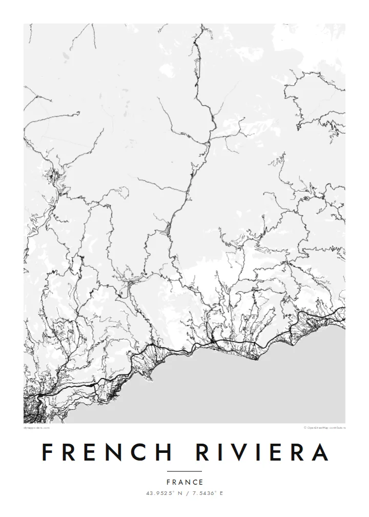
The French Riviera, or Côte d'Azur, runs along the Mediterranean in the far southeast of France, up to the Italian border. From above it is a series of wide bays separated by rocky capes: the Baie des Anges at Nice, Cap d'Antibes, Cap Ferrat and Cap Martin. Behind them the land rises quickly into the foothills of the Alps, which push the towns down toward the water.
The coast became a winter resort for wealthy British and Russian visitors in the nineteenth century, which is why the seafront at Nice is still called the Promenade des Anglais. Cannes holds its international film festival along the Croisette, and the principality of Monaco fills a tight pocket of coast between Nice and Menton.
A French Riviera map poster shows three distinct layers: the long curve of the seafront promenades, the dense street networks of the cities, and the corniche roads cut higher up the slope. East of Nice, the Basse, Moyenne and Grande Corniche run roughly parallel one above another, while west of Cannes the red rocks of the Estérel give the shore a jagged edge.
Nice's wide bay follows a smooth arc lined by the Promenade des Anglais, with the old town and the port tucked behind the castle hill at its eastern end.
Between Nice and Menton three roads run at different heights along the slope, and their near-parallel lines stack up one above another over the coast.
Cap d'Antibes and Cap Ferrat push into the sea as rounded peninsulas, their quiet villa roads contrasting with the denser cities on either side.
Agħmlu tiegħek
Żid data, isem jew sentenza tiegħek, ibdel l-istil, id-daqs jew l-orjentazzjoni.
Il-preview b'xejn hija b'riżoluzzjoni baxxa u bil-watermark. L-istampi u l-fajls HD jiġu ġġenerati b'300 DPI, sa 7,200 × 10,800 px, mingħajr watermark.
Għaliex French Riviera
It suits anyone who has lived on the coast, spent summers there or remembers one particular town. Set the title to Nice, Côte d'Azur or a place of your own, add a date in the subtitle, and move the coordinates to the spot that matters.
Noir gives the Mediterranean a night-time depth, while Sand suits the warm light of the coast. Classic black & white, Paper and Blueprint complete the five styles. Printed posters come on matte paper and ship from partners in more than 30 countries.
Ordna l-poster French Riviera| Daqs tal-istampa | Riżoluzzjoni | Fajls |
|---|---|---|
| 30 × 40 cm11.8 × 15.7″ | 3,543 × 4,724 px | PNG · PDF |
| 29.7 × 42 cm (A3)11.7 × 16.5″ | 3,508 × 4,961 px | PNG · PDF |
| 42 × 59.4 cm (A2)16.5 × 23.4″ | 4,961 × 7,016 px | PNG · PDF |
| 45.7 × 61 cm18 × 24″ | 5,400 × 7,200 px | PNG · PDF |
| 50 × 70 cm19.7 × 27.6″ | 5,906 × 8,268 px | PNG · PDF |
| 61 × 91.4 cm24 × 36″ | 7,200 × 10,800 px | PNG · PDF |
Għal paragun, il-preview b'xejn huwa wiesa' 900 px, għandu watermark u huwa maħsub għall-iskrins. Il-fajls HD għandhom sa 8× ir-riżoluzzjoni f'kull direzzjoni u jiġu stampati b'mod nadif fid-daqs sħiħ tal-poster.
Agħżel stil fin-naħa ta' fuq tal-paġna, imbagħad agħżel Poster Stampat — daqs u, jekk trid, kurniċa — jew Fajls Diġitali HD. Il-ħlas isir f'pass wieħed, u l-paġna tal-ordni tiegħek tiġi aġġornata malli l-ħlas jgħaddi.
Jiġi stampat fuq karta matte premium ta' 200 gsm f'wieħed minn sitt daqsijiet, minn 30 × 40 cm sa 24 × 36″. Il-posters stampati jibdew minn $39, bil-kunsinna inkluża.
Iva. Agħżel kurniċa tal-injam solidu f'iswed, abjad, ballut naturali jew injam skur. Tiġi bi ħġieġ li ma jinkisirx u lesta biex tittella'. Il-posters inkurnati jibdew minn $99, bil-kunsinna inkluża.
It-tbaħħir huwa b'xejn lejn 60+ pajjiż. Kull poster jiġi stampat mill-eqreb wieħed mis-sieħba tal-istampar tagħna f'30+ pajjiż u normalment jaslek fi 3–7 ijiem tax-xogħol. Tista' ssegwi l-istatus u t-traċċar taħt L-Ordnijiet Tiegħi. Xi pajjiżi jieħdu 2–5 ġimgħat, u fejn għadna ma nibagħtux, is-sit jgħidlek qabel tħallas.
Ibgħatilna ritratt fi żmien 14-il jum mill-kunsinna u aħna nistampawh mill-ġdid b'xejn jew nirrimborżawk.
Iva. Fl-editur ta' din il-paġna, biddel it-titlu, is-sottotitlu u l-linja tal-koordinati għal kwalunkwe ħaġa trid, u agħżel stil u daqs. L-ordnijiet stampati, inkurnati u diġitali kollha jużaw eżattament id-disinn tiegħek.
Għal $9 tikseb fajls PNG b'300 DPI u PDF lesti għall-istampar fis-sitt daqsijiet kollha, mingħajr watermark, biex tistampa kullimkien. Għadek mhux ċert? L-ewwel iddawnlowdja preview b'xejn bil-watermark.
