Oslofjord harbour
The inner fjord reaches into the city in a series of bays, piers and small islands. It gives the map a detailed, irregular southern edge.
Poster minimalist tal-mappa · in-Norveġja
59.9127° N / 10.7461° E
A fjord capital between water and forest, its compact centre wrapped around harbour inlets and backed by wooded hills


Belt waħda, ħames atmosferi
Agħfas fuq stil biex tarah fuq il-ħajt. Kull stil jiswa l-istess — stampat, inkurnat jew bħala fajls HD.
 Pixels reali · fajl tal-istampar 24 × 36″
Preċiż għall-istampar
Dan huwa qtugħ ta' 100% mill-fajl tal-istampar reali. Kull poster — stampat, inkurnat jew iddawnlowdjat — jiġi ġġenerat fuq is-servers tagħna b'300 DPI, sa 7,200 × 10,800 pixel, biex saħansitra l-iżgħar toroq jibqgħu ċari fuq stampa ta' 24 × 36″.
Fuq il-ħajt

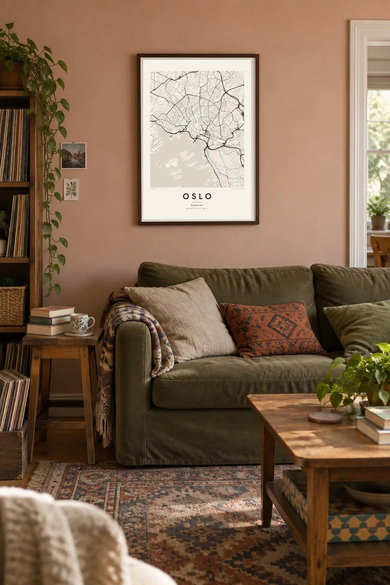

Il-mappa
Oslo lies at the head of the Oslofjord, where the long inlet narrows into a harbour scattered with small islands. The city fills the low ground around the water in a horseshoe, and forested hills known as the Marka enclose it to the north, east and west. On a map the contrast is striking: a dense centre, a shoreline of piers and peninsulas, and wide green space beyond the last streets.
The Akerselva river runs down from Lake Maridalsvannet through the city to the harbour. It once powered factories and is now lined with a footpath. On an Oslo map poster, Karl Johans gate draws a straight line from the Central Station to the Royal Palace, and the redeveloped Bjørvika waterfront, with the sloping marble Opera House, marks the eastern side of the harbour.
West of the centre, Frogner Park holds the Vigeland sculpture installation, a long axis of granite and bronze figures that shows on the map as a formal path through green space. On the hills above, the Holmenkollen ski jump looks down over the city and the fjord. Few capitals sit so close to both forest and water, and the map captures that balance in a single frame.
The inner fjord reaches into the city in a series of bays, piers and small islands. It gives the map a detailed, irregular southern edge.
A narrow river runs from the northern lakes through the city to the sea. It traces a thin, winding line that divides the eastern and western districts.
The Vigeland installation's formal central path cuts straight through the park. It is one of the clearest geometric features on the western side of the city.
Agħmlu tiegħek
Żid data, isem jew sentenza tiegħek, ibdel l-istil, id-daqs jew l-orjentazzjoni.
Il-preview b'xejn hija b'riżoluzzjoni baxxa u bil-watermark. L-istampi u l-fajls HD jiġu ġġenerati b'300 DPI, sa 7,200 × 10,800 px, mingħajr watermark.
Għaliex Oslo
Oslo is a city people remember for its light, water and nearby forest, whether they grew up there, studied there or came for a season. The map brings the whole shape of the place into one quiet image.
Add a title, subtitle and date, perhaps the year you moved to Norway, and choose Classic black & white, Noir, Paper, Blueprint or Sand. Download print-ready files instantly or order a matte poster shipped from a nearby print partner.
Ordna l-poster Oslo| Daqs tal-istampa | Riżoluzzjoni | Fajls |
|---|---|---|
| 30 × 40 cm (11.8 × 15.7″) | 3,543 × 4,724 px | PNG · PDF |
| 29.7 × 42 cm (A3, 11.7 × 16.5″) | 3,508 × 4,961 px | PNG · PDF |
| 42 × 59.4 cm (A2, 16.5 × 23.4″) | 4,961 × 7,016 px | PNG · PDF |
| 45.7 × 61 cm (18 × 24″) | 5,400 × 7,200 px | PNG · PDF |
| 50 × 70 cm (19.7 × 27.6″) | 5,906 × 8,268 px | PNG · PDF |
| 61 × 91.4 cm (24 × 36″) | 7,200 × 10,800 px | PNG · PDF |
Għal paragun, il-preview b'xejn huwa wiesa' 900 px, għandu watermark u huwa maħsub għall-iskrins. Il-fajls HD għandhom sa 8× ir-riżoluzzjoni f'kull direzzjoni u jiġu stampati b'mod nadif fid-daqs sħiħ tal-poster.
Agħżel stil fin-naħa ta' fuq tal-paġna, imbagħad agħżel Poster Stampat — daqs u, jekk trid, kurniċa — jew Fajls Diġitali HD. Il-ħlas isir f'pass wieħed, u l-paġna tal-ordni tiegħek tiġi aġġornata malli l-ħlas jgħaddi.
Jiġi stampat fuq karta matte premium ta' 200 gsm f'wieħed minn sitt daqsijiet, minn 30 × 40 cm sa 24 × 36″. Il-posters stampati jibdew minn {printFrom}, bil-kunsinna inkluża.
Iva. Agħżel kurniċa tal-injam solidu f'iswed, abjad, ballut naturali jew injam skur. Tiġi bi ħġieġ li ma jinkisirx u lesta biex tittella'. Il-posters inkurnati jibdew minn {framedFrom}, bil-kunsinna inkluża.
Il-kunsinna hija b'xejn madwar id-dinja. Kull poster jiġi stampat mill-eqreb sieħeb tal-istampar tagħna f'aktar minn 30 pajjiż u ġeneralment jasal fi 3–7 ijiem tax-xogħol. Tista' ssegwi l-istatus u t-tracking taħt L-Ordnijiet Tiegħi.
Ibgħatilna ritratt fi żmien 14-il jum mill-kunsinna u aħna nistampawh mill-ġdid b'xejn jew nirrimborżawk.
Iva. Fl-editur ta' din il-paġna, biddel it-titlu, is-sottotitlu u l-linja tal-koordinati għal kwalunkwe ħaġa trid, u agħżel stil u daqs. L-ordnijiet stampati, inkurnati u diġitali kollha jużaw eżattament id-disinn tiegħek.
Għal $9 tikseb fajls PNG b'300 DPI u PDF lesti għall-istampar fis-sitt daqsijiet kollha, mingħajr watermark, biex tistampa kullimkien. Għadek mhux ċert? L-ewwel iddawnlowdja preview b'xejn bil-watermark.
