Regent Street curve
The western boundary bends in a smooth arc down toward Piccadilly Circus. It is one of the most recognisable curves in central London and frames the district neatly on paper.
Poster minimalist tal-mappa · ir-Renju Unit
51.5132° N / 0.1356° W
A tight square of narrow streets boxed in by Oxford Street, Regent Street and Charing Cross Road


Belt waħda, ħames atmosferi
Agħfas fuq stil biex tarah fuq il-ħajt. Kull stil jiswa l-istess — stampat, inkurnat jew bħala fajls HD.
 Pixels reali · fajl tal-istampar 24 × 36″
Preċiż għall-istampar
Dan huwa qtugħ ta' 100% mill-fajl tal-istampar reali. Kull poster — stampat, inkurnat jew iddawnlowdjat — jiġi ġġenerat fuq is-servers tagħna b'300 DPI, sa 7,200 × 10,800 pixel, biex saħansitra l-iżgħar toroq jibqgħu ċari fuq stampa ta' 24 × 36″.
Fuq il-ħajt


Il-mappa
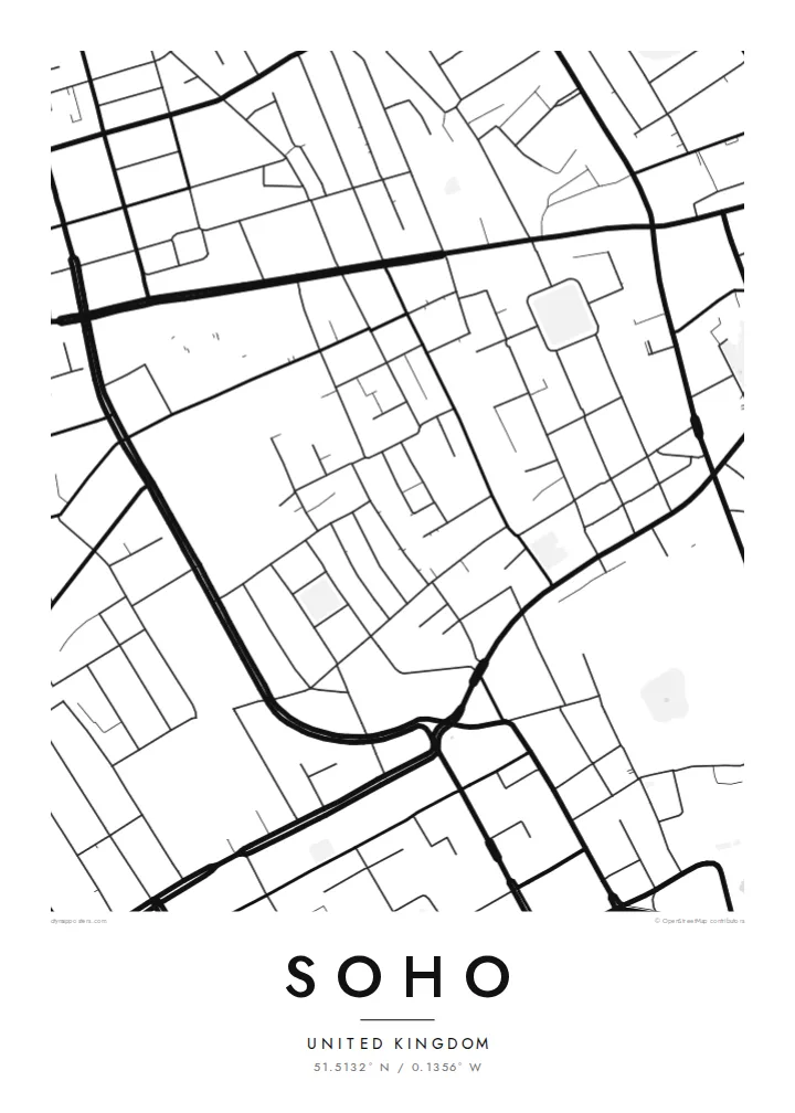
Soho is one of the most clearly bounded districts in London. Oxford Street runs along the north, Regent Street curves down the west, Charing Cross Road forms the east edge and Shaftesbury Avenue with Leicester Square marks the south. Inside that frame is a compact grid of short, narrow streets laid out largely in the seventeenth and eighteenth centuries.
Soho Square sits near the north-east corner and Golden Square near the west, both small green rectangles in a crowded pattern. Carnaby Street, Old Compton Street and Berwick Street run through the middle. Soho is also known in the history of medicine: in 1854 John Snow traced a cholera outbreak to a water pump on Broad Street, now Broadwick Street.
A Soho map poster shows how much is packed into such a small area. With no river or large park inside its edges, the image is all streets, and the curved line of Regent Street gives the print a single elegant sweep against the finer, more irregular blocks to its east.
The western boundary bends in a smooth arc down toward Piccadilly Circus. It is one of the most recognisable curves in central London and frames the district neatly on paper.
A small garden square near the north-east corner, one of the few open spaces in the district, reads as a clear pale rectangle among dense streets.
The street where John Snow identified the contaminated pump in 1854 runs east to west through the district, a small line on the map with a large place in public health history.
Agħmlu tiegħek
Żid data, isem jew sentenza tiegħek, ibdel l-istil, id-daqs jew l-orjentazzjoni.
Il-preview b'xejn hija b'riżoluzzjoni baxxa u bil-watermark. L-istampi u l-fajls HD jiġu ġġenerati b'300 DPI, sa 7,200 × 10,800 px, mingħajr watermark.
Għaliex Soho
Soho is where many people worked their first London job, saw a show, or spent long evenings in small restaurants. A map of it has the density of those memories, a lot of life in a very small square.
Give the poster your own title and subtitle, a year or a street name, and a coordinates line. Paper and Sand suit the older street pattern, while Noir works well for a district so closely tied to theatres and night-time.
Ordna l-poster Soho| Daqs tal-istampa | Riżoluzzjoni | Fajls |
|---|---|---|
| 30 × 40 cm (11.8 × 15.7″) | 3,543 × 4,724 px | PNG · PDF |
| 29.7 × 42 cm (A3, 11.7 × 16.5″) | 3,508 × 4,961 px | PNG · PDF |
| 42 × 59.4 cm (A2, 16.5 × 23.4″) | 4,961 × 7,016 px | PNG · PDF |
| 45.7 × 61 cm (18 × 24″) | 5,400 × 7,200 px | PNG · PDF |
| 50 × 70 cm (19.7 × 27.6″) | 5,906 × 8,268 px | PNG · PDF |
| 61 × 91.4 cm (24 × 36″) | 7,200 × 10,800 px | PNG · PDF |
Għal paragun, il-preview b'xejn huwa wiesa' 900 px, għandu watermark u huwa maħsub għall-iskrins. Il-fajls HD għandhom sa 8× ir-riżoluzzjoni f'kull direzzjoni u jiġu stampati b'mod nadif fid-daqs sħiħ tal-poster.
Agħżel stil fin-naħa ta' fuq tal-paġna, imbagħad agħżel Poster Stampat — daqs u, jekk trid, kurniċa — jew Fajls Diġitali HD. Il-ħlas isir f'pass wieħed, u l-paġna tal-ordni tiegħek tiġi aġġornata malli l-ħlas jgħaddi.
Jiġi stampat fuq karta matte premium ta' 200 gsm f'wieħed minn sitt daqsijiet, minn 30 × 40 cm sa 24 × 36″. Il-posters stampati jibdew minn {printFrom}, bil-kunsinna inkluża.
Iva. Agħżel kurniċa tal-injam solidu f'iswed, abjad, ballut naturali jew injam skur. Tiġi bi ħġieġ li ma jinkisirx u lesta biex tittella'. Il-posters inkurnati jibdew minn {framedFrom}, bil-kunsinna inkluża.
Il-kunsinna hija b'xejn madwar id-dinja. Kull poster jiġi stampat mill-eqreb sieħeb tal-istampar tagħna f'aktar minn 30 pajjiż u ġeneralment jasal fi 3–7 ijiem tax-xogħol. Tista' ssegwi l-istatus u t-tracking taħt L-Ordnijiet Tiegħi.
Ibgħatilna ritratt fi żmien 14-il jum mill-kunsinna u aħna nistampawh mill-ġdid b'xejn jew nirrimborżawk.
Iva. Fl-editur ta' din il-paġna, biddel it-titlu, is-sottotitlu u l-linja tal-koordinati għal kwalunkwe ħaġa trid, u agħżel stil u daqs. L-ordnijiet stampati, inkurnati u diġitali kollha jużaw eżattament id-disinn tiegħek.
Għal $9 tikseb fajls PNG b'300 DPI u PDF lesti għall-istampar fis-sitt daqsijiet kollha, mingħajr watermark, biex tistampa kullimkien. Għadek mhux ċert? L-ewwel iddawnlowdja preview b'xejn bil-watermark.
