Meeting of rivers
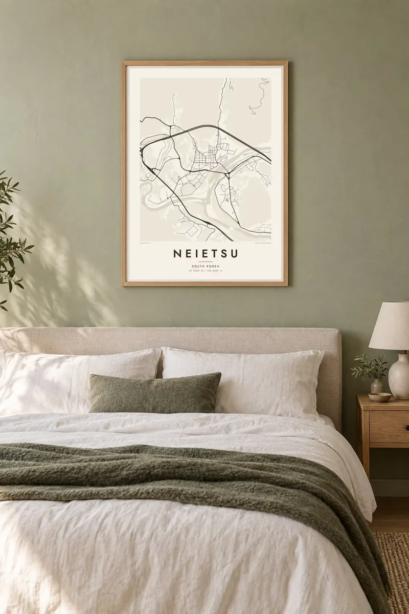
The Donggang and Seogang join close to the town centre. Their broad curves become the strongest shapes on the print and frame the streets from two sides.
Minimalist map poster · South Korea
37.1845° N / 128.4682° E
A mountain county town where the Dong and Seo rivers loop through steep valleys before meeting near its centre

One city, five moods
Tap a style to see it on the wall. Every style costs the same — printed, framed or as HD files.
 Actual pixels · 24 × 36″ print file
Print-sharp
This is a 100% crop of the real print file. Every poster — printed, framed or downloaded — is rendered on our servers at 300 DPI, up to 7,200 × 10,800 pixels, so even the smallest lanes stay crisp on a 24 × 36″ print.
On the wall


The map
Neietsu is the older Japanese reading of Yeongwol, a county seat in the mountains of Gangwon-do. From above, the town is shaped almost entirely by water and slope. The Donggang and Seogang wind through deep valleys and meet here to form the Namhan River, and the built area fills the narrow flat ground left between the riverbanks and the forested ridges.
Because the valleys are tight, the street network is small and follows the curve of the river rather than the compass. Bridges stitch together the neighbourhoods on either bank, and the roads leaving town squeeze through gaps in the hills. A Neietsu map poster turns this into a composition of long meanders, short bridges and dense pockets of streets set against open, empty mountain.
Yeongwol is closely tied to King Danjong, the young Joseon ruler exiled here in the fifteenth century. His place of exile at Cheongnyeongpo, a bend of the Seogang almost enclosed by water, lies near the town. So does his tomb at Jangneung, part of the UNESCO-listed Royal Tombs of the Joseon Dynasty.
The Donggang and Seogang join close to the town centre. Their broad curves become the strongest shapes on the print and frame the streets from two sides.
West of the centre, the Seogang wraps almost fully around a wooded peninsula, the site of Danjong's exile. The loop reads clearly even in plain black and white.
Housing and shops occupy the narrow flat land between river and ridge. As a result, the street network is compact, elongated and plainly shaped by the terrain around it.
Make it yours
Add a date, a name or a line of your own, switch style, size or orientation.
The free preview is low-resolution with a watermark. Prints and HD files are rendered at 300 DPI, up to 7,200 × 10,800 px, without a watermark.
Why Neietsu
Yeongwol draws visitors for its rivers, caves and Joseon history, and many leave with a strong memory of the valley. A map of the river bends is a quieter keepsake than a photograph and works in a study, hallway or living room.
Add a title such as a trip date or a name, adjust the subtitle and coordinates line, and pick one of five styles. Blueprint and Noir suit the strong river lines especially well. A free 900 px preview lets you check the framing before you buy.
Order the Neietsu poster| Print size | Resolution | Files |
|---|---|---|
| 30 × 40 cm11.8 × 15.7″ | 3,543 × 4,724 px | PNG · PDF |
| 29.7 × 42 cm (A3)11.7 × 16.5″ | 3,508 × 4,961 px | PNG · PDF |
| 42 × 59.4 cm (A2)16.5 × 23.4″ | 4,961 × 7,016 px | PNG · PDF |
| 45.7 × 61 cm18 × 24″ | 5,400 × 7,200 px | PNG · PDF |
| 50 × 70 cm19.7 × 27.6″ | 5,906 × 8,268 px | PNG · PDF |
| 61 × 91.4 cm24 × 36″ | 7,200 × 10,800 px | PNG · PDF |
For comparison, the free preview is 900 px wide, watermarked and meant for screens. The HD files have up to 8× the resolution in each direction and print cleanly at full poster size.
Pick a style at the top of the page, then choose Printed Poster — a size and, if you like, a frame — or Digital HD Files. Checkout takes one step, and your order page updates as soon as the payment goes through.
It is printed on premium 200 gsm matte paper in one of six sizes, from 30 × 40 cm to 24 × 36″. Printed posters start at $39, shipping included.
Yes. Choose a solid wood frame in black, white, natural oak or dark wood. It comes with shatterproof glazing and is ready to hang. Framed posters start at $99, shipping included.
Shipping is free to 60+ countries. Each poster is printed by the nearest of our print partners in 30+ countries and usually arrives in 3–7 business days. You can follow the status and tracking under My Orders. A few countries take 2–5 weeks, and where we don't ship yet, the site tells you before you pay.
Send us a photo within 14 days of delivery and we will reprint it for free or refund you.
Yes. In the editor on this page, change the title, the subtitle and the coordinates line to anything you like, and pick a style and size. Printed, framed and digital orders all use exactly your design.
For $9 you get 300 DPI PNG and print-ready PDF files in all six sizes, without a watermark, to print anywhere. Not sure yet? Download a free watermarked preview first.
Nearby
