Horyn River
The Horyn curves past the town in slow loops, adding the one organic line to a plan otherwise defined by straight avenues and orderly residential blocks.
Minimalist map poster · Ukraine
50.3286° N / 26.6487° E
A compact planned town beside the Horyn River, its apartment blocks set against the broad cooling pond of a nuclear plant

One city, five moods
Tap a style to see it on the wall. Every style costs the same — printed, framed or as HD files.
 Actual pixels · 24 × 36″ print file
Print-sharp
This is a 100% crop of the real print file. Every poster — printed, framed or downloaded — is rendered on our servers at 300 DPI, up to 7,200 × 10,800 pixels, so even the smallest lanes stay crisp on a 24 × 36″ print.
On the wall
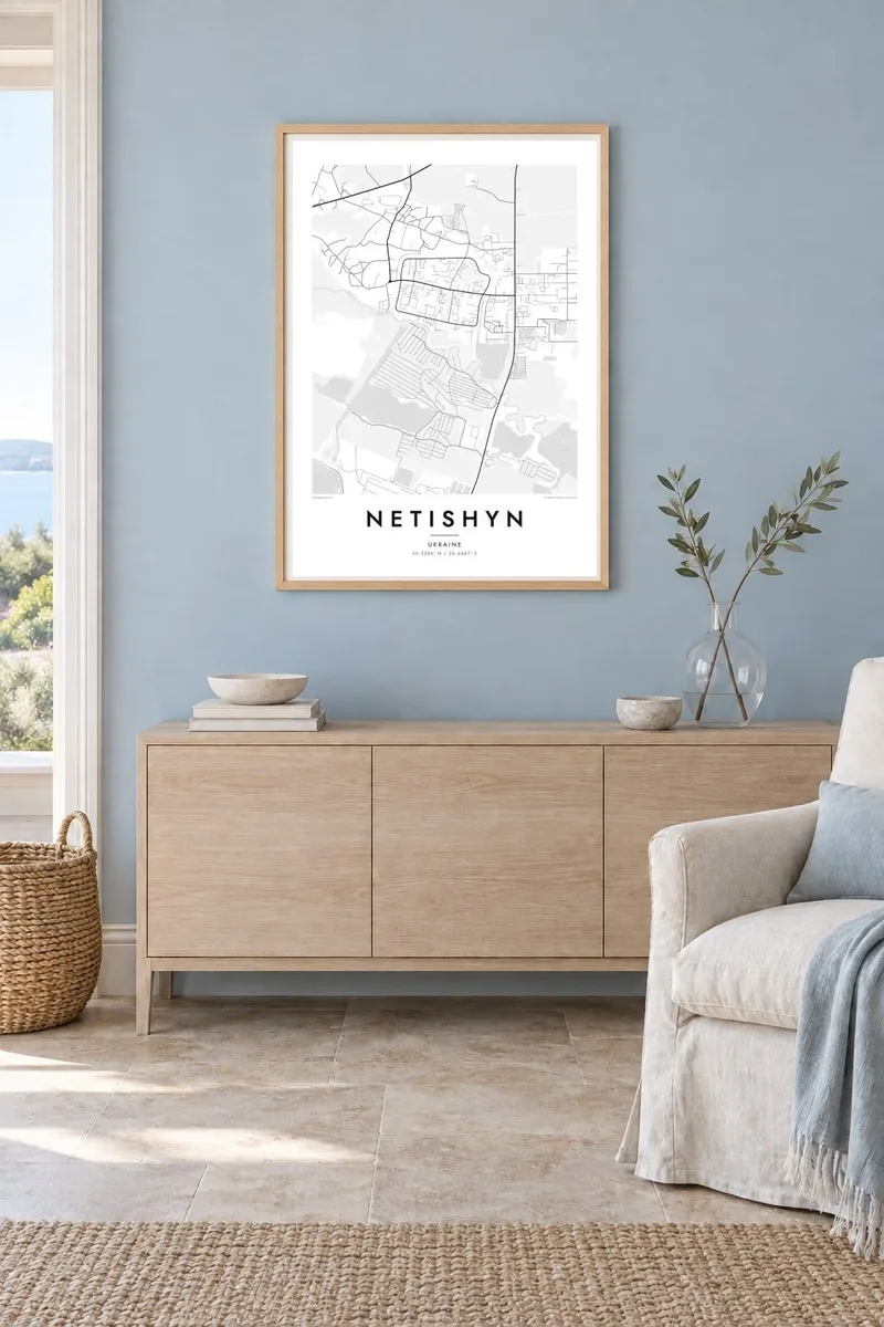


The map
Netishyn is one of the youngest towns in Ukraine. It grew from the 1970s as the residential settlement for the Khmelnytskyi Nuclear Power Plant, and its plan still shows that origin. Wide avenues, generous green gaps and large residential blocks were laid out in one deliberate sweep rather than built up over centuries. On paper the town reads as a neat cluster of rectangles and curving service roads.
Water shapes the rest of the sheet. The Horyn River winds through the flat, wooded country of the Khmelnytskyi region, and the plant's cooling pond spreads out as a large, smooth shape that dominates the surrounding map. Against those open surfaces, the tight pattern of streets and courtyards gains a clear outline, which is what makes a Netishyn map poster work so well in black and white.
Beyond the town, the map loosens into field boundaries, forest edges and country roads leading toward neighbouring towns and villages. Rendered in fine line work, the contrast between engineered order and the meandering river gives the composition a quiet tension. It is a portrait of a place built for a single purpose that has since become, simply, home for tens of thousands of people.
The Horyn curves past the town in slow loops, adding the one organic line to a plan otherwise defined by straight avenues and orderly residential blocks.
The reservoir built for the nuclear plant forms a broad, pale expanse beside the town, a strong graphic shape that anchors the whole composition.
Laid out from the 1970s onward, the residential districts follow a clear, repeating pattern of blocks, courtyards and green strips that reads cleanly at any size.
Make it yours
Add a date, a name or a line of your own, switch style, size or orientation.
The free preview is low-resolution with a watermark. Prints and HD files are rendered at 300 DPI, up to 7,200 × 10,800 px, without a watermark.
Why Netishyn
For people who grew up here or worked at the plant, Netishyn is often a very specific memory: a first flat, a school, a walk along the river. A map of the town is a restrained way to keep that place close, especially for those who have since moved elsewhere.
You can add your own title, a subtitle and a coordinates line, perhaps a family name or a year that matters. Choose from Classic black & white, Noir, Paper, Blueprint or Sand, then download the $9 HD files or order a printed poster, framed or unframed.
Order the Netishyn poster| Print size | Resolution | Files |
|---|---|---|
| 30 × 40 cm11.8 × 15.7″ | 3,543 × 4,724 px | PNG · PDF |
| 29.7 × 42 cm (A3)11.7 × 16.5″ | 3,508 × 4,961 px | PNG · PDF |
| 42 × 59.4 cm (A2)16.5 × 23.4″ | 4,961 × 7,016 px | PNG · PDF |
| 45.7 × 61 cm18 × 24″ | 5,400 × 7,200 px | PNG · PDF |
| 50 × 70 cm19.7 × 27.6″ | 5,906 × 8,268 px | PNG · PDF |
| 61 × 91.4 cm24 × 36″ | 7,200 × 10,800 px | PNG · PDF |
For comparison, the free preview is 900 px wide, watermarked and meant for screens. The HD files have up to 8× the resolution in each direction and print cleanly at full poster size.
Pick a style at the top of the page, then choose Printed Poster — a size and, if you like, a frame — or Digital HD Files. Checkout takes one step, and your order page updates as soon as the payment goes through.
It is printed on premium 200 gsm matte paper in one of six sizes, from 30 × 40 cm to 24 × 36″. Printed posters start at $39, shipping included.
Yes. Choose a solid wood frame in black, white, natural oak or dark wood. It comes with shatterproof glazing and is ready to hang. Framed posters start at $99, shipping included.
Shipping is free to 60+ countries. Each poster is printed by the nearest of our print partners in 30+ countries and usually arrives in 3–7 business days. You can follow the status and tracking under My Orders. A few countries take 2–5 weeks, and where we don't ship yet, the site tells you before you pay.
Send us a photo within 14 days of delivery and we will reprint it for free or refund you.
Yes. In the editor on this page, change the title, the subtitle and the coordinates line to anything you like, and pick a style and size. Printed, framed and digital orders all use exactly your design.
For $9 you get 300 DPI PNG and print-ready PDF files in all six sizes, without a watermark, to print anywhere. Not sure yet? Download a free watermarked preview first.
Nearby
