The Écusson
The old town's shield shape, traced by encircling boulevards, gives the map an instantly recognisable centre, with a dense maze of lanes inside and wider streets outside.
Minimalist map poster · France
43.8366° N / 4.3579° E
A shield-shaped Roman core wrapped by boulevards, with formal gardens and garrigue hills rising to the north

One city, five moods
Tap a style to see it on the wall. Every style costs the same — printed, framed or as HD files.
 Actual pixels · 24 × 36″ print file
Print-sharp
This is a 100% crop of the real print file. Every poster — printed, framed or downloaded — is rendered on our servers at 300 DPI, up to 7,200 × 10,800 pixels, so even the smallest lanes stay crisp on a 24 × 36″ print.
On the wall


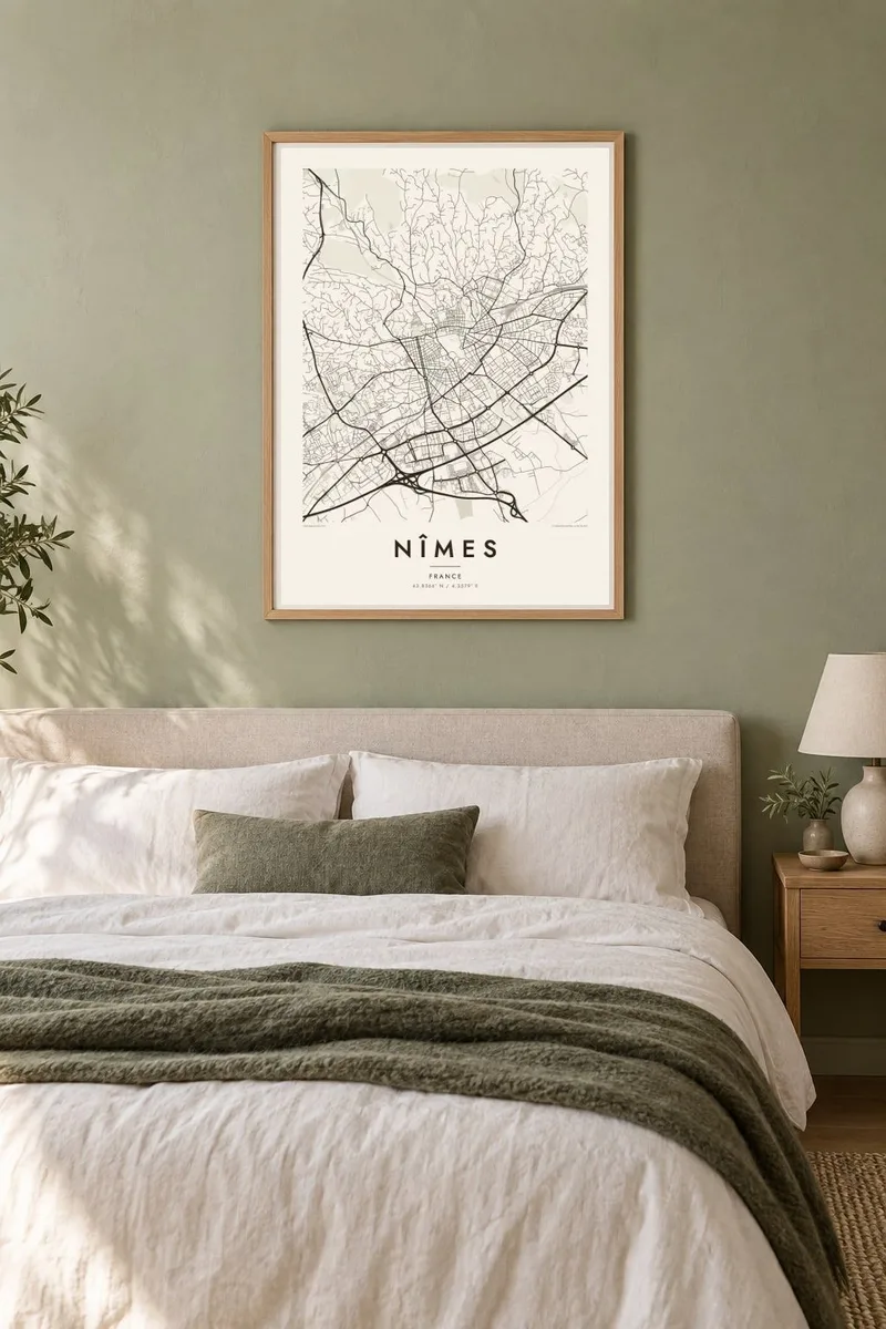
The map
The centre of Nîmes is known as the Écusson, the shield, because the old town forms a rough shield shape when seen from above. Wide boulevards laid out along the line of former ramparts surround it, and inside them the streets are narrow and irregular, bending around small squares and courtyards. It is one of the clearest old-town outlines in southern France.
Nîmes was an important Roman colony, and its monuments sit directly in the street plan. The Arena, a remarkably well-preserved amphitheatre, occupies an oval at the southern tip of the Écusson, and the Maison Carrée, a Roman temple, stands on its own square to the west. Water for the ancient city arrived via the aqueduct that crosses the Gardon at the Pont du Gard.
A Nîmes map poster shows these layers with unusual clarity. The oval of the Arena, the open square around the Maison Carrée and the geometric paths of the Jardins de la Fontaine, laid out in the eighteenth century around an ancient spring, all read cleanly in line. Beyond the boulevards, the grid widens and gives way to the hills of the garrigue.
The old town's shield shape, traced by encircling boulevards, gives the map an instantly recognisable centre, with a dense maze of lanes inside and wider streets outside.
Two Roman monuments appear as distinct shapes in the plan: the oval amphitheatre at the edge of the old town and the rectangular temple standing in its open square.
Formal gardens with canals and terraces, built around the spring that first drew settlers here, climb toward the Tour Magne on the hill above, adding geometric order to the northwest.
Make it yours
Add a date, a name or a line of your own, switch style, size or orientation.
The free preview is low-resolution with a watermark. Prints and HD files are rendered at 300 DPI, up to 7,200 × 10,800 px, without a watermark.
Why Nîmes
Nîmes appeals to anyone drawn to places where the Roman past is still legible in the street plan. It also makes a fitting keepsake for a southern French summer, a wedding in Occitanie or a few years spent living beside the Arena.
Personalise the title and subtitle, perhaps with a date, and keep the coordinates line or adjust it. Five styles are available, Classic black & white, Noir, Paper, Blueprint and Sand, with HD files for $9 or printed posters shipped from partners in 30+ countries.
Order the Nîmes poster| Print size | Resolution | Files |
|---|---|---|
| 30 × 40 cm11.8 × 15.7″ | 3,543 × 4,724 px | PNG · PDF |
| 29.7 × 42 cm (A3)11.7 × 16.5″ | 3,508 × 4,961 px | PNG · PDF |
| 42 × 59.4 cm (A2)16.5 × 23.4″ | 4,961 × 7,016 px | PNG · PDF |
| 45.7 × 61 cm18 × 24″ | 5,400 × 7,200 px | PNG · PDF |
| 50 × 70 cm19.7 × 27.6″ | 5,906 × 8,268 px | PNG · PDF |
| 61 × 91.4 cm24 × 36″ | 7,200 × 10,800 px | PNG · PDF |
For comparison, the free preview is 900 px wide, watermarked and meant for screens. The HD files have up to 8× the resolution in each direction and print cleanly at full poster size.
Pick a style at the top of the page, then choose Printed Poster — a size and, if you like, a frame — or Digital HD Files. Checkout takes one step, and your order page updates as soon as the payment goes through.
It is printed on premium 200 gsm matte paper in one of six sizes, from 30 × 40 cm to 24 × 36″. Printed posters start at $39, shipping included.
Yes. Choose a solid wood frame in black, white, natural oak or dark wood. It comes with shatterproof glazing and is ready to hang. Framed posters start at $99, shipping included.
Shipping is free to 60+ countries. Each poster is printed by the nearest of our print partners in 30+ countries and usually arrives in 3–7 business days. You can follow the status and tracking under My Orders. A few countries take 2–5 weeks, and where we don't ship yet, the site tells you before you pay.
Send us a photo within 14 days of delivery and we will reprint it for free or refund you.
Yes. In the editor on this page, change the title, the subtitle and the coordinates line to anything you like, and pick a style and size. Printed, framed and digital orders all use exactly your design.
For $9 you get 300 DPI PNG and print-ready PDF files in all six sizes, without a watermark, to print anywhere. Not sure yet? Download a free watermarked preview first.
Nearby
