The Écusson
The old town's roughly shield-shaped outline, packed with narrow lanes and small squares, forms the densest area of the poster and is ringed by boulevards tracing the former walls.
Minimalist map poster · France
43.6109° N / 3.8763° E
A tight medieval shield of lanes on a low hill, with a neoclassical axis running east toward the River Lez.

One city, five moods
Tap a style to see it on the wall. Every style costs the same — printed, framed or as HD files.
 Actual pixels · 24 × 36″ print file
Print-sharp
This is a 100% crop of the real print file. Every poster — printed, framed or downloaded — is rendered on our servers at 300 DPI, up to 7,200 × 10,800 pixels, so even the smallest lanes stay crisp on a 24 × 36″ print.
On the wall

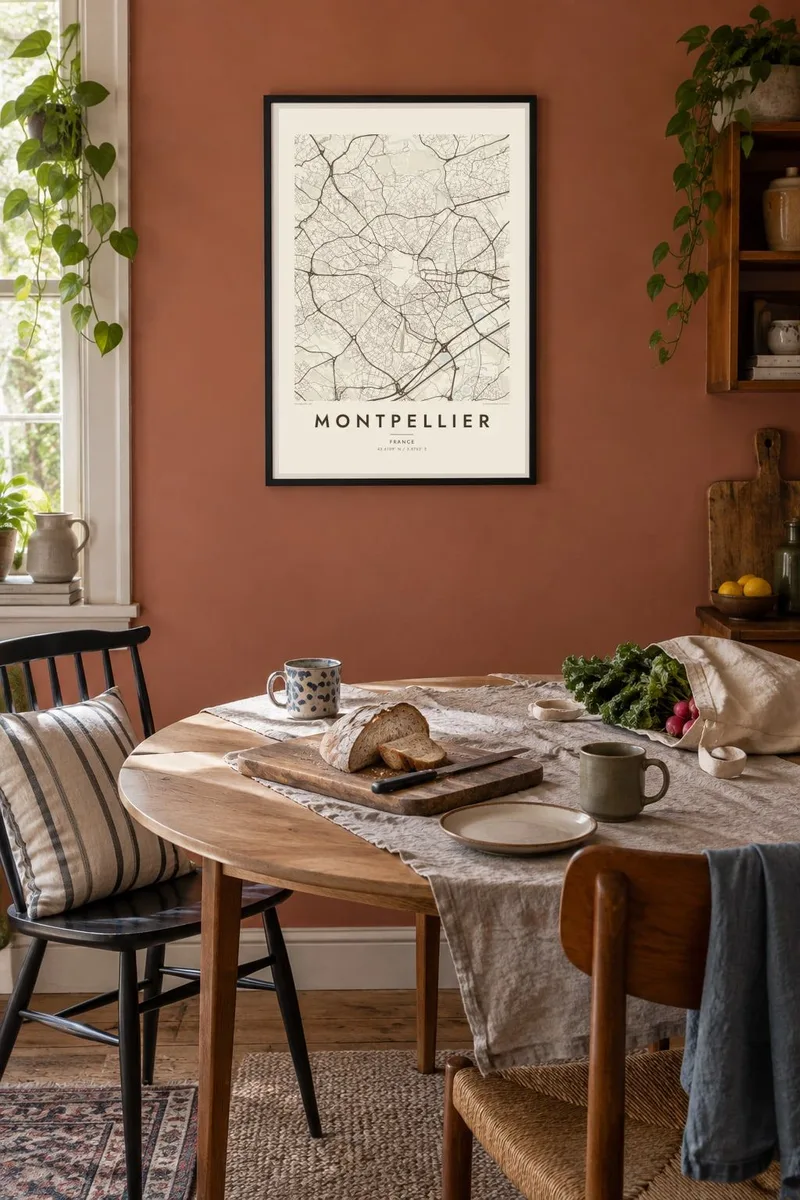
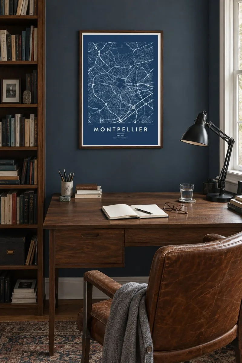
The map
Montpellier grew up on a low hill a few kilometres inland from the Mediterranean, and its oldest quarter still stands out clearly on the map. Known as the Écusson, or shield, for its rough shape, the historic centre is a knot of narrow, winding streets enclosed by boulevards that follow the line of the vanished medieval walls. Around it, later districts spread in every direction.
At the western tip of the old town, the Promenade du Peyrou forms a formal terrace ending at a stone aqueduct, while on the eastern side the Place de la Comédie opens onto the Esplanade. Beyond lies Antigone, a district designed by Ricardo Bofill, whose long neoclassical axis runs straight down to the River Lez. The contrast between these shapes makes the city unusually graphic.
Montpellier is home to one of the oldest medical schools in the world still in operation, and it has become one of the fastest-growing large cities in France, linked by a network of distinctive tram lines. A Montpellier map poster captures its layered plan, from the medieval shield to the modern districts reaching toward the sea.
The old town's roughly shield-shaped outline, packed with narrow lanes and small squares, forms the densest area of the poster and is ringed by boulevards tracing the former walls.
East of the centre, Ricardo Bofill's Antigone district lines up monumental buildings along a single straight axis toward the River Lez, a striking piece of geometry among the surrounding streets.
On the western edge of the old town, the formal Promenade du Peyrou and the long stone aqueduct beyond it add a clean, straight line to the map's composition.
Make it yours
Add a date, a name or a line of your own, switch style, size or orientation.
The free preview is low-resolution with a watermark. Prints and HD files are rendered at 300 DPI, up to 7,200 × 10,800 px, without a watermark.
Why Montpellier
Montpellier is a city of students, doctors and people who came for a few years and stayed longer. Its map holds memories of lectures, terraces and summers near the coast, and the contrast between medieval lanes and Bofill's axis makes it striking on a wall.
Give the poster your own title and subtitle, perhaps the year you arrived or graduated, and edit the coordinates line. Choose among five styles, from Classic black & white to Paper, and download HD files for $9 or order a printed version on matte paper.
Order the Montpellier poster| Print size | Resolution | Files |
|---|---|---|
| 30 × 40 cm11.8 × 15.7″ | 3,543 × 4,724 px | PNG · PDF |
| 29.7 × 42 cm (A3)11.7 × 16.5″ | 3,508 × 4,961 px | PNG · PDF |
| 42 × 59.4 cm (A2)16.5 × 23.4″ | 4,961 × 7,016 px | PNG · PDF |
| 45.7 × 61 cm18 × 24″ | 5,400 × 7,200 px | PNG · PDF |
| 50 × 70 cm19.7 × 27.6″ | 5,906 × 8,268 px | PNG · PDF |
| 61 × 91.4 cm24 × 36″ | 7,200 × 10,800 px | PNG · PDF |
For comparison, the free preview is 900 px wide, watermarked and meant for screens. The HD files have up to 8× the resolution in each direction and print cleanly at full poster size.
Pick a style at the top of the page, then choose Printed Poster — a size and, if you like, a frame — or Digital HD Files. Checkout takes one step, and your order page updates as soon as the payment goes through.
It is printed on premium 200 gsm matte paper in one of six sizes, from 30 × 40 cm to 24 × 36″. Printed posters start at $39, shipping included.
Yes. Choose a solid wood frame in black, white, natural oak or dark wood. It comes with shatterproof glazing and is ready to hang. Framed posters start at $99, shipping included.
Shipping is free to 60+ countries. Each poster is printed by the nearest of our print partners in 30+ countries and usually arrives in 3–7 business days. You can follow the status and tracking under My Orders. A few countries take 2–5 weeks, and where we don't ship yet, the site tells you before you pay.
Send us a photo within 14 days of delivery and we will reprint it for free or refund you.
Yes. In the editor on this page, change the title, the subtitle and the coordinates line to anything you like, and pick a style and size. Printed, framed and digital orders all use exactly your design.
For $9 you get 300 DPI PNG and print-ready PDF files in all six sizes, without a watermark, to print anywhere. Not sure yet? Download a free watermarked preview first.
Nearby
