Leninsky Prospekt
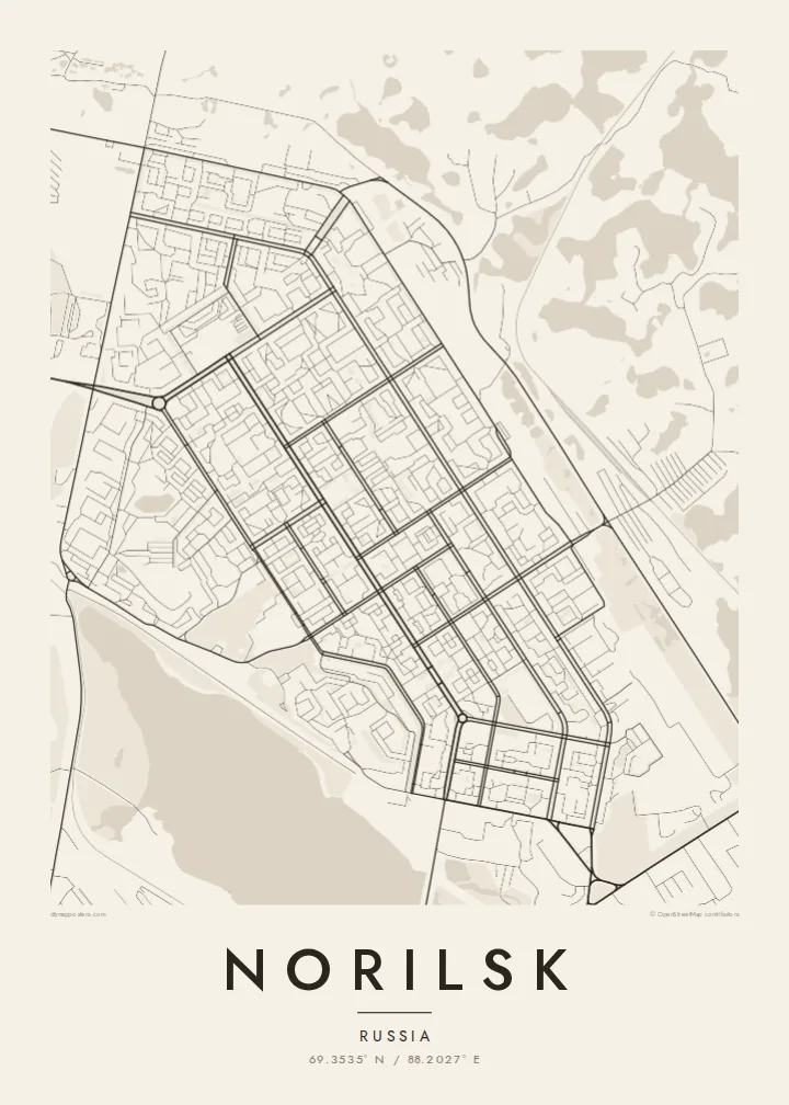
The main avenue runs in a straight line through the planned centre, lined with uniform blocks that give the map a strong geometric axis.
Minimalist map poster · Russia
A planned Arctic city of straight avenues and tight courtyard blocks, set in open tundra beside lakes
69.3535° N / 88.2027° E




One city, five moods
Tap a style to see it on the wall. Every style is included in the same $9 price.
 Actual pixels · 24 × 36″ HD file
Print-sharp
This is a crop of the real HD file at 100%. The paid download is rendered on our servers at 300 DPI, up to 7,200 × 10,800 pixels, so even the smallest lanes stay crisp on a 24 × 36″ print.
The map
Norilsk lies well north of the Arctic Circle, and its map looks unlike almost any other city. The centre was planned in the Soviet era as a compact, regular grid, with Leninsky Prospekt running straight through it. Apartment buildings stand close together around enclosed courtyards, a layout designed to block the wind during the long winter.
Around the planned centre, the map is dominated by industry and open land. Large smelters and processing plants take up big irregular areas, linked by rail lines and pipelines across the tundra. Lake Dolgoye lies next to the city, and the separate districts of Talnakh and Kayerkan appear as distinct clusters some distance away.
Norilsk is one of the world's main sources of nickel and palladium, and it has no permanent road connection to the rest of Russia. Most travel is by air or by river and sea. A Norilsk map poster shows a city built to a plan in an extreme environment, dense and orderly at the centre, surrounded by a very wide empty space.
The main avenue runs in a straight line through the planned centre, lined with uniform blocks that give the map a strong geometric axis.
Buildings are grouped tightly around enclosed yards to shelter residents from wind and snow, creating a dense, repeating pattern on the map.
Plants, rail lines and pipelines spread across the tundra around the city, their loose shapes contrasting with the orderly centre.
Make it yours
Add a date, a name or a line of your own, switch style, size or orientation.
Free preview is low-resolution with a watermark. The HD version is 7,200 × 10,800 px, 300 DPI, no watermark.
Why Norilsk
Norilsk is a city people rarely see, and its strict grid in an empty landscape makes a striking, graphic poster. It has particular meaning for those who grew up or worked there through polar nights.
You can personalise the title, subtitle and coordinates line, in Latin or Cyrillic script. Choose from five styles: Classic black & white, Noir, Paper, Blueprint and Sand. The Noir style suits the polar setting especially well.
Get the Norilsk poster — $9| Print size | Resolution | Files |
|---|---|---|
| 30 × 40 cm | 3,543 × 4,724 px | PNG · PDF |
| 50 × 70 cm | 5,906 × 8,268 px | PNG · PDF |
| A3 · 29.7 × 42 cm | 3,508 × 4,961 px | PNG · PDF |
| A2 · 42 × 59.4 cm | 4,961 × 7,016 px | PNG · PDF |
| 18 × 24" | 5,400 × 7,200 px | PNG · PDF |
| 24 × 36" | 7,200 × 10,800 px | PNG · PDF |
For comparison, the free preview is 900 px wide, watermarked and meant for screens. The HD files have up to 8× the resolution in each direction and print cleanly at full poster size.
Yes. Drag and zoom the map in the editor — centre it on your neighbourhood, the old town or the whole metro area. The text updates independently.
The HD purchase includes 30×40 cm, 50×70 cm, A3, A2, 18×24″ and 24×36″, each as a 300 DPI PNG and a print-ready PDF.
You can download a free 900 px preview with a watermark. The paid HD files have no watermark and are sharp enough for large prints.
Send the PDF to any local print shop or online printing service and ask for the matching paper size. Matte paper and a thin black or oak frame suit this style best.
Nearby
