Castle Rock
Nottingham Castle stands on a sheer sandstone cliff at the western edge of the old town. The streets bend around it, leaving a distinct open shape near the centre of the map.
Minimalist map poster · United Kingdom
52.9536° N / 1.1505° W
A dense Midlands centre on a sandstone ridge, bounded to the south by the broad curve of the River Trent

One city, five moods
Tap a style to see it on the wall. Every style costs the same — printed, framed or as HD files.
 Actual pixels · 24 × 36″ print file
Print-sharp
This is a 100% crop of the real print file. Every poster — printed, framed or downloaded — is rendered on our servers at 300 DPI, up to 7,200 × 10,800 pixels, so even the smallest lanes stay crisp on a 24 × 36″ print.
On the wall
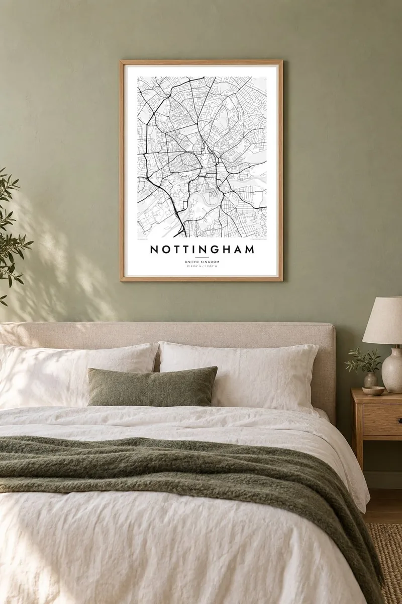


The map
Nottingham's centre sits on a sandstone outcrop above the Trent valley, and the map still reflects that geography. The medieval street pattern gathers around the Old Market Square, the castle occupies its rock on the western edge, and the Lace Market rises to the east. To the south the land drops toward the canal, the railway and finally the River Trent, which makes a long, calm arc across the bottom of the city.
Beneath the streets are hundreds of man-made caves, cut into the soft sandstone over many centuries and used as homes, cellars and tanneries. They do not appear on a street map, but the ridge explains why the old town is so tightly packed. Around it, Victorian terraces spread out in dense rows, and the tram lines add long, smooth curves through the suburbs.
West of the centre, Wollaton Park and the University Park campus form two large green spaces, and University Park has a lake and landscaped grounds. A Nottingham map poster brings these layers together in one clear composition: the castle rock, the market square, the Trent and Trent Bridge. The result feels both historic and lived in.
Nottingham Castle stands on a sheer sandstone cliff at the western edge of the old town. The streets bend around it, leaving a distinct open shape near the centre of the map.
The Trent sweeps across the south of the city. It is crossed by Trent Bridge, next to the cricket ground of the same name, and gives the whole map a strong lower edge.
A large landscaped campus west of the centre. Its lake, curving drives and wide lawns contrast with the tight terraced streets around it.
Make it yours
Add a date, a name or a line of your own, switch style, size or orientation.
The free preview is low-resolution with a watermark. Prints and HD files are rendered at 300 DPI, up to 7,200 × 10,800 px, without a watermark.
Why Nottingham
Nottingham draws students, graduates, cricket followers and long-time residents, and a map of the city tends to mean something different to each of them. For many it marks three or four formative years. For others it holds a lifetime of walks from the market square down to the river.
Add a title, a subtitle such as a graduation year or a street name, and a coordinates line of your choosing. Classic black and white suits the dense terraces well, while Blueprint, Noir, Paper and Sand each give the Trent and the castle rock a different mood.
Order the Nottingham poster| Print size | Resolution | Files |
|---|---|---|
| 30 × 40 cm11.8 × 15.7″ | 3,543 × 4,724 px | PNG · PDF |
| 29.7 × 42 cm (A3)11.7 × 16.5″ | 3,508 × 4,961 px | PNG · PDF |
| 42 × 59.4 cm (A2)16.5 × 23.4″ | 4,961 × 7,016 px | PNG · PDF |
| 45.7 × 61 cm18 × 24″ | 5,400 × 7,200 px | PNG · PDF |
| 50 × 70 cm19.7 × 27.6″ | 5,906 × 8,268 px | PNG · PDF |
| 61 × 91.4 cm24 × 36″ | 7,200 × 10,800 px | PNG · PDF |
For comparison, the free preview is 900 px wide, watermarked and meant for screens. The HD files have up to 8× the resolution in each direction and print cleanly at full poster size.
Pick a style at the top of the page, then choose Printed Poster — a size and, if you like, a frame — or Digital HD Files. Checkout takes one step, and your order page updates as soon as the payment goes through.
It is printed on premium 200 gsm matte paper in one of six sizes, from 30 × 40 cm to 24 × 36″. Printed posters start at $39, shipping included.
Yes. Choose a solid wood frame in black, white, natural oak or dark wood. It comes with shatterproof glazing and is ready to hang. Framed posters start at $99, shipping included.
Shipping is free to 60+ countries. Each poster is printed by the nearest of our print partners in 30+ countries and usually arrives in 3–7 business days. You can follow the status and tracking under My Orders. A few countries take 2–5 weeks, and where we don't ship yet, the site tells you before you pay.
Send us a photo within 14 days of delivery and we will reprint it for free or refund you.
Yes. In the editor on this page, change the title, the subtitle and the coordinates line to anything you like, and pick a style and size. Printed, framed and digital orders all use exactly your design.
For $9 you get 300 DPI PNG and print-ready PDF files in all six sizes, without a watermark, to print anywhere. Not sure yet? Download a free watermarked preview first.
Nearby
