Five rivers
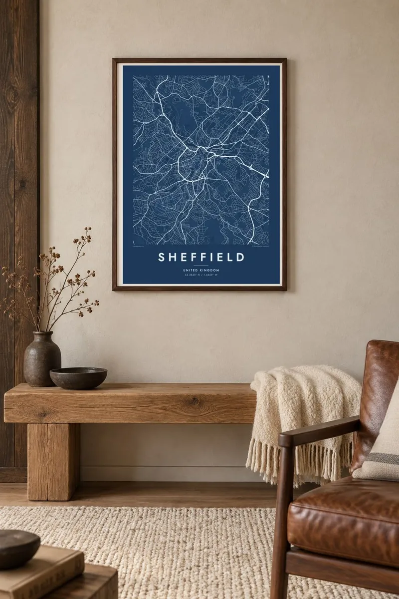
The Don, Sheaf, Porter, Rivelin and Loxley shape the city, and on the poster their valleys appear as corridors of streets separated by ridges and green space.
Minimalist map poster · United Kingdom
53.3830° N / 1.4659° W
Built across seven hills where five rivers meet, Sheffield's streets fan out along valleys toward the edge of the Peak District.

One city, five moods
Tap a style to see it on the wall. Every style costs the same — printed, framed or as HD files.
 Actual pixels · 24 × 36″ print file
Print-sharp
This is a 100% crop of the real print file. Every poster — printed, framed or downloaded — is rendered on our servers at 300 DPI, up to 7,200 × 10,800 pixels, so even the smallest lanes stay crisp on a 24 × 36″ print.
On the wall


The map
Sheffield is a city of valleys. Its map is shaped by the River Don and its tributaries, the Sheaf, Porter, Rivelin and Loxley, which cut the land into ridges and slopes. Streets climb from the centre in long radial lines, following the valleys west toward open moorland, while the inner ring road loops tightly around the city centre and the older industrial districts stretch northeast along the Don.
The city made its name on steel, from cutlery to Benjamin Huntsman's crucible process and the invention of stainless steel by Harry Brearley in 1913. It is also one of the greenest cities in England, with large parks and woodland throughout, and part of its boundary lies within the Peak District National Park, so the western edge of any map fades into hills.
A Sheffield map poster shows how topography drives a city. Instead of a grid, you see fingers of streets reaching into valleys, the Don winding past Kelham Island and the old works, and wide green gaps where hills and parks resist building. In black and white the contours are implied by the roads alone, and the effect is surprisingly sculptural.
The Don, Sheaf, Porter, Rivelin and Loxley shape the city, and on the poster their valleys appear as corridors of streets separated by ridges and green space.
A compact ring encircles the city centre, giving the middle of the poster a defined loop from which main roads radiate outward toward the suburbs and hills.
To the west, the Rivelin and Loxley valleys lead out toward the Peak District, where the street pattern thins into winding lanes, reservoirs and open moorland at the edge of the frame.
Make it yours
Add a date, a name or a line of your own, switch style, size or orientation.
The free preview is low-resolution with a watermark. Prints and HD files are rendered at 300 DPI, up to 7,200 × 10,800 px, without a watermark.
Why Sheffield
Sheffield inspires strong loyalty, from students who stayed after university to families whose grandparents worked in the steelworks. A map of its hills and rivers is instantly recognisable to anyone who has walked them, and it sits well in both modern and traditional interiors.
Personalise the title, subtitle and coordinates line with your street, your club's founding year or the date you moved. Choose Classic black & white, Noir, Paper, Blueprint or Sand, and order a matte print, with an optional wooden frame, or download the HD files.
Order the Sheffield poster| Print size | Resolution | Files |
|---|---|---|
| 30 × 40 cm11.8 × 15.7″ | 3,543 × 4,724 px | PNG · PDF |
| 29.7 × 42 cm (A3)11.7 × 16.5″ | 3,508 × 4,961 px | PNG · PDF |
| 42 × 59.4 cm (A2)16.5 × 23.4″ | 4,961 × 7,016 px | PNG · PDF |
| 45.7 × 61 cm18 × 24″ | 5,400 × 7,200 px | PNG · PDF |
| 50 × 70 cm19.7 × 27.6″ | 5,906 × 8,268 px | PNG · PDF |
| 61 × 91.4 cm24 × 36″ | 7,200 × 10,800 px | PNG · PDF |
For comparison, the free preview is 900 px wide, watermarked and meant for screens. The HD files have up to 8× the resolution in each direction and print cleanly at full poster size.
Pick a style at the top of the page, then choose Printed Poster — a size and, if you like, a frame — or Digital HD Files. Checkout takes one step, and your order page updates as soon as the payment goes through.
It is printed on premium 200 gsm matte paper in one of six sizes, from 30 × 40 cm to 24 × 36″. Printed posters start at $39, shipping included.
Yes. Choose a solid wood frame in black, white, natural oak or dark wood. It comes with shatterproof glazing and is ready to hang. Framed posters start at $99, shipping included.
Shipping is free to 60+ countries. Each poster is printed by the nearest of our print partners in 30+ countries and usually arrives in 3–7 business days. You can follow the status and tracking under My Orders. A few countries take 2–5 weeks, and where we don't ship yet, the site tells you before you pay.
Send us a photo within 14 days of delivery and we will reprint it for free or refund you.
Yes. In the editor on this page, change the title, the subtitle and the coordinates line to anything you like, and pick a style and size. Printed, framed and digital orders all use exactly your design.
For $9 you get 300 DPI PNG and print-ready PDF files in all six sizes, without a watermark, to print anywhere. Not sure yet? Download a free watermarked preview first.
Nearby
