The border river
The Oiapoque River runs along the eastern side of the map. It is the international boundary with French Guiana, wide enough to dominate the composition, with Saint-Georges visible on the far bank.
Minimalist map poster · Brazil
3.8431° N / 51.8350° W
A riverside town at Brazil's northern tip, facing French Guiana across the wide, slow Oiapoque River

One city, five moods
Tap a style to see it on the wall. Every style costs the same — printed, framed or as HD files.
 Actual pixels · 24 × 36″ print file
Print-sharp
This is a 100% crop of the real print file. Every poster — printed, framed or downloaded — is rendered on our servers at 300 DPI, up to 7,200 × 10,800 pixels, so even the smallest lanes stay crisp on a 24 × 36″ print.
On the wall


The map
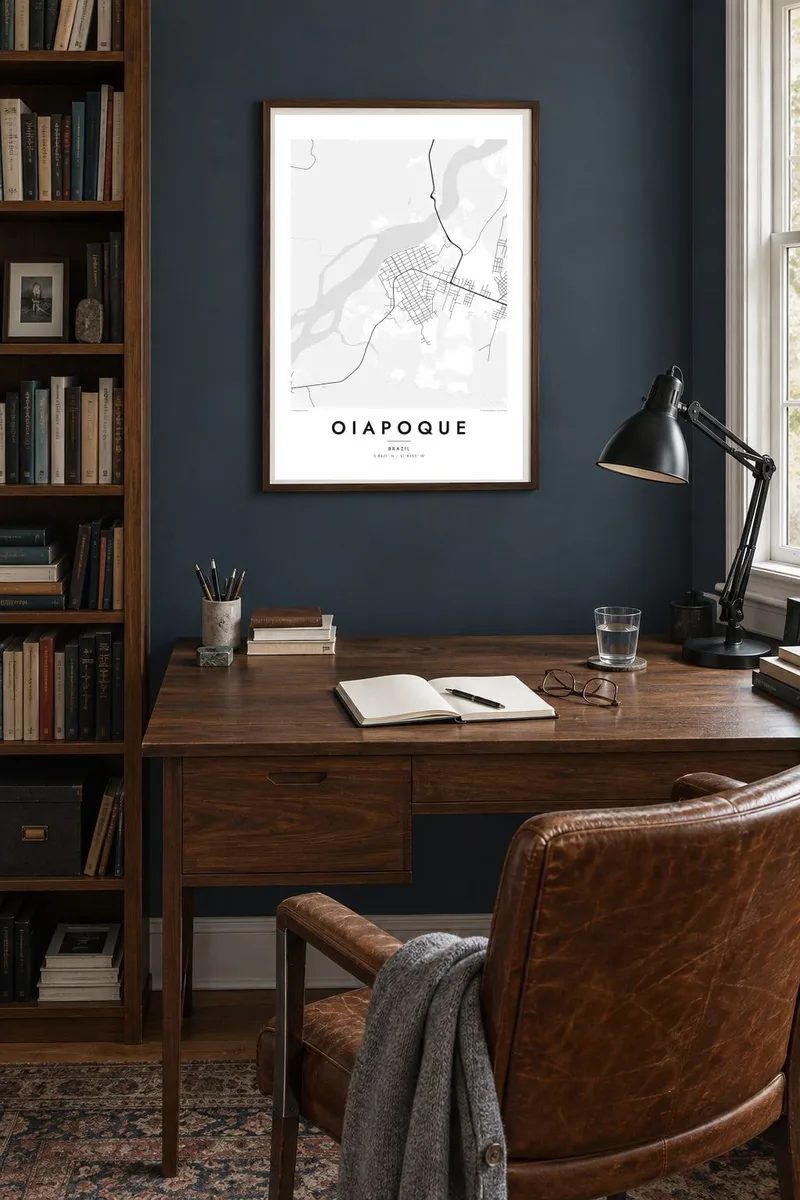
Oiapoque lies at the far northern edge of Amapá, where Brazil meets French Guiana. The town is laid out along the west bank of the Oiapoque River. Its streets run in a loose grid back from the waterfront, and the forest closes in quickly at the edges. On the opposite bank sits the French town of Saint-Georges, so one river holds two countries.
For generations the phrase Aqui começa o Brasil, here Brazil begins, has been tied to this place. A monument by the river marks the idea. Upstream, a cable-stayed bridge now crosses the Oiapoque to link the Brazilian and French road networks. It is one of the few land connections between the European Union and South America.
An Oiapoque map poster shows how thin human settlement is at this frontier. It is a small grid pressed against a broad band of water, with a single highway leading south towards Macapá. The river takes up much of the frame. Its curves and islands give the composition a soft weight that inland towns rarely have.
The Oiapoque River runs along the eastern side of the map. It is the international boundary with French Guiana, wide enough to dominate the composition, with Saint-Georges visible on the far bank.
South of town, a long bridge carries the road across the river into French territory. It is a thin, precise line joining two national road systems that otherwise never meet.
The highway to Macapá leaves town heading south through forest. On the map it is a lone line that shows how remote this corner of Brazil still is.
Make it yours
Add a date, a name or a line of your own, switch style, size or orientation.
The free preview is low-resolution with a watermark. Prints and HD files are rendered at 300 DPI, up to 7,200 × 10,800 px, without a watermark.
Why Oiapoque
Oiapoque stands for an edge: the point where a whole country starts or ends, depending on your direction. People who have worked, travelled or crossed the border here often want a quiet record of that frontier on their wall.
Add your own title, a subtitle and the coordinates line, perhaps the date you crossed the river. Then pick Classic black and white, Noir, Paper, Blueprint or Sand. The Blueprint style suits the strong line of the border water especially well.
Order the Oiapoque poster| Print size | Resolution | Files |
|---|---|---|
| 30 × 40 cm11.8 × 15.7″ | 3,543 × 4,724 px | PNG · PDF |
| 29.7 × 42 cm (A3)11.7 × 16.5″ | 3,508 × 4,961 px | PNG · PDF |
| 42 × 59.4 cm (A2)16.5 × 23.4″ | 4,961 × 7,016 px | PNG · PDF |
| 45.7 × 61 cm18 × 24″ | 5,400 × 7,200 px | PNG · PDF |
| 50 × 70 cm19.7 × 27.6″ | 5,906 × 8,268 px | PNG · PDF |
| 61 × 91.4 cm24 × 36″ | 7,200 × 10,800 px | PNG · PDF |
For comparison, the free preview is 900 px wide, watermarked and meant for screens. The HD files have up to 8× the resolution in each direction and print cleanly at full poster size.
Pick a style at the top of the page, then choose Printed Poster — a size and, if you like, a frame — or Digital HD Files. Checkout takes one step, and your order page updates as soon as the payment goes through.
It is printed on premium 200 gsm matte paper in one of six sizes, from 30 × 40 cm to 24 × 36″. Printed posters start at $39, shipping included.
Yes. Choose a solid wood frame in black, white, natural oak or dark wood. It comes with shatterproof glazing and is ready to hang. Framed posters start at $99, shipping included.
Shipping is free to 60+ countries. Each poster is printed by the nearest of our print partners in 30+ countries and usually arrives in 3–7 business days. You can follow the status and tracking under My Orders. A few countries take 2–5 weeks, and where we don't ship yet, the site tells you before you pay.
Send us a photo within 14 days of delivery and we will reprint it for free or refund you.
Yes. In the editor on this page, change the title, the subtitle and the coordinates line to anything you like, and pick a style and size. Printed, framed and digital orders all use exactly your design.
For $9 you get 300 DPI PNG and print-ready PDF files in all six sizes, without a watermark, to print anywhere. Not sure yet? Download a free watermarked preview first.
Nearby
