Tampa Bypass Canal
This long, straight flood-control channel runs through the area. It is one of the most distinctive lines on the map, clearly engineered rather than natural.
Minimalist map poster · United States
27.9239° N / 82.3794° W
A community east of Tampa shaped by the Palm River, the Tampa Bypass Canal and the edge of McKay Bay


One city, five moods
Tap a style to see it on the wall. Every style costs the same — printed, framed or as HD files.
 Actual pixels · 24 × 36″ print file
Print-sharp
This is a 100% crop of the real print file. Every poster — printed, framed or downloaded — is rendered on our servers at 300 DPI, up to 7,200 × 10,800 pixels, so even the smallest lanes stay crisp on a 24 × 36″ print.
On the wall


The map
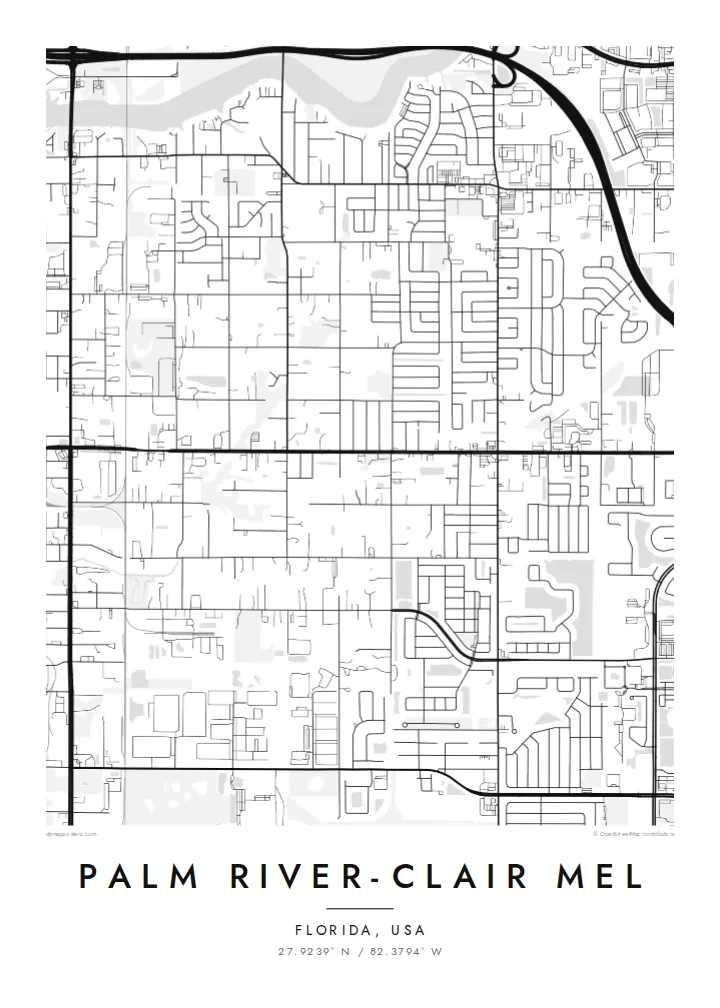
Palm River-Clair Mel is an unincorporated community in Hillsborough County, just east of Tampa. From above, water defines it. The Palm River winds towards McKay Bay, and the straight, man-made Tampa Bypass Canal cuts north to south across the landscape. Between them are residential streets in the familiar Florida pattern of blocks, cul-de-sacs and long arterial roads.
The Tampa Bypass Canal was built as a flood-control channel to protect the city from the overflow of the Hillsborough River. On the map it is one of the clearest features: a long, deliberate line that contrasts with the natural bends of the Palm River. Industrial areas near the port and highways add heavier shapes to the western edge.
A Palm River-Clair Mel map poster captures a place that is often overlooked from the freeway. It shows neighbourhood streets, the meeting of canal, river and bay, and the transition from suburb to waterfront. It is a detailed, specific portrait of an area that residents know well and visitors rarely see as a whole.
This long, straight flood-control channel runs through the area. It is one of the most distinctive lines on the map, clearly engineered rather than natural.
The river takes a winding course towards McKay Bay. Its curves soften the grid of the surrounding streets.
To the west, the land opens onto the waters of McKay Bay near the Port of Tampa, which gives the map a clear coastal edge.
Make it yours
Add a date, a name or a line of your own, switch style, size or orientation.
The free preview is low-resolution with a watermark. Prints and HD files are rendered at 300 DPI, up to 7,200 × 10,800 px, without a watermark.
Why Palm River-Clair Mel
For people who live between the canal and the bay, this map shows their neighbourhood as its own place, not just a corner of Tampa. It makes a good first-home gift or a reminder of a Florida chapter.
Add a custom title, a subtitle such as your street or family name, and the coordinates. Choose Classic black & white, Noir, Paper, Blueprint or Sand. HD files come in six sizes, including 18×24″ and 24×36″, for $9.
Order the Palm River-Clair Mel poster| Print size | Resolution | Files |
|---|---|---|
| 30 × 40 cm11.8 × 15.7″ | 3,543 × 4,724 px | PNG · PDF |
| 29.7 × 42 cm (A3)11.7 × 16.5″ | 3,508 × 4,961 px | PNG · PDF |
| 42 × 59.4 cm (A2)16.5 × 23.4″ | 4,961 × 7,016 px | PNG · PDF |
| 45.7 × 61 cm18 × 24″ | 5,400 × 7,200 px | PNG · PDF |
| 50 × 70 cm19.7 × 27.6″ | 5,906 × 8,268 px | PNG · PDF |
| 61 × 91.4 cm24 × 36″ | 7,200 × 10,800 px | PNG · PDF |
For comparison, the free preview is 900 px wide, watermarked and meant for screens. The HD files have up to 8× the resolution in each direction and print cleanly at full poster size.
Pick a style at the top of the page, then choose Printed Poster — a size and, if you like, a frame — or Digital HD Files. Checkout takes one step, and your order page updates as soon as the payment goes through.
It is printed on premium 200 gsm matte paper in one of six sizes, from 30 × 40 cm to 24 × 36″. Printed posters start at $39, shipping included.
Yes. Choose a solid wood frame in black, white, natural oak or dark wood. It comes with shatterproof glazing and is ready to hang. Framed posters start at $99, shipping included.
Shipping is free to 60+ countries. Each poster is printed by the nearest of our print partners in 30+ countries and usually arrives in 3–7 business days. You can follow the status and tracking under My Orders. A few countries take 2–5 weeks, and where we don't ship yet, the site tells you before you pay.
Send us a photo within 14 days of delivery and we will reprint it for free or refund you.
Yes. In the editor on this page, change the title, the subtitle and the coordinates line to anything you like, and pick a style and size. Printed, framed and digital orders all use exactly your design.
For $9 you get 300 DPI PNG and print-ready PDF files in all six sizes, without a watermark, to print anywhere. Not sure yet? Download a free watermarked preview first.
Nearby
