Canal avenues
In the historic centre, rivers run in open channels down the middle of the avenues, creating pairs of parallel streets with water between them.
Minimalist map poster · Brazil
22.5050° S / 43.1786° W
The imperial city of the Rio mountains, its streets and canalised rivers threading through narrow, steep-sided valleys

One city, five moods
Tap a style to see it on the wall. Every style costs the same — printed, framed or as HD files.
 Actual pixels · 24 × 36″ print file
Print-sharp
This is a 100% crop of the real print file. Every poster — printed, framed or downloaded — is rendered on our servers at 300 DPI, up to 7,200 × 10,800 pixels, so even the smallest lanes stay crisp on a 24 × 36″ print.
On the wall
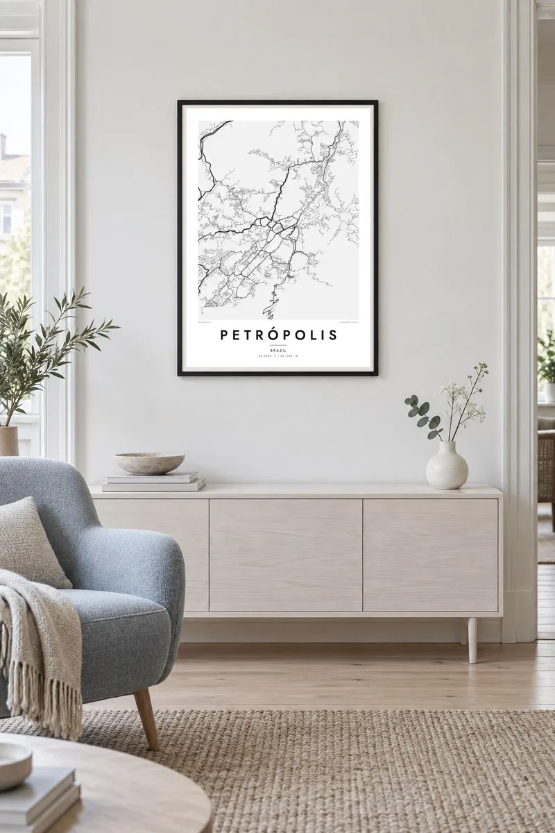


The map
Petrópolis lies high in the mountains north of Rio de Janeiro, in the Serra dos Órgãos. Unlike most Brazilian cities, it has no room for a regular grid: the town fills a network of narrow valleys, and the streets follow the valley floors, branching and winding wherever the hills allow. On a map this creates an unmistakable pattern of long, fingerlike urban strips.
The city was planned in the 1840s as a summer retreat for Emperor Pedro II, laid out by the German-born engineer Julius Koeler. A distinctive feature of the plan was to keep the rivers open in the middle of the main avenues, so channels of water run through the historic centre flanked by tree-lined streets.
The Imperial Museum, the emperor's former summer palace, stands in the centre, along with the Cathedral of St Peter of Alcantara and the Crystal Palace. A Petrópolis map poster reveals how closely the city is bound to its landscape, with streets squeezed between slopes and forested mountains filling all the space in between.
In the historic centre, rivers run in open channels down the middle of the avenues, creating pairs of parallel streets with water between them.
Urban areas stretch along several narrow valleys that meet near the centre, so the map resembles a branching tree rather than a solid block.
The palace, cathedral and grand nineteenth-century houses cluster in the centre, where the original planned layout is still easy to read.
Make it yours
Add a date, a name or a line of your own, switch style, size or orientation.
The free preview is low-resolution with a watermark. Prints and HD files are rendered at 300 DPI, up to 7,200 × 10,800 px, without a watermark.
Why Petrópolis
Petrópolis draws visitors from Rio and beyond, and for many it is a place of family weekends or first trips into the mountains. The branching valleys create one of the most organic and unusual street patterns you can hang on a wall.
Change the title, subtitle and coordinates line as you like, and pick from Classic black & white, Noir, Paper, Blueprint or Sand. The $9 digital files come in six print sizes, and printed posters on matte paper can be ordered with a wooden frame.
Order the Petrópolis poster| Print size | Resolution | Files |
|---|---|---|
| 30 × 40 cm11.8 × 15.7″ | 3,543 × 4,724 px | PNG · PDF |
| 29.7 × 42 cm (A3)11.7 × 16.5″ | 3,508 × 4,961 px | PNG · PDF |
| 42 × 59.4 cm (A2)16.5 × 23.4″ | 4,961 × 7,016 px | PNG · PDF |
| 45.7 × 61 cm18 × 24″ | 5,400 × 7,200 px | PNG · PDF |
| 50 × 70 cm19.7 × 27.6″ | 5,906 × 8,268 px | PNG · PDF |
| 61 × 91.4 cm24 × 36″ | 7,200 × 10,800 px | PNG · PDF |
For comparison, the free preview is 900 px wide, watermarked and meant for screens. The HD files have up to 8× the resolution in each direction and print cleanly at full poster size.
Pick a style at the top of the page, then choose Printed Poster — a size and, if you like, a frame — or Digital HD Files. Checkout takes one step, and your order page updates as soon as the payment goes through.
It is printed on premium 200 gsm matte paper in one of six sizes, from 30 × 40 cm to 24 × 36″. Printed posters start at $39, shipping included.
Yes. Choose a solid wood frame in black, white, natural oak or dark wood. It comes with shatterproof glazing and is ready to hang. Framed posters start at $99, shipping included.
Shipping is free to 60+ countries. Each poster is printed by the nearest of our print partners in 30+ countries and usually arrives in 3–7 business days. You can follow the status and tracking under My Orders. A few countries take 2–5 weeks, and where we don't ship yet, the site tells you before you pay.
Send us a photo within 14 days of delivery and we will reprint it for free or refund you.
Yes. In the editor on this page, change the title, the subtitle and the coordinates line to anything you like, and pick a style and size. Printed, framed and digital orders all use exactly your design.
For $9 you get 300 DPI PNG and print-ready PDF files in all six sizes, without a watermark, to print anywhere. Not sure yet? Download a free watermarked preview first.
Nearby
