East–west corridor
The city lies in a long band with hills on one side and lowland on the other. Its main avenues run the length of that band in parallel lines.
Minimalist map poster · China
A long industrial city stretched east to west between the hills and a broad reservoir in central Henan.
33.7309° N / 113.3155° E


One city, five moods
Tap a style to see it on the wall. Every style is included in the same $9 price.
 Actual pixels · 24 × 36″ HD file
Print-sharp
This is a crop of the real HD file at 100%. The paid download is rendered on our servers at 300 DPI, up to 7,200 × 10,800 pixels, so even the smallest lanes stay crisp on a 24 × 36″ print.
The map
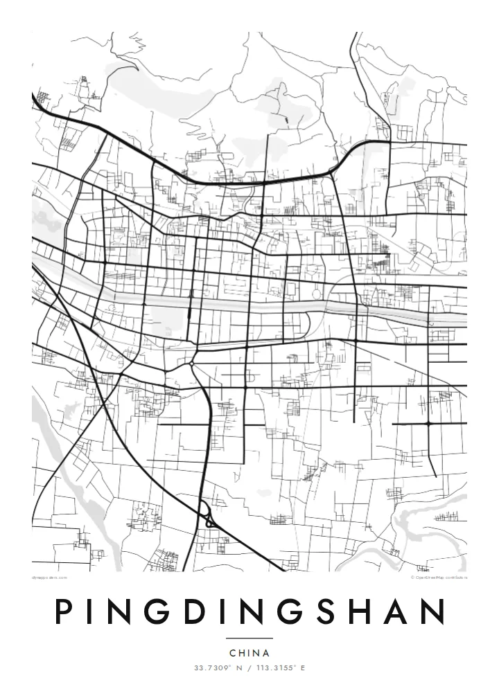
Pingdingshan grew along a corridor. Low hills rise to the north, and river plains and water lie to the south. The built-up area follows that band in a long east-west stretch, so on the map the city is wider than it is deep. The main roads run parallel through it, joined by shorter north-south cross streets.
The city's name means flat-topped mountain, after the level summit of a nearby hill. Its modern growth came from coal. Pingdingshan became one of the major coal-mining centres of central China in the second half of the twentieth century, and the mining districts and rail lines still shape its outer edges.
West of the centre lies the Baiguishan Reservoir, a large irregular body of water with a shoreline full of small inlets. The Lushan area, also administered by the city, is home to the Spring Temple Buddha, one of the tallest statues in the world. A Pingdingshan map poster frames the working city between its hills and its water.
The city lies in a long band with hills on one side and lowland on the other. Its main avenues run the length of that band in parallel lines.
A wide reservoir west of the centre with a ragged, branching shoreline. It is the largest open shape on the map and fills the frame beside the grid.
The high ground north of the city keeps development to the south of it. On the map, the dense streets stop where the slopes begin.
Make it yours
Add a date, a name or a line of your own, switch style, size or orientation.
Free preview is low-resolution with a watermark. The HD version is 7,200 × 10,800 px, 300 DPI, no watermark.
Why Pingdingshan
Pingdingshan is home to people whose families built its mines, railways and neighbourhoods. A map of it is a quiet tribute to a working city, and the reservoir and hills give the print a strong composition.
Add a family name, a year or a district to the title and subtitle, and adjust the coordinates line. Then pick Classic black & white, Noir, Paper, Blueprint or Sand to suit the room it will hang in.
Get the Pingdingshan poster — $9| Print size | Resolution | Files |
|---|---|---|
| 30 × 40 cm | 3,543 × 4,724 px | PNG · PDF |
| 50 × 70 cm | 5,906 × 8,268 px | PNG · PDF |
| A3 · 29.7 × 42 cm | 3,508 × 4,961 px | PNG · PDF |
| A2 · 42 × 59.4 cm | 4,961 × 7,016 px | PNG · PDF |
| 18 × 24" | 5,400 × 7,200 px | PNG · PDF |
| 24 × 36" | 7,200 × 10,800 px | PNG · PDF |
For comparison, the free preview is 900 px wide, watermarked and meant for screens. The HD files have up to 8× the resolution in each direction and print cleanly at full poster size.
Yes. Drag and zoom the map in the editor — centre it on your neighbourhood, the old town or the whole metro area. The text updates independently.
The HD purchase includes 30×40 cm, 50×70 cm, A3, A2, 18×24″ and 24×36″, each as a 300 DPI PNG and a print-ready PDF.
You can download a free 900 px preview with a watermark. The paid HD files have no watermark and are sharp enough for large prints.
Send the PDF to any local print shop or online printing service and ask for the matching paper size. Matte paper and a thin black or oak frame suit this style best.
Nearby
