Fig Tree Bay
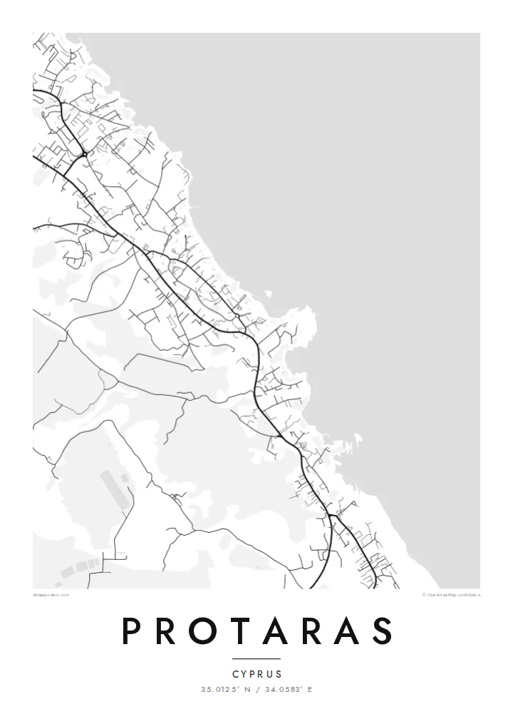
A sheltered cove with a small islet just offshore, Fig Tree Bay is the most recognisable curve along this coast. On the map it forms a neat notch in the shoreline.
Minimalist map poster · Cyprus
35.0125° N / 34.0583° E
A resort strip on the eastern coast of Cyprus, its roads tracing a jagged shoreline of small bays and rocky headlands.
One city, five moods
Tap a style to see it on the wall. Every style costs the same — printed, framed or as HD files.
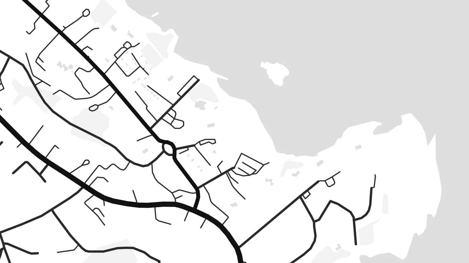 Actual pixels · 24 × 36″ print file
Print-sharp
This is a 100% crop of the real print file. Every poster — printed, framed or downloaded — is rendered on our servers at 300 DPI, up to 7,200 × 10,800 pixels, so even the smallest lanes stay crisp on a 24 × 36″ print.
On the wall


The map
Protaras lies on the east coast of Cyprus, just north of Cape Greco, in the part of Famagusta District administered by the Republic of Cyprus. On a map it is a place defined by its edge. The coastline breaks into a series of small coves and rocky points, and the town follows it as a long band of hotels, apartments and villas rather than gathering around a traditional centre.
The best known of these coves is Fig Tree Bay, named after a fig tree that has stood near the shore for centuries, with a small islet just offshore. Inland, a main avenue runs roughly parallel to the sea, and short streets drop from it to the beaches. The pattern is practical and linear, shaped by tourism that grew quickly from the 1970s onward.
Above the coast rises a rocky hill topped by the small church of Profitis Ilias, reached by a long flight of steps and visible from much of the town. Further south, the protected headland of Cape Greco closes the view. A Protaras map poster sets all of this against the open sea, where the plain water gives the coastline its full shape.
A sheltered cove with a small islet just offshore, Fig Tree Bay is the most recognisable curve along this coast. On the map it forms a neat notch in the shoreline.
Between the beaches, low rocky headlands push into the sea. The resulting outline is irregular and finely detailed, which gives the poster a lively edge against the calm expanse of water.
South of town the land narrows toward Cape Greco, a protected area of cliffs and sea caves. It frames the southern side of the map and adds a wild counterpoint to the resort streets.
Make it yours
Add a date, a name or a line of your own, switch style, size or orientation.
The free preview is low-resolution with a watermark. Prints and HD files are rendered at 300 DPI, up to 7,200 × 10,800 px, without a watermark.
Why Protaras
For many people Protaras is the place of a particular summer, a honeymoon or a family holiday that became a tradition. A map of its coastline is a more lasting souvenir than a photograph, and it suits a bright room or a hallway.
Set a title and subtitle, perhaps with the year of your trip, and adjust the coordinates line. Choose Classic black & white, Noir, Paper, Blueprint or Sand, then download the $9 HD files or order a printed poster with an optional wooden frame.
Order the Protaras poster| Print size | Resolution | Files |
|---|---|---|
| 30 × 40 cm11.8 × 15.7″ | 3,543 × 4,724 px | PNG · PDF |
| 29.7 × 42 cm (A3)11.7 × 16.5″ | 3,508 × 4,961 px | PNG · PDF |
| 42 × 59.4 cm (A2)16.5 × 23.4″ | 4,961 × 7,016 px | PNG · PDF |
| 45.7 × 61 cm18 × 24″ | 5,400 × 7,200 px | PNG · PDF |
| 50 × 70 cm19.7 × 27.6″ | 5,906 × 8,268 px | PNG · PDF |
| 61 × 91.4 cm24 × 36″ | 7,200 × 10,800 px | PNG · PDF |
For comparison, the free preview is 900 px wide, watermarked and meant for screens. The HD files have up to 8× the resolution in each direction and print cleanly at full poster size.
Pick a style at the top of the page, then choose Printed Poster — a size and, if you like, a frame — or Digital HD Files. Checkout takes one step, and your order page updates as soon as the payment goes through.
It is printed on premium 200 gsm matte paper in one of six sizes, from 30 × 40 cm to 24 × 36″. Printed posters start at $39, shipping included.
Yes. Choose a solid wood frame in black, white, natural oak or dark wood. It comes with shatterproof glazing and is ready to hang. Framed posters start at $99, shipping included.
Shipping is free to 60+ countries. Each poster is printed by the nearest of our print partners in 30+ countries and usually arrives in 3–7 business days. You can follow the status and tracking under My Orders. A few countries take 2–5 weeks, and where we don't ship yet, the site tells you before you pay.
Send us a photo within 14 days of delivery and we will reprint it for free or refund you.
Yes. In the editor on this page, change the title, the subtitle and the coordinates line to anything you like, and pick a style and size. Printed, framed and digital orders all use exactly your design.
For $9 you get 300 DPI PNG and print-ready PDF files in all six sizes, without a watermark, to print anywhere. Not sure yet? Download a free watermarked preview first.
Nearby
