Downtown rivers
The rivers were uncovered and realigned in the late twentieth century, and now run through downtown as narrow channels with walkways and a series of small bridges.
Minimalist map poster · United States
41.8240° N / 71.4128° W
A compact New England capital where rivers meet at the head of Narragansett Bay, with College Hill rising to the east.

One city, five moods
Tap a style to see it on the wall. Every style costs the same — printed, framed or as HD files.
 Actual pixels · 24 × 36″ print file
Print-sharp
This is a 100% crop of the real print file. Every poster — printed, framed or downloaded — is rendered on our servers at 300 DPI, up to 7,200 × 10,800 pixels, so even the smallest lanes stay crisp on a 24 × 36″ print.
On the wall
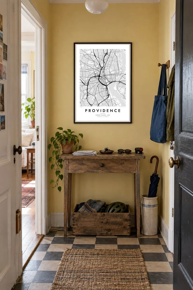


The map
Providence grew around the point where the Woonasquatucket and Moshassuck rivers join to form the Providence River, which flows south into Narragansett Bay. Downtown sits on low ground beside the water, College Hill climbs steeply to the east, and Federal Hill rises to the west. The street pattern mixes colonial lanes, nineteenth-century grids and the arcs of Interstate 95 and 195.
The city was founded in 1636 by Roger Williams as a place of religious freedom, making it one of the oldest cities in the United States. College Hill is home to Brown University and the Rhode Island School of Design, and Benefit Street is lined with historic houses. On selected summer evenings, WaterFire lights braziers on the downtown rivers.
A Providence map poster shows how much the city has reshaped itself: rivers uncovered in the late twentieth century, a highway moved to open land for new streets, and the old grain of the hills left intact. Framed at a wider scale, the Seekonk River and the upper reaches of the bay make a strong natural border.
The rivers were uncovered and realigned in the late twentieth century, and now run through downtown as narrow channels with walkways and a series of small bridges.
A steep neighbourhood of irregular streets east of the river, home to Brown University, RISD and some of the oldest surviving houses in the city.
The Seekonk River traces the eastern edge of the city, and to the south the Providence River widens into the upper part of Narragansett Bay.
Make it yours
Add a date, a name or a line of your own, switch style, size or orientation.
The free preview is low-resolution with a watermark. Prints and HD files are rendered at 300 DPI, up to 7,200 × 10,800 px, without a watermark.
Why Providence
Providence is a city many people live in for a few formative years, whether at Brown, RISD or one of the hospitals, and it tends to stay with them. A map of the neighbourhoods they walked every day makes a thoughtful graduation or moving gift.
Personalise the title and subtitle, perhaps with a class year or a wedding date, and edit the coordinates line. Paper and Classic black & white suit the old streets of College Hill, while Noir, Blueprint and Sand offer different moods. Digital files are $9 with no watermark.
Order the Providence poster| Print size | Resolution | Files |
|---|---|---|
| 30 × 40 cm11.8 × 15.7″ | 3,543 × 4,724 px | PNG · PDF |
| 29.7 × 42 cm (A3)11.7 × 16.5″ | 3,508 × 4,961 px | PNG · PDF |
| 42 × 59.4 cm (A2)16.5 × 23.4″ | 4,961 × 7,016 px | PNG · PDF |
| 45.7 × 61 cm18 × 24″ | 5,400 × 7,200 px | PNG · PDF |
| 50 × 70 cm19.7 × 27.6″ | 5,906 × 8,268 px | PNG · PDF |
| 61 × 91.4 cm24 × 36″ | 7,200 × 10,800 px | PNG · PDF |
For comparison, the free preview is 900 px wide, watermarked and meant for screens. The HD files have up to 8× the resolution in each direction and print cleanly at full poster size.
Pick a style at the top of the page, then choose Printed Poster — a size and, if you like, a frame — or Digital HD Files. Checkout takes one step, and your order page updates as soon as the payment goes through.
It is printed on premium 200 gsm matte paper in one of six sizes, from 30 × 40 cm to 24 × 36″. Printed posters start at $39, shipping included.
Yes. Choose a solid wood frame in black, white, natural oak or dark wood. It comes with shatterproof glazing and is ready to hang. Framed posters start at $99, shipping included.
Shipping is free to 60+ countries. Each poster is printed by the nearest of our print partners in 30+ countries and usually arrives in 3–7 business days. You can follow the status and tracking under My Orders. A few countries take 2–5 weeks, and where we don't ship yet, the site tells you before you pay.
Send us a photo within 14 days of delivery and we will reprint it for free or refund you.
Yes. In the editor on this page, change the title, the subtitle and the coordinates line to anything you like, and pick a style and size. Printed, framed and digital orders all use exactly your design.
For $9 you get 300 DPI PNG and print-ready PDF files in all six sizes, without a watermark, to print anywhere. Not sure yet? Download a free watermarked preview first.
Nearby
