Flushing Meadows
The park forms a long green spine in central Queens, holding Meadow Lake, the Unisphere from the 1964 World's Fair and the tennis centre of the US Open.
Minimalist map poster · United States
40.6815° N / 73.8365° W
New York's largest borough by area, a broad patchwork of grids spreading from the East River to Jamaica Bay and the Rockaways.
One city, five moods
Tap a style to see it on the wall. Every style costs the same — printed, framed or as HD files.
 Actual pixels · 24 × 36″ print file
Print-sharp
This is a 100% crop of the real print file. Every poster — printed, framed or downloaded — is rendered on our servers at 300 DPI, up to 7,200 × 10,800 pixels, so even the smallest lanes stay crisp on a 24 × 36″ print.
On the wall


The map
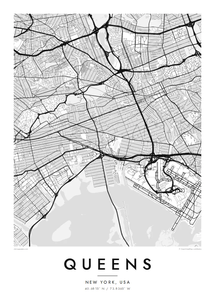
Queens covers the western end of Long Island, and on the map it looks like a vast patchwork of grids that do not quite align. Numbered streets, avenues, roads and drives run in slightly different directions from one neighbourhood to the next, stitched together by expressways and rail lines. Along the East River, Long Island City faces Manhattan, while the eastern edge runs into Nassau County.
Large open shapes break the street fabric. Flushing Meadows–Corona Park stretches north to south through the middle, a long green corridor with lakes and the site of two World's Fairs. A belt of cemeteries lines the border with Brooklyn. To the south, JFK Airport sits on the edge of Jamaica Bay, and beyond the water the long Rockaway peninsula faces the Atlantic.
Queens is often cited as one of the most linguistically diverse places on earth, with communities from around the world. It is home to both of New York's main airports and to the US Open tennis championships. A Queens map poster shows the borough in full, from its riverfront skyline to its ocean beaches.
The park forms a long green spine in central Queens, holding Meadow Lake, the Unisphere from the 1964 World's Fair and the tennis centre of the US Open.
A wide expanse of marsh islands and open water on the southern edge, with the runways of JFK Airport laid out along its shore.
A narrow strip of land between the bay and the Atlantic, lined with beach and boardwalk, forming the borough's slender southern border.
Make it yours
Add a date, a name or a line of your own, switch style, size or orientation.
The free preview is low-resolution with a watermark. Prints and HD files are rendered at 300 DPI, up to 7,200 × 10,800 px, without a watermark.
Why Queens
Queens is where many New Yorkers actually live, and neighbourhoods like Astoria, Jackson Heights, Flushing or Forest Hills carry strong personal meaning. A map of the whole borough tells that story more honestly than another Manhattan skyline, and it looks striking in black and white.
Title the poster with your neighbourhood, add a year or a street in the subtitle, and adjust the coordinates to your block. Five styles are available. The $9 digital set includes 18×24″ and 24×36″ alongside the metric formats, or you can order a framed print.
Order the Queens poster| Print size | Resolution | Files |
|---|---|---|
| 30 × 40 cm11.8 × 15.7″ | 3,543 × 4,724 px | PNG · PDF |
| 29.7 × 42 cm (A3)11.7 × 16.5″ | 3,508 × 4,961 px | PNG · PDF |
| 42 × 59.4 cm (A2)16.5 × 23.4″ | 4,961 × 7,016 px | PNG · PDF |
| 45.7 × 61 cm18 × 24″ | 5,400 × 7,200 px | PNG · PDF |
| 50 × 70 cm19.7 × 27.6″ | 5,906 × 8,268 px | PNG · PDF |
| 61 × 91.4 cm24 × 36″ | 7,200 × 10,800 px | PNG · PDF |
For comparison, the free preview is 900 px wide, watermarked and meant for screens. The HD files have up to 8× the resolution in each direction and print cleanly at full poster size.
Pick a style at the top of the page, then choose Printed Poster — a size and, if you like, a frame — or Digital HD Files. Checkout takes one step, and your order page updates as soon as the payment goes through.
It is printed on premium 200 gsm matte paper in one of six sizes, from 30 × 40 cm to 24 × 36″. Printed posters start at $39, shipping included.
Yes. Choose a solid wood frame in black, white, natural oak or dark wood. It comes with shatterproof glazing and is ready to hang. Framed posters start at $99, shipping included.
Shipping is free to 60+ countries. Each poster is printed by the nearest of our print partners in 30+ countries and usually arrives in 3–7 business days. You can follow the status and tracking under My Orders. A few countries take 2–5 weeks, and where we don't ship yet, the site tells you before you pay.
Send us a photo within 14 days of delivery and we will reprint it for free or refund you.
Yes. In the editor on this page, change the title, the subtitle and the coordinates line to anything you like, and pick a style and size. Printed, framed and digital orders all use exactly your design.
For $9 you get 300 DPI PNG and print-ready PDF files in all six sizes, without a watermark, to print anywhere. Not sure yet? Download a free watermarked preview first.
Nearby
