Al-Manara Square
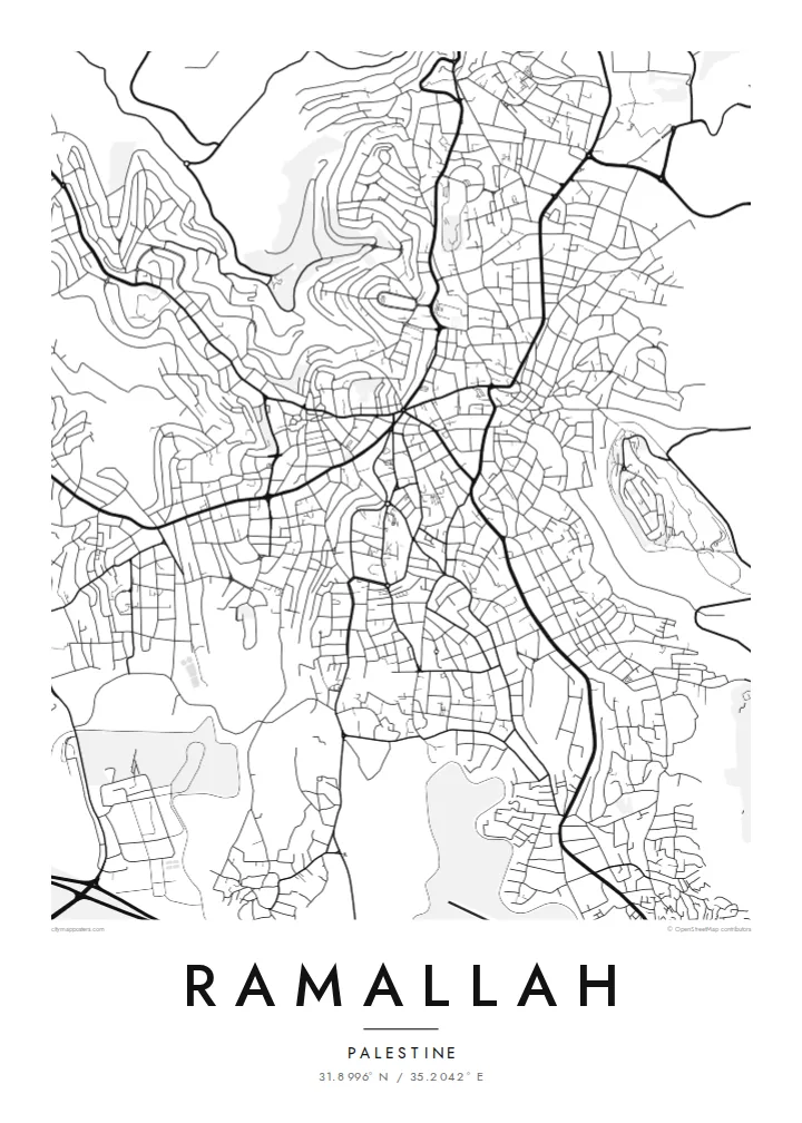
The central roundabout where major streets converge forms the heart of the map. The downtown pattern spreads out from this single point.
Minimalist map poster · Palestine
31.8996° N / 35.2042° E
A hilltop city north of Jerusalem, with streets winding over ridges and descending into terraced valleys
One city, five moods
Tap a style to see it on the wall. Every style costs the same — printed, framed or as HD files.
 Actual pixels · 24 × 36″ print file
Print-sharp
This is a 100% crop of the real print file. Every poster — printed, framed or downloaded — is rendered on our servers at 300 DPI, up to 7,200 × 10,800 pixels, so even the smallest lanes stay crisp on a 24 × 36″ print.
On the wall


The map
Ramallah sits high in the central hills of the West Bank, about 15 kilometres north of Jerusalem, at an elevation of around 800 metres or more. Its street plan is shaped by the terrain. Roads follow ridgelines and curve down into wadis, and many blocks are irregular because the ground rarely stays flat for long. Ramallah merges with the neighbouring city of al-Bireh, and the two form one continuous urban area.
At the centre is al-Manara Square, a roundabout where several main streets meet. It is the most recognisable point on the map. The city also serves as the administrative centre of the Palestinian Authority, and the Muqata'a compound includes the mausoleum of Yasser Arafat. Beyond the built-up edge, the map shows olive terraces and surrounding villages across the hills.
A Ramallah map poster shows a city defined by the land it stands on. Contour-following streets and scattered neighbourhoods on separate hills make it very different from a flat-plain city. For Palestinians at home and abroad, the map offers a way to hold a familiar place quietly and precisely.
The central roundabout where major streets converge forms the heart of the map. The downtown pattern spreads out from this single point.
Roads curve along ridges and drop into valleys, producing irregular blocks and flowing lines that clearly reflect the steep terrain beneath them.
Ramallah and al-Bireh run together without a visible break, forming one continuous urban area across several adjoining hills.
Make it yours
Add a date, a name or a line of your own, switch style, size or orientation.
The free preview is low-resolution with a watermark. Prints and HD files are rendered at 300 DPI, up to 7,200 × 10,800 px, without a watermark.
Why Ramallah
For many in the Palestinian diaspora, Ramallah is where family, work and memory meet. A precise, unadorned map lets the place speak for itself, without slogans or souvenir imagery. It suits a home, a studio or an office.
You can set the title in any form you prefer, add a neighbourhood or year in the subtitle, and keep or edit the coordinates. There are five styles to choose from. Sand and Paper suit the stone-coloured hills, and Noir brings out the winding streets most strongly.
Order the Ramallah poster| Print size | Resolution | Files |
|---|---|---|
| 30 × 40 cm11.8 × 15.7″ | 3,543 × 4,724 px | PNG · PDF |
| 29.7 × 42 cm (A3)11.7 × 16.5″ | 3,508 × 4,961 px | PNG · PDF |
| 42 × 59.4 cm (A2)16.5 × 23.4″ | 4,961 × 7,016 px | PNG · PDF |
| 45.7 × 61 cm18 × 24″ | 5,400 × 7,200 px | PNG · PDF |
| 50 × 70 cm19.7 × 27.6″ | 5,906 × 8,268 px | PNG · PDF |
| 61 × 91.4 cm24 × 36″ | 7,200 × 10,800 px | PNG · PDF |
For comparison, the free preview is 900 px wide, watermarked and meant for screens. The HD files have up to 8× the resolution in each direction and print cleanly at full poster size.
Pick a style at the top of the page, then choose Printed Poster — a size and, if you like, a frame — or Digital HD Files. Checkout takes one step, and your order page updates as soon as the payment goes through.
It is printed on premium 200 gsm matte paper in one of six sizes, from 30 × 40 cm to 24 × 36″. Printed posters start at $39, shipping included.
Yes. Choose a solid wood frame in black, white, natural oak or dark wood. It comes with shatterproof glazing and is ready to hang. Framed posters start at $99, shipping included.
Shipping is free to 60+ countries. Each poster is printed by the nearest of our print partners in 30+ countries and usually arrives in 3–7 business days. You can follow the status and tracking under My Orders. A few countries take 2–5 weeks, and where we don't ship yet, the site tells you before you pay.
Send us a photo within 14 days of delivery and we will reprint it for free or refund you.
Yes. In the editor on this page, change the title, the subtitle and the coordinates line to anything you like, and pick a style and size. Printed, framed and digital orders all use exactly your design.
For $9 you get 300 DPI PNG and print-ready PDF files in all six sizes, without a watermark, to print anywhere. Not sure yet? Download a free watermarked preview first.
Nearby
