Ara Tapu
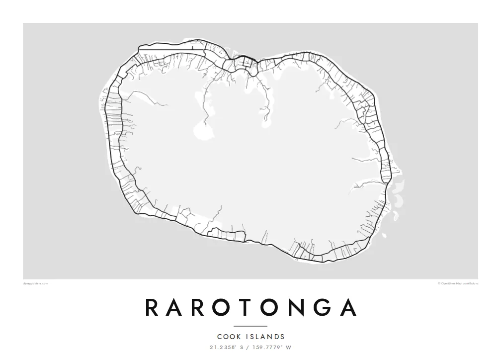
The coastal road circles the whole island, following the shore past beaches and villages. On the poster it traces a near-perfect loop, the most recognisable line on the map.
Minimalist map poster · Cook Islands
21.2358° S / 159.7779° W
A small, round volcanic island wrapped in a reef, a shallow lagoon and a single road that circles the coast.
One city, five moods
Tap a style to see it on the wall. Every style costs the same — printed, framed or as HD files.
 Actual pixels · 24 × 36″ print file
Print-sharp
This is a 100% crop of the real print file. Every poster — printed, framed or downloaded — is rendered on our servers at 300 DPI, up to 7,200 × 10,800 pixels, so even the smallest lanes stay crisp on a 24 × 36″ print.
On the wall


The island
Rarotonga is the largest and most populous of the Cook Islands and home to the capital, Avarua. From above it looks almost like a circle: a green, steep interior of volcanic peaks, a narrow strip of flat land around the edge, and a coral reef enclosing a shallow lagoon. The contrast between the empty centre and the lived-in ring defines every map of the island.
A coastal road, the Ara Tapu, circles the island in about 32 kilometres, and a bus runs around it in both directions. Inland, an older road, the Ara Metua, runs roughly parallel through gardens and plantations. Avarua sits on the north coast near the airport, while Muri, on the southeast, looks across a wide lagoon dotted with small islets.
The interior peaks are largely roadless, crossed only by walking tracks. The best known leads to Te Rua Manga, a spire of rock often called the Needle. A Rarotonga map poster traces the reef, the two concentric roads and the steep centre, a simple composition that shows exactly how life on the island is arranged.
The coastal road circles the whole island, following the shore past beaches and villages. On the poster it traces a near-perfect loop, the most recognisable line on the map.
On the southeast coast, a wide lagoon holds several small islets inside the reef. It is one of the few places where the outline opens into broad shapes of water.
The capital on the north coast, where streets cluster around the harbour and the main road. Just to the west, the airport runway runs along the shore.
Make it yours
Add a date, a name or a line of your own, switch style, size or orientation.
The free preview is low-resolution with a watermark. Prints and HD files are rendered at 300 DPI, up to 7,200 × 10,800 px, without a watermark.
Why Rarotonga
Rarotonga is a honeymoon island, a family home and a place people keep returning to. A map of the whole island, with its loop road and lagoon, captures that sense of a complete world small enough to cycle around.
Add names, a wedding date or a trip year to the title and subtitle, and keep the coordinates line. Choose Classic black & white, Noir, Paper, Blueprint or Sand. The $9 HD files include six print sizes, or order a printed poster instead.
Order the Rarotonga poster| Print size | Resolution | Files |
|---|---|---|
| 30 × 40 cm11.8 × 15.7″ | 3,543 × 4,724 px | PNG · PDF |
| 29.7 × 42 cm (A3)11.7 × 16.5″ | 3,508 × 4,961 px | PNG · PDF |
| 42 × 59.4 cm (A2)16.5 × 23.4″ | 4,961 × 7,016 px | PNG · PDF |
| 45.7 × 61 cm18 × 24″ | 5,400 × 7,200 px | PNG · PDF |
| 50 × 70 cm19.7 × 27.6″ | 5,906 × 8,268 px | PNG · PDF |
| 61 × 91.4 cm24 × 36″ | 7,200 × 10,800 px | PNG · PDF |
For comparison, the free preview is 900 px wide, watermarked and meant for screens. The HD files have up to 8× the resolution in each direction and print cleanly at full poster size.
Pick a style at the top of the page, then choose Printed Poster — a size and, if you like, a frame — or Digital HD Files. Checkout takes one step, and your order page updates as soon as the payment goes through.
It is printed on premium 200 gsm matte paper in one of six sizes, from 30 × 40 cm to 24 × 36″. Printed posters start at $39, shipping included.
Yes. Choose a solid wood frame in black, white, natural oak or dark wood. It comes with shatterproof glazing and is ready to hang. Framed posters start at $99, shipping included.
Shipping is free to 60+ countries. Each poster is printed by the nearest of our print partners in 30+ countries and usually arrives in 3–7 business days. You can follow the status and tracking under My Orders. A few countries take 2–5 weeks, and where we don't ship yet, the site tells you before you pay.
Send us a photo within 14 days of delivery and we will reprint it for free or refund you.
Yes. In the editor on this page, change the title, the subtitle and the coordinates line to anything you like, and pick a style and size. Printed, framed and digital orders all use exactly your design.
For $9 you get 300 DPI PNG and print-ready PDF files in all six sizes, without a watermark, to print anywhere. Not sure yet? Download a free watermarked preview first.
Nearby
