Sundarbans edge
The mangrove forest begins just to the south, its maze of creeks and channels forming one of the most intricate textures any map can show.
Minimalist map poster · Bangladesh
22.3101° N / 89.7911° E
A riverside area on the edge of the Sundarbans, where tidal channels and embankments meet the mangrove forest

One city, five moods
Tap a style to see it on the wall. Every style costs the same — printed, framed or as HD files.
 Actual pixels · 24 × 36″ print file
Print-sharp
This is a 100% crop of the real print file. Every poster — printed, framed or downloaded — is rendered on our servers at 300 DPI, up to 7,200 × 10,800 pixels, so even the smallest lanes stay crisp on a 24 × 36″ print.
On the wall


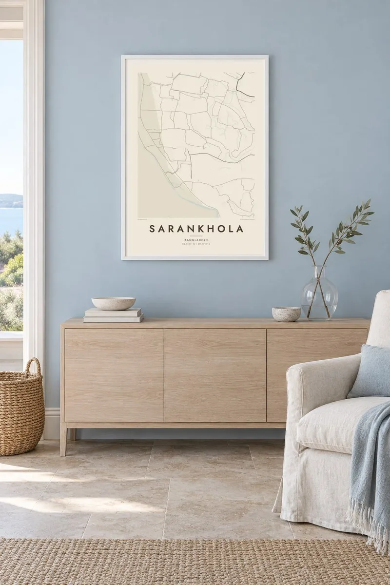
The map
Sarankhola lies in Bagerhat District in southwestern Bangladesh, at the northern edge of the Sundarbans, the largest mangrove forest in the world. The landscape here is shaped almost entirely by water. On the map, rivers and tidal creeks branch across the land in intricate patterns, with villages, fields and roads following the raised embankments that run between them.
The broad Baleshwar River forms a strong boundary on one side, while to the south the settled land gives way to the dense, channel-laced forest. Houses tend to line the embankments in narrow strips, and small markets grow where roads and waterways meet. The area was hit hard by Cyclone Sidr in 2007, and embankments and cyclone shelters remain part of daily life.
A Sarankhola map poster renders this delicate, water-bound geography with unusual clarity. Rivers and creeks become fine, branching lines, the forest edge a softer texture, and the settlements thin, deliberate strokes along the banks. It is a map of a place defined by its relationship with tides and mangroves, and it looks quite unlike any conventional town plan.
The mangrove forest begins just to the south, its maze of creeks and channels forming one of the most intricate textures any map can show.
The wide river running past the area is a major waterway of the southern delta, a broad band that anchors the whole composition.
Homes and roads follow raised embankments between the waterways, producing long, narrow lines of settlement rather than a compact centre or a street grid.
Make it yours
Add a date, a name or a line of your own, switch style, size or orientation.
The free preview is low-resolution with a watermark. Prints and HD files are rendered at 300 DPI, up to 7,200 × 10,800 px, without a watermark.
Why Sarankhola
People from Sarankhola often carry a deep attachment to the rivers and the forest, especially if they now live in Dhaka, Khulna or overseas. A map of home keeps that landscape present, and it also appeals to anyone who has travelled into the Sundarbans.
Personalise the title, subtitle and coordinates line to name a village, a family or a year. Choose from Classic black & white, Noir, Paper, Blueprint and Sand, then download six print sizes as 300 DPI PNG and print-ready PDF files for $9.
Order the Sarankhola poster| Print size | Resolution | Files |
|---|---|---|
| 30 × 40 cm11.8 × 15.7″ | 3,543 × 4,724 px | PNG · PDF |
| 29.7 × 42 cm (A3)11.7 × 16.5″ | 3,508 × 4,961 px | PNG · PDF |
| 42 × 59.4 cm (A2)16.5 × 23.4″ | 4,961 × 7,016 px | PNG · PDF |
| 45.7 × 61 cm18 × 24″ | 5,400 × 7,200 px | PNG · PDF |
| 50 × 70 cm19.7 × 27.6″ | 5,906 × 8,268 px | PNG · PDF |
| 61 × 91.4 cm24 × 36″ | 7,200 × 10,800 px | PNG · PDF |
For comparison, the free preview is 900 px wide, watermarked and meant for screens. The HD files have up to 8× the resolution in each direction and print cleanly at full poster size.
Pick a style at the top of the page, then choose Printed Poster — a size and, if you like, a frame — or Digital HD Files. Checkout takes one step, and your order page updates as soon as the payment goes through.
It is printed on premium 200 gsm matte paper in one of six sizes, from 30 × 40 cm to 24 × 36″. Printed posters start at $39, shipping included.
Yes. Choose a solid wood frame in black, white, natural oak or dark wood. It comes with shatterproof glazing and is ready to hang. Framed posters start at $99, shipping included.
Shipping is free to 60+ countries. Each poster is printed by the nearest of our print partners in 30+ countries and usually arrives in 3–7 business days. You can follow the status and tracking under My Orders. A few countries take 2–5 weeks, and where we don't ship yet, the site tells you before you pay.
Send us a photo within 14 days of delivery and we will reprint it for free or refund you.
Yes. In the editor on this page, change the title, the subtitle and the coordinates line to anything you like, and pick a style and size. Printed, framed and digital orders all use exactly your design.
For $9 you get 300 DPI PNG and print-ready PDF files in all six sizes, without a watermark, to print anywhere. Not sure yet? Download a free watermarked preview first.
Nearby
