Bhavani River
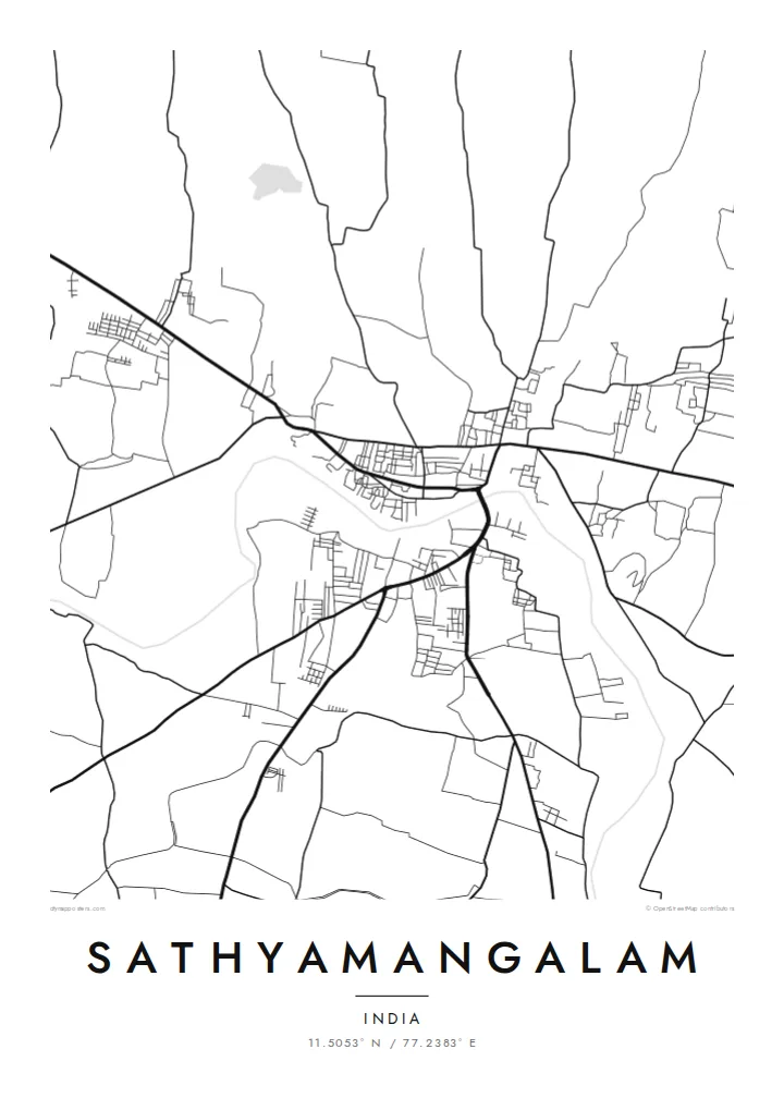
The river runs past the town in a wide curve. Its banks and bridges give the map a strong natural axis and a clear sense of direction.
Minimalist map poster · India
A river town on the Bhavani, where farm roads and town streets meet the forested edge of the hills.
11.5053° N / 77.2383° E


One city, five moods
Tap a style to see it on the wall. Every style is included in the same $9 price.
 Actual pixels · 24 × 36″ HD file
Print-sharp
This is a crop of the real HD file at 100%. The paid download is rendered on our servers at 300 DPI, up to 7,200 × 10,800 pixels, so even the smallest lanes stay crisp on a 24 × 36″ print.
The map
Sathyamangalam sits in Erode district in western Tamil Nadu, on the banks of the Bhavani River. The town's streets gather close to the water. On a map the river forms a broad, gently curving line that cuts through the grid, and the main roads follow its course.
To the north and west the landscape changes quickly. Irrigated fields give way to the forests of the Sathyamangalam Tiger Reserve, where the Western and Eastern Ghats meet, and the road toward the hills climbs through winding bends. The well-known Bannari Amman temple lies along this route, a stop for pilgrims heading into the forest country.
A Sathyamangalam map poster captures this meeting of settled plain and wild upland. The town reads as a dense cluster of lanes and bazaars beside the river. The space around it opens into canals, field boundaries and the first folds of the hills, so the composition has both detail and calm.
The river runs past the town in a wide curve. Its banks and bridges give the map a strong natural axis and a clear sense of direction.
Beyond the farmland lies the tiger reserve, a large protected forest. On the map it appears as open space broken only by a few roads climbing into the hills.
The route toward the Karnataka border winds uphill in a series of tight bends. It makes a graphic line that contrasts with the straight roads of the plain below.
Make it yours
Add a date, a name or a line of your own, switch style, size or orientation.
Free preview is low-resolution with a watermark. The HD version is 7,200 × 10,800 px, 300 DPI, no watermark.
Why Sathyamangalam
For those who know Sathyamangalam, it means river mornings, temple visits and the drive toward the hills. A map of the town and its surroundings keeps that setting in one frame, and it makes a thoughtful gift for family members who have moved to Coimbatore, Chennai or overseas.
Edit the title, subtitle and coordinates line to add a house name or a date, and choose Classic black & white, Noir, Paper, Blueprint or Sand. The $9 download includes 300 DPI PNG and print-ready PDF files, and matte prints ship from partners in 30+ countries.
Get the Sathyamangalam poster — $9| Print size | Resolution | Files |
|---|---|---|
| 30 × 40 cm (11.8 × 15.7″) | 3,543 × 4,724 px | PNG · PDF |
| 50 × 70 cm (19.7 × 27.6″) | 5,906 × 8,268 px | PNG · PDF |
| 29.7 × 42 cm (A3, 11.7 × 16.5″) | 3,508 × 4,961 px | PNG · PDF |
| 42 × 59.4 cm (A2, 16.5 × 23.4″) | 4,961 × 7,016 px | PNG · PDF |
| 45.7 × 61 cm (18 × 24″) | 5,400 × 7,200 px | PNG · PDF |
| 61 × 91.4 cm (24 × 36″) | 7,200 × 10,800 px | PNG · PDF |
For comparison, the free preview is 900 px wide, watermarked and meant for screens. The HD files have up to 8× the resolution in each direction and print cleanly at full poster size.
Yes. Drag and zoom the map in the editor — centre it on your neighbourhood, the old town or the whole metro area. The text updates independently.
The HD purchase includes 30×40 cm, 50×70 cm, A3, A2, 18×24″ and 24×36″, each as a 300 DPI PNG and a print-ready PDF.
You can download a free 900 px preview with a watermark. The paid HD files have no watermark and are sharp enough for large prints.
Send the PDF to any local print shop or online printing service and ask for the matching paper size. Matte paper and a thin black or oak frame suit this style best.
Nearby
