Great Western line
The main line from London Paddington cuts straight across the town, with the station near the centre and a short branch line heading south toward Windsor.
Minimalist map poster · United Kingdom
51.5095° N / 0.5954° W
A railway town west of London, stretched along the Great Western line with the M4, Windsor and the Thames to the south.

One city, five moods
Tap a style to see it on the wall. Every style costs the same — printed, framed or as HD files.
 Actual pixels · 24 × 36″ print file
Print-sharp
This is a 100% crop of the real print file. Every poster — printed, framed or downloaded — is rendered on our servers at 300 DPI, up to 7,200 × 10,800 pixels, so even the smallest lanes stay crisp on a 24 × 36″ print.
On the wall

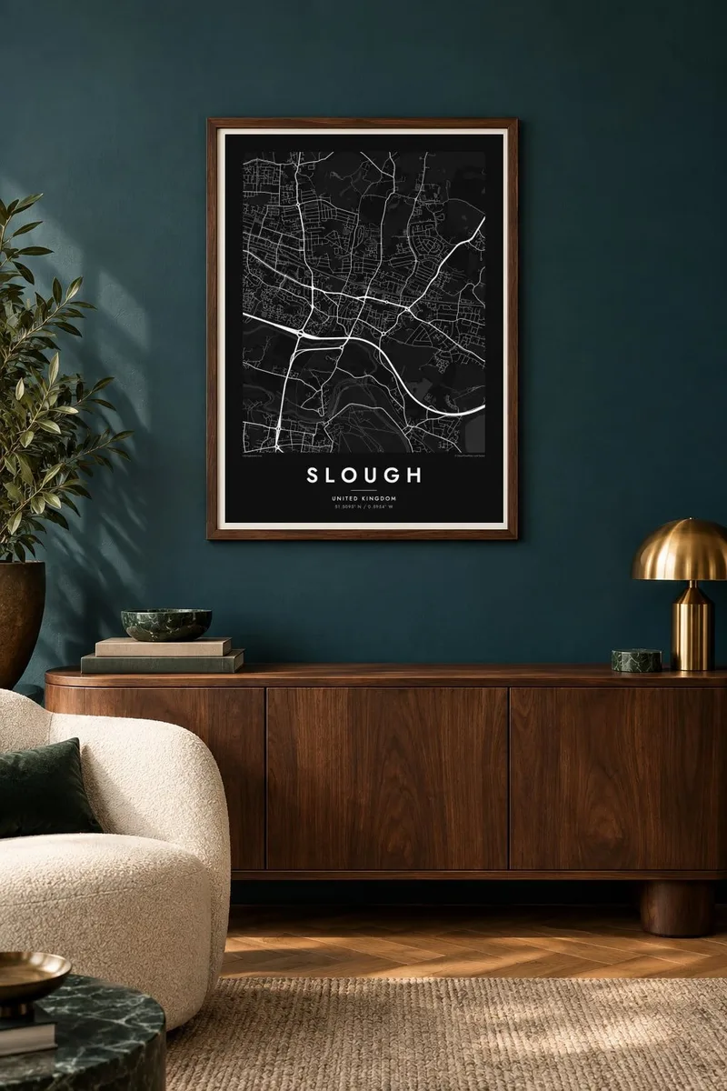
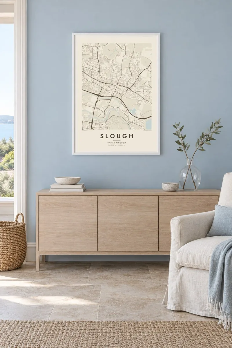
The map
Slough lies in Berkshire, a little over twenty miles west of central London, on flat ground in the Thames Valley. The map is organised along an east–west axis: the Great Western Main Line runs through the middle of town, the old Bath Road runs parallel to it, and the M4 motorway follows the southern edge. Residential streets fill the spaces between, from Victorian terraces to twentieth-century estates.
Northwest of the centre lies the Slough Trading Estate, founded after the First World War and often described as the largest industrial estate in single private ownership in Europe. Its rectangular plots and long service roads make a distinctive pattern, and today they hold offices and data centres as well as factories. Heathrow Airport lies a short distance to the east.
The astronomer William Herschel lived in Slough and built his great telescopes here, discovering several planetary moons from the town. South of the M4, Eton and then the Thames lead to Windsor Castle on the far bank. A Slough map poster places this commuter town in its context: rail, road, industry and the river valley.
The main line from London Paddington cuts straight across the town, with the station near the centre and a short branch line heading south toward Windsor.
The large grid of industrial plots northwest of the centre stands out on the map as a different texture, with long parallel roads and big rectangular blocks.
The M4 motorway forms a firm boundary along the south of the town, with Eton, the Thames and Windsor lying just beyond it.
Make it yours
Add a date, a name or a line of your own, switch style, size or orientation.
The free preview is low-resolution with a watermark. Prints and HD files are rendered at 300 DPI, up to 7,200 × 10,800 px, without a watermark.
Why Slough
Slough is home to a large, diverse population and a workplace for many more, from the trading estate to Heathrow. A precise map of the town is a considered way to mark where someone grew up, settled or started a career.
Give it a title, add a subtitle or date, and choose whether to show the coordinates. Pick from five styles, including the strong contrast of Noir, then download six print sizes for $9 or order a printed poster from a partner near you.
Order the Slough poster| Print size | Resolution | Files |
|---|---|---|
| 30 × 40 cm11.8 × 15.7″ | 3,543 × 4,724 px | PNG · PDF |
| 29.7 × 42 cm (A3)11.7 × 16.5″ | 3,508 × 4,961 px | PNG · PDF |
| 42 × 59.4 cm (A2)16.5 × 23.4″ | 4,961 × 7,016 px | PNG · PDF |
| 45.7 × 61 cm18 × 24″ | 5,400 × 7,200 px | PNG · PDF |
| 50 × 70 cm19.7 × 27.6″ | 5,906 × 8,268 px | PNG · PDF |
| 61 × 91.4 cm24 × 36″ | 7,200 × 10,800 px | PNG · PDF |
For comparison, the free preview is 900 px wide, watermarked and meant for screens. The HD files have up to 8× the resolution in each direction and print cleanly at full poster size.
Pick a style at the top of the page, then choose Printed Poster — a size and, if you like, a frame — or Digital HD Files. Checkout takes one step, and your order page updates as soon as the payment goes through.
It is printed on premium 200 gsm matte paper in one of six sizes, from 30 × 40 cm to 24 × 36″. Printed posters start at $39, shipping included.
Yes. Choose a solid wood frame in black, white, natural oak or dark wood. It comes with shatterproof glazing and is ready to hang. Framed posters start at $99, shipping included.
Shipping is free to 60+ countries. Each poster is printed by the nearest of our print partners in 30+ countries and usually arrives in 3–7 business days. You can follow the status and tracking under My Orders. A few countries take 2–5 weeks, and where we don't ship yet, the site tells you before you pay.
Send us a photo within 14 days of delivery and we will reprint it for free or refund you.
Yes. In the editor on this page, change the title, the subtitle and the coordinates line to anything you like, and pick a style and size. Printed, framed and digital orders all use exactly your design.
For $9 you get 300 DPI PNG and print-ready PDF files in all six sizes, without a watermark, to print anywhere. Not sure yet? Download a free watermarked preview first.
Nearby
