Basingstoke Canal
The canal traces a slow, winding line across the town from west to east. It passes under roads and the railway and links pockets of green space.
Minimalist map poster · United Kingdom
51.3190° N / 0.5589° W
A commuter town spread along the railway and the Basingstoke Canal, framed by open heathland commons to the north.

One city, five moods
Tap a style to see it on the wall. Every style costs the same — printed, framed or as HD files.
 Actual pixels · 24 × 36″ print file
Print-sharp
This is a 100% crop of the real print file. Every poster — printed, framed or downloaded — is rendered on our servers at 300 DPI, up to 7,200 × 10,800 pixels, so even the smallest lanes stay crisp on a 24 × 36″ print.
On the wall
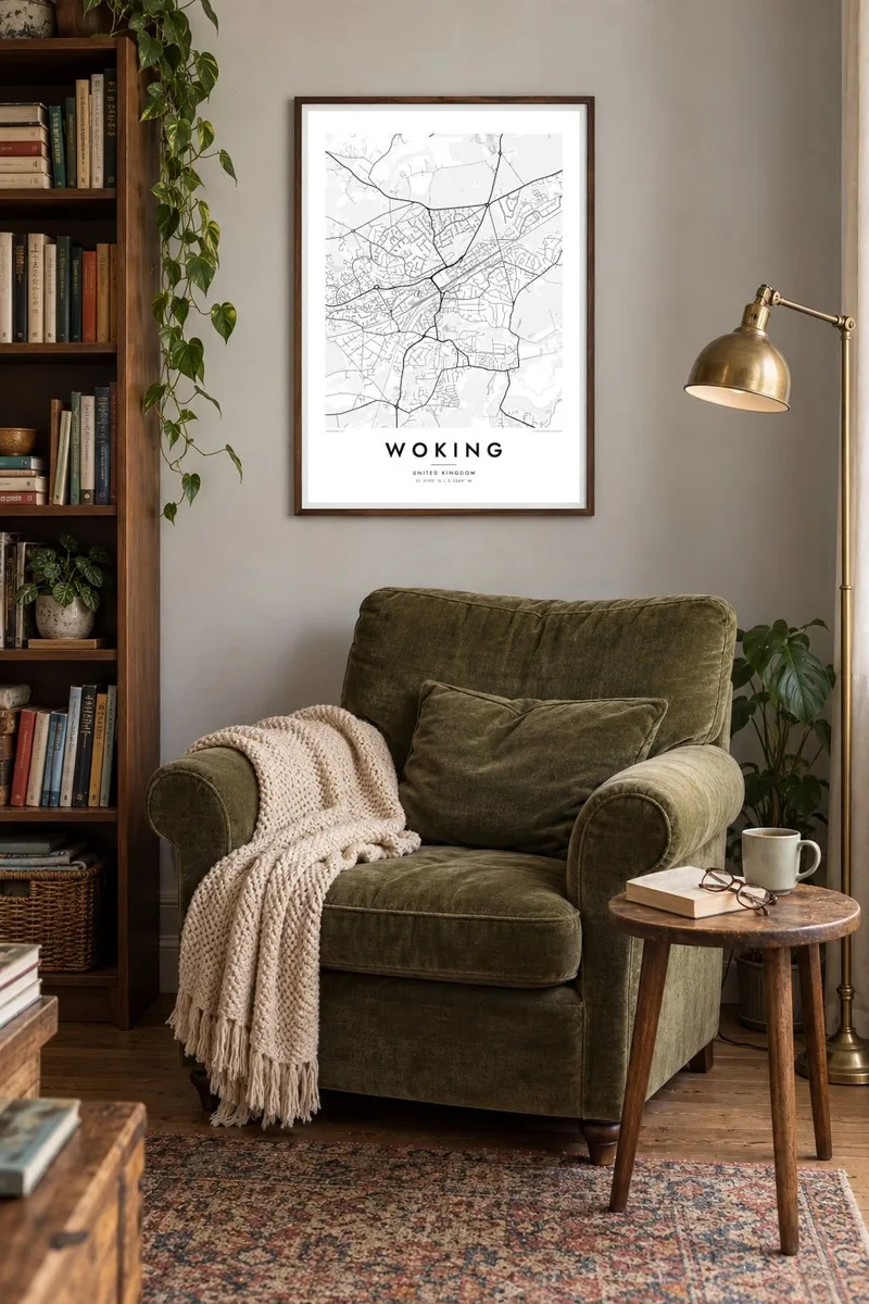


The map
Woking grew largely because of the railway. When the line from London arrived in the nineteenth century, a new town formed around the station, away from the older village of Old Woking to the south-east. On the map the town centre sits tight against the tracks. Suburbs spread out from it in curving roads and cul-de-sacs toward the surrounding villages.
The Basingstoke Canal runs east to west through the town just north of the centre, a thin line that bends through housing and green space. Woking is also home to the Shah Jahan Mosque, built in 1889 as the first purpose-built mosque in Britain. On Horsell Common, H. G. Wells set the Martian landing of The War of the Worlds.
A Woking map poster brings these layers together: the straight railway, the looping canal, the dense centre and the soft green gaps of commons and golf courses. It is a map of a suburban town, but one with more shape and story than most, and it looks particularly good in the lighter styles.
The canal traces a slow, winding line across the town from west to east. It passes under roads and the railway and links pockets of green space.
The main line to London cuts straight through Woking, with the station at the heart of the town centre and the tracks dividing north from south.
North of the centre, this large area of heath and woodland appears as a broad open space. It is the landing site of Wells's fictional Martians.
Make it yours
Add a date, a name or a line of your own, switch style, size or orientation.
The free preview is low-resolution with a watermark. Prints and HD files are rendered at 300 DPI, up to 7,200 × 10,800 px, without a watermark.
Why Woking
Woking is a place of first homes and family years, close to London yet distinct from it. A map poster makes a considered housewarming or leaving gift. Title it with the street name, add the date you moved in, and let the coordinates mark the exact front door.
Five styles are available: Classic black & white, Noir, Paper, Blueprint and Sand. The $9 digital files cover 30×40 cm, 50×70 cm, A3, A2, 18×24″ and 24×36″ as 300 DPI PNG and PDF. You can also order a matte print, optionally in a wooden frame.
Order the Woking poster| Print size | Resolution | Files |
|---|---|---|
| 30 × 40 cm11.8 × 15.7″ | 3,543 × 4,724 px | PNG · PDF |
| 29.7 × 42 cm (A3)11.7 × 16.5″ | 3,508 × 4,961 px | PNG · PDF |
| 42 × 59.4 cm (A2)16.5 × 23.4″ | 4,961 × 7,016 px | PNG · PDF |
| 45.7 × 61 cm18 × 24″ | 5,400 × 7,200 px | PNG · PDF |
| 50 × 70 cm19.7 × 27.6″ | 5,906 × 8,268 px | PNG · PDF |
| 61 × 91.4 cm24 × 36″ | 7,200 × 10,800 px | PNG · PDF |
For comparison, the free preview is 900 px wide, watermarked and meant for screens. The HD files have up to 8× the resolution in each direction and print cleanly at full poster size.
Pick a style at the top of the page, then choose Printed Poster — a size and, if you like, a frame — or Digital HD Files. Checkout takes one step, and your order page updates as soon as the payment goes through.
It is printed on premium 200 gsm matte paper in one of six sizes, from 30 × 40 cm to 24 × 36″. Printed posters start at $39, shipping included.
Yes. Choose a solid wood frame in black, white, natural oak or dark wood. It comes with shatterproof glazing and is ready to hang. Framed posters start at $99, shipping included.
Shipping is free to 60+ countries. Each poster is printed by the nearest of our print partners in 30+ countries and usually arrives in 3–7 business days. You can follow the status and tracking under My Orders. A few countries take 2–5 weeks, and where we don't ship yet, the site tells you before you pay.
Send us a photo within 14 days of delivery and we will reprint it for free or refund you.
Yes. In the editor on this page, change the title, the subtitle and the coordinates line to anything you like, and pick a style and size. Printed, framed and digital orders all use exactly your design.
For $9 you get 300 DPI PNG and print-ready PDF files in all six sizes, without a watermark, to print anywhere. Not sure yet? Download a free watermarked preview first.
Nearby
