The Tapi bend
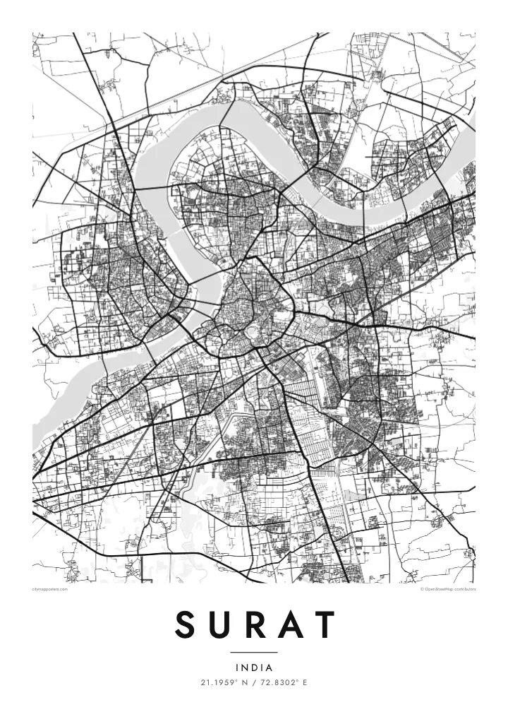
The river curves around the old city in a wide arc, forming the most prominent line on the map and dividing older and newer Surat.
Minimalist map poster · India
A city built around a wide bend of the Tapi River, with ring roads circling the old centre on the south bank.
21.1959° N / 72.8302° E


One city, five moods
Tap a style to see it on the wall. Every style is included in the same $9 price.
 Actual pixels · 24 × 36″ HD file
Print-sharp
This is a crop of the real HD file at 100%. The paid download is rendered on our servers at 300 DPI, up to 7,200 × 10,800 pixels, so even the smallest lanes stay crisp on a 24 × 36″ print.
The map
Surat takes its shape from the Tapi River, which sweeps through the city in a broad curve on its way to the Arabian Sea. The older city sits on the southern bank inside that bend, and its dense, irregular streets reflect centuries of trade. Several bridges cross the river, linking it to newer districts that have grown quickly to the north and west.
Around the historic centre, a series of ring roads encircles the city at increasing distances, giving the map a layered, concentric structure. Surat Castle, a sixteenth-century fort, stands beside the river near the old core. Toward the coast, the land becomes flatter and more open, with industrial areas reaching out toward Hazira.
In the seventeenth century Surat was one of the most important ports of Mughal India, and the English and Dutch both established trading posts here. Today it is known worldwide as a centre for cutting and polishing diamonds and for textiles. A Surat map poster traces a city whose outline is set by its river and its circling roads.
The river curves around the old city in a wide arc, forming the most prominent line on the map and dividing older and newer Surat.
Concentric ring roads circle the centre at intervals, giving the street network a clear, almost target-like structure that reads well in a minimal print.
The riverside fort, built in the sixteenth century, sits at the edge of the old city where the dense street pattern meets the water.
Make it yours
Add a date, a name or a line of your own, switch style, size or orientation.
Free preview is low-resolution with a watermark. The HD version is 7,200 × 10,800 px, 300 DPI, no watermark.
Why Surat
Surat has grown and changed quickly, and for people who have watched it happen, a map is a way to hold the city still for a moment. The river and the rings of road give it a clear, graphic character that works well in a small or large print.
Personalise the title, subtitle and coordinates line to mark a home, a business or a year. Choose from Classic black & white, Noir, Paper, Blueprint and Sand, and receive 300 DPI files for $9 or a printed poster on matte paper.
Get the Surat poster — $9| Print size | Resolution | Files |
|---|---|---|
| 30 × 40 cm | 3,543 × 4,724 px | PNG · PDF |
| 50 × 70 cm | 5,906 × 8,268 px | PNG · PDF |
| A3 · 29.7 × 42 cm | 3,508 × 4,961 px | PNG · PDF |
| A2 · 42 × 59.4 cm | 4,961 × 7,016 px | PNG · PDF |
| 18 × 24" | 5,400 × 7,200 px | PNG · PDF |
| 24 × 36" | 7,200 × 10,800 px | PNG · PDF |
For comparison, the free preview is 900 px wide, watermarked and meant for screens. The HD files have up to 8× the resolution in each direction and print cleanly at full poster size.
Yes. Drag and zoom the map in the editor — centre it on your neighbourhood, the old town or the whole metro area. The text updates independently.
The HD purchase includes 30×40 cm, 50×70 cm, A3, A2, 18×24″ and 24×36″, each as a 300 DPI PNG and a print-ready PDF.
You can download a free 900 px preview with a watermark. The paid HD files have no watermark and are sharp enough for large prints.
Send the PDF to any local print shop or online printing service and ask for the matching paper size. Matte paper and a thin black or oak frame suit this style best.
Nearby
