Maumee River
The river crosses the city on a wide diagonal toward Maumee Bay. Lined with docks and parks, this strong pale band divides the poster into two halves.
Minimalist map poster · United States
41.6639° N / 83.5552° W
A Great Lakes city where the Maumee River widens into Maumee Bay at the western tip of Lake Erie.

One city, five moods
Tap a style to see it on the wall. Every style costs the same — printed, framed or as HD files.
 Actual pixels · 24 × 36″ print file
Print-sharp
This is a 100% crop of the real print file. Every poster — printed, framed or downloaded — is rendered on our servers at 300 DPI, up to 7,200 × 10,800 pixels, so even the smallest lanes stay crisp on a 24 × 36″ print.
On the wall


The map
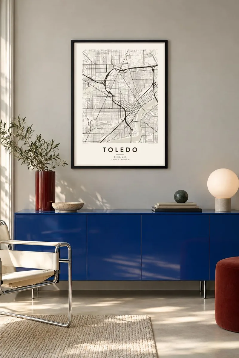
Toledo sits in northwestern Ohio on the Maumee River, just before it flows into Maumee Bay at the western end of Lake Erie. The river runs diagonally through the city, from southwest to northeast, with downtown on the west bank and East Toledo on the other side. On a map, the broad, slow river and its port facilities are the most striking features.
Several bridges cross the Maumee, among them the Veterans' Glass City Skyway, a cable-stayed bridge with a single pylon lit through glass. Downtown's streets line up with the river, while many outer neighbourhoods follow the compass. Where these grids meet, the map takes on an unusual texture. Interstates 75 and 280 add long, curving lines through the city.
Toledo earned the name Glass City from its long history of glass manufacturing, and the Toledo Museum of Art, with its Glass Pavilion, reflects that heritage. The city is also closely tied to Jeep, which has been built there for decades. A Toledo map poster captures the river, the bay and the meeting of street grids, a composition shaped by water and industry.
The river crosses the city on a wide diagonal toward Maumee Bay. Lined with docks and parks, this strong pale band divides the poster into two halves.
The cable-stayed bridge carrying I-280 over the Maumee is a clean single line across the water. It is the most recognisable of the city's river crossings.
Downtown's grid follows the angle of the river, while outer neighbourhoods run north to south. The seams between these patterns give the map its distinctive texture.
Make it yours
Add a date, a name or a line of your own, switch style, size or orientation.
The free preview is low-resolution with a watermark. Prints and HD files are rendered at 300 DPI, up to 7,200 × 10,800 px, without a watermark.
Why Toledo
Family ties in Toledo run long, to the plants, the neighbourhoods and the river. A map poster is a clear, understated way to mark where you grew up, where you work, or where you came from before moving away.
Edit the title, subtitle and coordinates line to add a name or a date, then choose Classic black & white, Noir, Paper, Blueprint or Sand. The $9 download covers six sizes, including 18×24″ and 24×36″, each as a 300 DPI PNG and a PDF.
Order the Toledo poster| Print size | Resolution | Files |
|---|---|---|
| 30 × 40 cm11.8 × 15.7″ | 3,543 × 4,724 px | PNG · PDF |
| 29.7 × 42 cm (A3)11.7 × 16.5″ | 3,508 × 4,961 px | PNG · PDF |
| 42 × 59.4 cm (A2)16.5 × 23.4″ | 4,961 × 7,016 px | PNG · PDF |
| 45.7 × 61 cm18 × 24″ | 5,400 × 7,200 px | PNG · PDF |
| 50 × 70 cm19.7 × 27.6″ | 5,906 × 8,268 px | PNG · PDF |
| 61 × 91.4 cm24 × 36″ | 7,200 × 10,800 px | PNG · PDF |
For comparison, the free preview is 900 px wide, watermarked and meant for screens. The HD files have up to 8× the resolution in each direction and print cleanly at full poster size.
Pick a style at the top of the page, then choose Printed Poster — a size and, if you like, a frame — or Digital HD Files. Checkout takes one step, and your order page updates as soon as the payment goes through.
It is printed on premium 200 gsm matte paper in one of six sizes, from 30 × 40 cm to 24 × 36″. Printed posters start at $39, shipping included.
Yes. Choose a solid wood frame in black, white, natural oak or dark wood. It comes with shatterproof glazing and is ready to hang. Framed posters start at $99, shipping included.
Shipping is free to 60+ countries. Each poster is printed by the nearest of our print partners in 30+ countries and usually arrives in 3–7 business days. You can follow the status and tracking under My Orders. A few countries take 2–5 weeks, and where we don't ship yet, the site tells you before you pay.
Send us a photo within 14 days of delivery and we will reprint it for free or refund you.
Yes. In the editor on this page, change the title, the subtitle and the coordinates line to anything you like, and pick a style and size. Printed, framed and digital orders all use exactly your design.
For $9 you get 300 DPI PNG and print-ready PDF files in all six sizes, without a watermark, to print anywhere. Not sure yet? Download a free watermarked preview first.
Nearby
