Nidelva loop
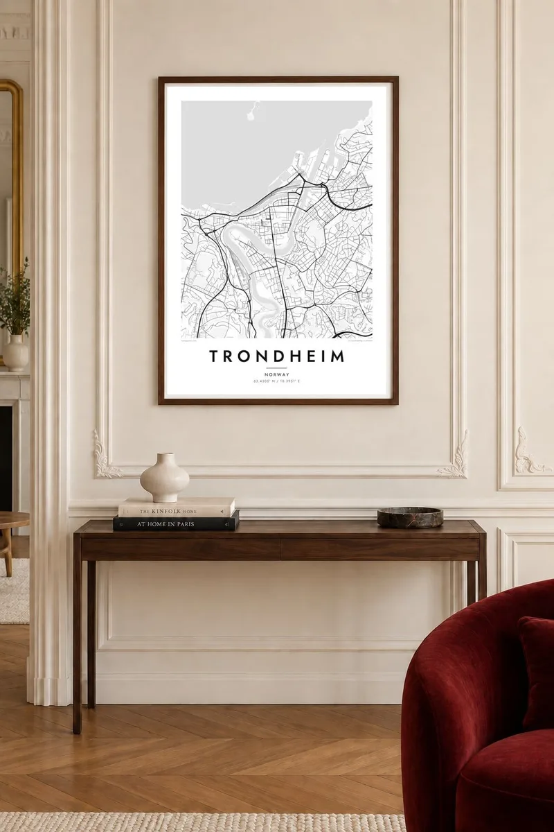
The river bends almost completely around Midtbyen before reaching the fjord, giving the centre its distinctive near-island shape and the map a natural frame.
Minimalist map poster · Norway
63.4305° N / 10.3951° E
A fjord city whose old centre sits almost enclosed by a tight loop of the Nidelva river.

One city, five moods
Tap a style to see it on the wall. Every style costs the same — printed, framed or as HD files.
 Actual pixels · 24 × 36″ print file
Print-sharp
This is a 100% crop of the real print file. Every poster — printed, framed or downloaded — is rendered on our servers at 300 DPI, up to 7,200 × 10,800 pixels, so even the smallest lanes stay crisp on a 24 × 36″ print.
On the wall


The map
Trondheim lies on the southern shore of the Trondheimsfjord, where the Nidelva river makes a sharp meander before entering the sea. The loop nearly encircles the city centre, Midtbyen, turning it into a peninsula held between river and fjord. On the map this is one of the clearest city shapes in Scandinavia: a compact grid of wide streets inside a ring of water.
The wide streets date from the plan drawn after a great fire in 1681, designed to stop flames from spreading. At the southern end of the centre stands Nidaros Cathedral, the northernmost medieval cathedral of its scale and a long-standing pilgrimage destination. Across the Old Town Bridge, the wooden warehouses and houses of Bakklandet line the eastern riverbank.
Trondheim served as Norway's capital in the Viking Age and is today home to NTNU, the country's largest university, whose campus at Gløshaugen overlooks the centre from the hill. Offshore, the small island of Munkholmen sits in the fjord. A Trondheim map poster frames the river loop, the fjord shoreline and the surrounding hills in a single balanced image.
The river bends almost completely around Midtbyen before reaching the fjord, giving the centre its distinctive near-island shape and the map a natural frame.
Broad, straight streets laid out after the great fire of 1681 cross the centre, a clear, open pattern set within the curve of the river.
A small island lies in the fjord just off the city, a single compact shape in the open water north of the harbour and the centre.
Make it yours
Add a date, a name or a line of your own, switch style, size or orientation.
The free preview is low-resolution with a watermark. Prints and HD files are rendered at 300 DPI, up to 7,200 × 10,800 px, without a watermark.
Why Trondheim
Students who spent years at NTNU, pilgrims who walked to Nidaros and families who have lived here for generations all recognise the river loop immediately. It is one of those city maps that works as graphic design even for people who have never visited.
Personalise the title, subtitle and coordinates line, whether with a graduation year or the name of a street in Bakklandet. Choose Classic black & white, Noir, Paper, Blueprint or Sand. Download six print sizes for $9 or order a matte print shipped from a nearby partner.
Order the Trondheim poster| Print size | Resolution | Files |
|---|---|---|
| 30 × 40 cm11.8 × 15.7″ | 3,543 × 4,724 px | PNG · PDF |
| 29.7 × 42 cm (A3)11.7 × 16.5″ | 3,508 × 4,961 px | PNG · PDF |
| 42 × 59.4 cm (A2)16.5 × 23.4″ | 4,961 × 7,016 px | PNG · PDF |
| 45.7 × 61 cm18 × 24″ | 5,400 × 7,200 px | PNG · PDF |
| 50 × 70 cm19.7 × 27.6″ | 5,906 × 8,268 px | PNG · PDF |
| 61 × 91.4 cm24 × 36″ | 7,200 × 10,800 px | PNG · PDF |
For comparison, the free preview is 900 px wide, watermarked and meant for screens. The HD files have up to 8× the resolution in each direction and print cleanly at full poster size.
Pick a style at the top of the page, then choose Printed Poster — a size and, if you like, a frame — or Digital HD Files. Checkout takes one step, and your order page updates as soon as the payment goes through.
It is printed on premium 200 gsm matte paper in one of six sizes, from 30 × 40 cm to 24 × 36″. Printed posters start at $39, shipping included.
Yes. Choose a solid wood frame in black, white, natural oak or dark wood. It comes with shatterproof glazing and is ready to hang. Framed posters start at $99, shipping included.
Shipping is free to 60+ countries. Each poster is printed by the nearest of our print partners in 30+ countries and usually arrives in 3–7 business days. You can follow the status and tracking under My Orders. A few countries take 2–5 weeks, and where we don't ship yet, the site tells you before you pay.
Send us a photo within 14 days of delivery and we will reprint it for free or refund you.
Yes. In the editor on this page, change the title, the subtitle and the coordinates line to anything you like, and pick a style and size. Printed, framed and digital orders all use exactly your design.
For $9 you get 300 DPI PNG and print-ready PDF files in all six sizes, without a watermark, to print anywhere. Not sure yet? Download a free watermarked preview first.
Nearby
