Island city
The urban area is split across low islands, so the street grid appears in compact fragments separated by water and linked by bridges.
Minimalist map poster · Colombia
1.7911° N / 78.7927° W
A Pacific port spread across low islands and mangrove channels, linked by bridges to the mainland of southwestern Colombia

One city, five moods
Tap a style to see it on the wall. Every style costs the same — printed, framed or as HD files.
 Actual pixels · 24 × 36″ print file
Print-sharp
This is a 100% crop of the real print file. Every poster — printed, framed or downloaded — is rendered on our servers at 300 DPI, up to 7,200 × 10,800 pixels, so even the smallest lanes stay crisp on a 24 × 36″ print.
On the wall


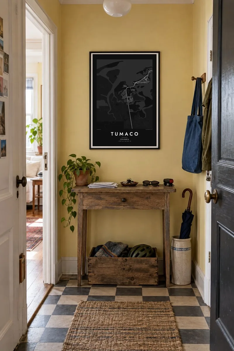
The map
Tumaco lies on Colombia's Pacific coast in the department of Nariño, close to the border with Ecuador. The town is built largely on islands in a shallow bay, chiefly Tumaco and El Morro, joined to each other and to the mainland by bridges. On the map, the urban grid is squeezed into these small pieces of land, surrounded by tidal channels, mangroves and open water.
El Morro faces the open ocean, with the beaches and the rock arch known as the Arco del Morro that have become symbols of the town. The port handles fishing and trade, and Tumaco is the Pacific terminal of the Trans-Andean oil pipeline. In 1979 a powerful earthquake and tsunami struck this coast, an event that remains part of local memory.
A Tumaco map poster is as much about water as about land. The outlines of the islands, the bridges and the channels threading through the mangroves create an organic, almost nautical composition, with dense streets packed in wherever there is ground to build on. It is a strong image for anyone from the Colombian Pacific, where the sea shapes every map.
The urban area is split across low islands, so the street grid appears in compact fragments separated by water and linked by bridges.
On the ocean side, the island of El Morro has beaches and a natural rock arch, and its shoreline forms the outer edge of the town.
Around the bay and along the mainland shore, tidal channels wind through mangrove forest, drawing fine, branching lines across the water.
Make it yours
Add a date, a name or a line of your own, switch style, size or orientation.
The free preview is low-resolution with a watermark. Prints and HD files are rendered at 300 DPI, up to 7,200 × 10,800 px, without a watermark.
Why Tumaco
Tumaco carries deep meaning for Afro-Colombian families of the Pacific coast, including those who moved inland to Cali or Bogotá. A map of its islands and bridges is a personal way to keep the sea close when the coast is far away.
You can personalise the title and subtitle, add a date or a family name and adjust the coordinates line. Choose from five styles, including Noir and Blueprint, which suit the coastline especially well, then download HD files or order a matte print.
Order the Tumaco poster| Print size | Resolution | Files |
|---|---|---|
| 30 × 40 cm11.8 × 15.7″ | 3,543 × 4,724 px | PNG · PDF |
| 29.7 × 42 cm (A3)11.7 × 16.5″ | 3,508 × 4,961 px | PNG · PDF |
| 42 × 59.4 cm (A2)16.5 × 23.4″ | 4,961 × 7,016 px | PNG · PDF |
| 45.7 × 61 cm18 × 24″ | 5,400 × 7,200 px | PNG · PDF |
| 50 × 70 cm19.7 × 27.6″ | 5,906 × 8,268 px | PNG · PDF |
| 61 × 91.4 cm24 × 36″ | 7,200 × 10,800 px | PNG · PDF |
For comparison, the free preview is 900 px wide, watermarked and meant for screens. The HD files have up to 8× the resolution in each direction and print cleanly at full poster size.
Pick a style at the top of the page, then choose Printed Poster — a size and, if you like, a frame — or Digital HD Files. Checkout takes one step, and your order page updates as soon as the payment goes through.
It is printed on premium 200 gsm matte paper in one of six sizes, from 30 × 40 cm to 24 × 36″. Printed posters start at $39, shipping included.
Yes. Choose a solid wood frame in black, white, natural oak or dark wood. It comes with shatterproof glazing and is ready to hang. Framed posters start at $99, shipping included.
Shipping is free to 60+ countries. Each poster is printed by the nearest of our print partners in 30+ countries and usually arrives in 3–7 business days. You can follow the status and tracking under My Orders. A few countries take 2–5 weeks, and where we don't ship yet, the site tells you before you pay.
Send us a photo within 14 days of delivery and we will reprint it for free or refund you.
Yes. In the editor on this page, change the title, the subtitle and the coordinates line to anything you like, and pick a style and size. Printed, framed and digital orders all use exactly your design.
For $9 you get 300 DPI PNG and print-ready PDF files in all six sizes, without a watermark, to print anywhere. Not sure yet? Download a free watermarked preview first.
Nearby
