Coastal ring road
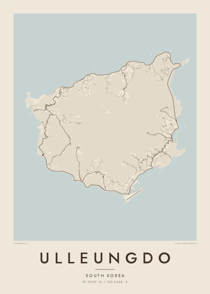
A road now circles the island close to the water, passing through tunnels and along cliffs. On the map it forms an almost complete loop just inside the shoreline.
Minimalist map poster · South Korea
A steep volcanic island rising from the East Sea, ringed by a coastal road and small harbours set in narrow valleys.
37.5012° N / 130.8562° E


One city, five moods
Tap a style to see it on the wall. Every style is included in the same $9 price.
 Actual pixels · 24 × 36″ HD file
Print-sharp
This is a crop of the real HD file at 100%. The paid download is rendered on our servers at 300 DPI, up to 7,200 × 10,800 pixels, so even the smallest lanes stay crisp on a 24 × 36″ print.
The island
Ulleungdo lies in the sea east of the Korean peninsula. It is the summit of an old volcano that rises steeply from deep water. From above it is nearly round, with a rugged interior that climbs to Seonginbong, its highest peak, and a coastline dominated by cliffs. Villages occupy the few places where valleys meet the sea, most of them on narrow strips of flat ground.
Dodong, the main port, is squeezed into a steep valley on the east coast. Its streets climb inland because there is no room to spread along the shore. For generations the island has been known for squid fishing, with the catch hung out to dry around the harbours. On the north side, the Nari Basin is a rare stretch of flat ground high among the peaks.
An Ulleungdo map poster is shaped by the tension between a smooth, round outline and crowded detail at its edges. The coastal road, which took decades to complete around the whole island, draws a ring just inside the shoreline, and the harbour towns appear as small, dense knots. The interior peaks are left almost entirely clear.
A road now circles the island close to the water, passing through tunnels and along cliffs. On the map it forms an almost complete loop just inside the shoreline.
The main port fills a deep, narrow valley on the east coast. Its streets run uphill rather than along the water, which gives it a compact, vertical pattern.
In the north, a flat basin inside the old volcano holds farmland and a small village. On the map it is a quiet, open patch surrounded by high ground.
Make it yours
Add a date, a name or a line of your own, switch style, size or orientation.
Free preview is low-resolution with a watermark. The HD version is 7,200 × 10,800 px, 300 DPI, no watermark.
Why Ulleungdo
Ulleungdo is a place people travel far to reach, usually by a long ferry ride, and it stays with them. A map poster records its unusual shape and what it takes to live there, which makes it a natural choice for anyone who has walked its trails or grown up in its harbours.
Put the island's name in the title and the date of your visit in the subtitle, and keep or edit the coordinates line. Choose Classic black & white, Noir, Paper, Blueprint or Sand. Each $9 download includes 300 DPI PNG and print-ready PDF files in six sizes, without a watermark.
Get the Ulleungdo poster — $9| Print size | Resolution | Files |
|---|---|---|
| 30 × 40 cm | 3,543 × 4,724 px | PNG · PDF |
| 50 × 70 cm | 5,906 × 8,268 px | PNG · PDF |
| A3 · 29.7 × 42 cm | 3,508 × 4,961 px | PNG · PDF |
| A2 · 42 × 59.4 cm | 4,961 × 7,016 px | PNG · PDF |
| 18 × 24" | 5,400 × 7,200 px | PNG · PDF |
| 24 × 36" | 7,200 × 10,800 px | PNG · PDF |
For comparison, the free preview is 900 px wide, watermarked and meant for screens. The HD files have up to 8× the resolution in each direction and print cleanly at full poster size.
The map is framed to show the whole island, with a calm margin around it.
The HD purchase includes 30×40 cm, 50×70 cm, A3, A2, 18×24″ and 24×36″, each as a 300 DPI PNG and a print-ready PDF. You can also order it printed and shipped.
Yes — change the title, subtitle and coordinates line to anything you like, such as your names and the dates of your trip.
You can download a free 900 px preview with a watermark. The paid HD files have no watermark and are sharp enough for large prints.
Nearby
