The Singel ring
A water-filled moat that follows the old city walls and almost fully surrounds the centre. On the poster it draws a clear boundary around the medieval streets.
Minimalist map poster · Netherlands
52.0908° N / 5.1222° E
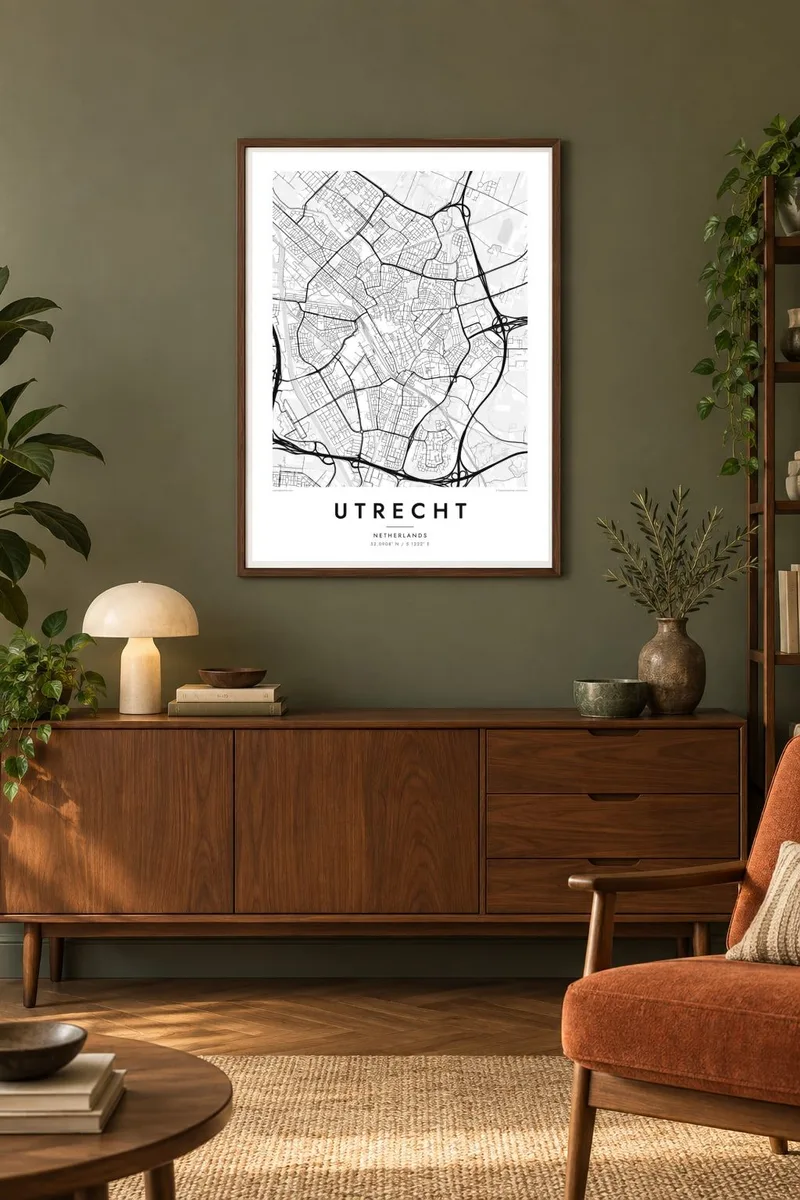
A medieval canal core circled by the moat-like Singel, with the Dom Tower at its centre and new districts spreading west.

One city, five moods
Tap a style to see it on the wall. Every style costs the same — printed, framed or as HD files.
 Actual pixels · 24 × 36″ print file
Print-sharp
This is a 100% crop of the real print file. Every poster — printed, framed or downloaded — is rendered on our servers at 300 DPI, up to 7,200 × 10,800 pixels, so even the smallest lanes stay crisp on a 24 × 36″ print.
On the wall


The map
Utrecht's historic centre is one of the most legible old towns in the Netherlands. The Oudegracht runs through it from south to north, and around the whole core the Singel follows the line of the former city walls as a continuous ring of water. At the centre stands the Dom Tower, which at about 112 metres is the tallest church tower in the country.
The Oudegracht is unusual for its two levels. Below the street, old wharf cellars open onto a waterside quay now used for cafés and walking. West of the centre, Utrecht Centraal is the busiest railway station in the Netherlands. Beside it, the Catharijnesingel was reopened as a canal after decades as a motorway. Further west, Leidsche Rijn adds a large planned district.
A Utrecht map poster shows the city's growth in rings. The tight medieval streets sit inside the Singel, and nineteenth-century neighbourhoods spread outward along radial roads. Later districts, the Amsterdam-Rhine Canal and the university campus at the Uithof add straighter lines and larger blocks. Few Dutch cities show their history in plan quite so clearly.
A water-filled moat that follows the old city walls and almost fully surrounds the centre. On the poster it draws a clear boundary around the medieval streets.
The main canal through the old town, with wharf cellars at water level beneath the streets. It forms the long central spine of the historic core.
The Domplein marks where the cathedral nave stood until a storm destroyed it in 1674, leaving the tower standing on its own. It is the centre of every Utrecht map.
Make it yours
Add a date, a name or a line of your own, switch style, size or orientation.
The free preview is low-resolution with a watermark. Prints and HD files are rendered at 300 DPI, up to 7,200 × 10,800 px, without a watermark.
Why Utrecht
Utrecht is a city of students, commuters and people who stayed longer than they planned, and its compact ring makes a strong image on a wall. Mark a graduation, a first apartment or a move with a custom title and subtitle, and edit the coordinates line to point at a canal or street.
The map is available in Classic black & white, Noir, Paper, Blueprint and Sand. HD files cost $9 and cover six print sizes, including A3, A2 and 50×70 cm, as 300 DPI PNG and print-ready PDF. Printed posters come on matte paper, framed if you wish.
Order the Utrecht poster| Print size | Resolution | Files |
|---|---|---|
| 30 × 40 cm11.8 × 15.7″ | 3,543 × 4,724 px | PNG · PDF |
| 29.7 × 42 cm (A3)11.7 × 16.5″ | 3,508 × 4,961 px | PNG · PDF |
| 42 × 59.4 cm (A2)16.5 × 23.4″ | 4,961 × 7,016 px | PNG · PDF |
| 45.7 × 61 cm18 × 24″ | 5,400 × 7,200 px | PNG · PDF |
| 50 × 70 cm19.7 × 27.6″ | 5,906 × 8,268 px | PNG · PDF |
| 61 × 91.4 cm24 × 36″ | 7,200 × 10,800 px | PNG · PDF |
For comparison, the free preview is 900 px wide, watermarked and meant for screens. The HD files have up to 8× the resolution in each direction and print cleanly at full poster size.
Pick a style at the top of the page, then choose Printed Poster — a size and, if you like, a frame — or Digital HD Files. Checkout takes one step, and your order page updates as soon as the payment goes through.
It is printed on premium 200 gsm matte paper in one of six sizes, from 30 × 40 cm to 24 × 36″. Printed posters start at $39, shipping included.
Yes. Choose a solid wood frame in black, white, natural oak or dark wood. It comes with shatterproof glazing and is ready to hang. Framed posters start at $99, shipping included.
Shipping is free to 60+ countries. Each poster is printed by the nearest of our print partners in 30+ countries and usually arrives in 3–7 business days. You can follow the status and tracking under My Orders. A few countries take 2–5 weeks, and where we don't ship yet, the site tells you before you pay.
Send us a photo within 14 days of delivery and we will reprint it for free or refund you.
Yes. In the editor on this page, change the title, the subtitle and the coordinates line to anything you like, and pick a style and size. Printed, framed and digital orders all use exactly your design.
For $9 you get 300 DPI PNG and print-ready PDF files in all six sizes, without a watermark, to print anywhere. Not sure yet? Download a free watermarked preview first.
Nearby
