District layout
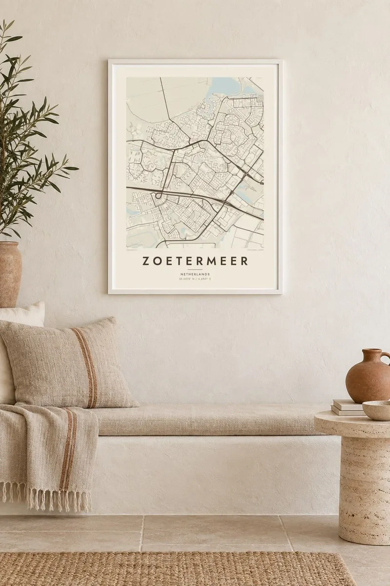
Each neighbourhood, from Meerzicht to Rokkeveen, has its own internal pattern of streets, and on the map the districts read as distinct, carefully fitted blocks.
Minimalist map poster · Netherlands
52.0575° N / 4.4931° E
A planned new town east of The Hague, organised into distinct districts around lakes, parks and a light-rail loop.

One city, five moods
Tap a style to see it on the wall. Every style costs the same — printed, framed or as HD files.
 Actual pixels · 24 × 36″ print file
Print-sharp
This is a 100% crop of the real print file. Every poster — printed, framed or downloaded — is rendered on our servers at 300 DPI, up to 7,200 × 10,800 pixels, so even the smallest lanes stay crisp on a 24 × 36″ print.
On the wall


The map
Zoetermeer was a small village until the 1960s, when it was designated a growth town to house people from The Hague and the wider Randstad. Within a few decades its population grew many times over, and the map shows the result: a set of clearly separated districts, each with its own street pattern, divided by green belts, canals and main roads.
A light-rail line, now part of RandstadRail, runs through the districts and loops around the city, linking neighbourhoods to the centre and on to The Hague. The Noord Aa lake and surrounding parks add open water to the plan, and on the edge of town an artificial hill holds an indoor ski slope, one of Zoetermeer's more unusual landmarks.
A Zoetermeer map poster reveals the thinking of Dutch postwar planning, with neighbourhoods arranged like parts of a diagram and water woven through them. It suits residents and anyone interested in how a new town is designed, and the flat polder landscape frames the city neatly on every side.
Each neighbourhood, from Meerzicht to Rokkeveen, has its own internal pattern of streets, and on the map the districts read as distinct, carefully fitted blocks.
The city's light-rail line curves through the districts in a loop, a strong continuous line that connects the neighbourhoods and structures the whole map.
The Noord Aa lake and the Buytenpark add areas of open water and green on the poster that balance the dense residential streets.
Make it yours
Add a date, a name or a line of your own, switch style, size or orientation.
The free preview is low-resolution with a watermark. Prints and HD files are rendered at 300 DPI, up to 7,200 × 10,800 px, without a watermark.
Why Zoetermeer
Zoetermeer is where many families in the Randstad found space for a first house with a garden. A map of the town, district by district, marks that chapter and looks at home in an interior that values clean lines.
Change the title, subtitle and coordinates to name your district or a moving date. Choose Classic black & white, Noir, Paper, Blueprint or Sand. HD files for $9 cover six sizes including A3 and A2, and printed posters are available with a wooden frame.
Order the Zoetermeer poster| Print size | Resolution | Files |
|---|---|---|
| 30 × 40 cm11.8 × 15.7″ | 3,543 × 4,724 px | PNG · PDF |
| 29.7 × 42 cm (A3)11.7 × 16.5″ | 3,508 × 4,961 px | PNG · PDF |
| 42 × 59.4 cm (A2)16.5 × 23.4″ | 4,961 × 7,016 px | PNG · PDF |
| 45.7 × 61 cm18 × 24″ | 5,400 × 7,200 px | PNG · PDF |
| 50 × 70 cm19.7 × 27.6″ | 5,906 × 8,268 px | PNG · PDF |
| 61 × 91.4 cm24 × 36″ | 7,200 × 10,800 px | PNG · PDF |
For comparison, the free preview is 900 px wide, watermarked and meant for screens. The HD files have up to 8× the resolution in each direction and print cleanly at full poster size.
Pick a style at the top of the page, then choose Printed Poster — a size and, if you like, a frame — or Digital HD Files. Checkout takes one step, and your order page updates as soon as the payment goes through.
It is printed on premium 200 gsm matte paper in one of six sizes, from 30 × 40 cm to 24 × 36″. Printed posters start at $39, shipping included.
Yes. Choose a solid wood frame in black, white, natural oak or dark wood. It comes with shatterproof glazing and is ready to hang. Framed posters start at $99, shipping included.
Shipping is free to 60+ countries. Each poster is printed by the nearest of our print partners in 30+ countries and usually arrives in 3–7 business days. You can follow the status and tracking under My Orders. A few countries take 2–5 weeks, and where we don't ship yet, the site tells you before you pay.
Send us a photo within 14 days of delivery and we will reprint it for free or refund you.
Yes. In the editor on this page, change the title, the subtitle and the coordinates line to anything you like, and pick a style and size. Printed, framed and digital orders all use exactly your design.
For $9 you get 300 DPI PNG and print-ready PDF files in all six sizes, without a watermark, to print anywhere. Not sure yet? Download a free watermarked preview first.
Nearby
