Housing blocks
The estate's tall residential towers appear as crisp, repeated footprints, arranged around open courtyards and linked by footpaths and covered walkways.
Minimalist map poster · Hong Kong
22.3902° N / 114.1922° E
A public housing estate in Sha Tin New Town, its tower blocks set near the Shing Mun River beneath steep green hills.

One city, five moods
Tap a style to see it on the wall. Every style costs the same — printed, framed or as HD files.
 Actual pixels · 24 × 36″ print file
Print-sharp
This is a 100% crop of the real print file. Every poster — printed, framed or downloaded — is rendered on our servers at 300 DPI, up to 7,200 × 10,800 pixels, so even the smallest lanes stay crisp on a 24 × 36″ print.
On the wall

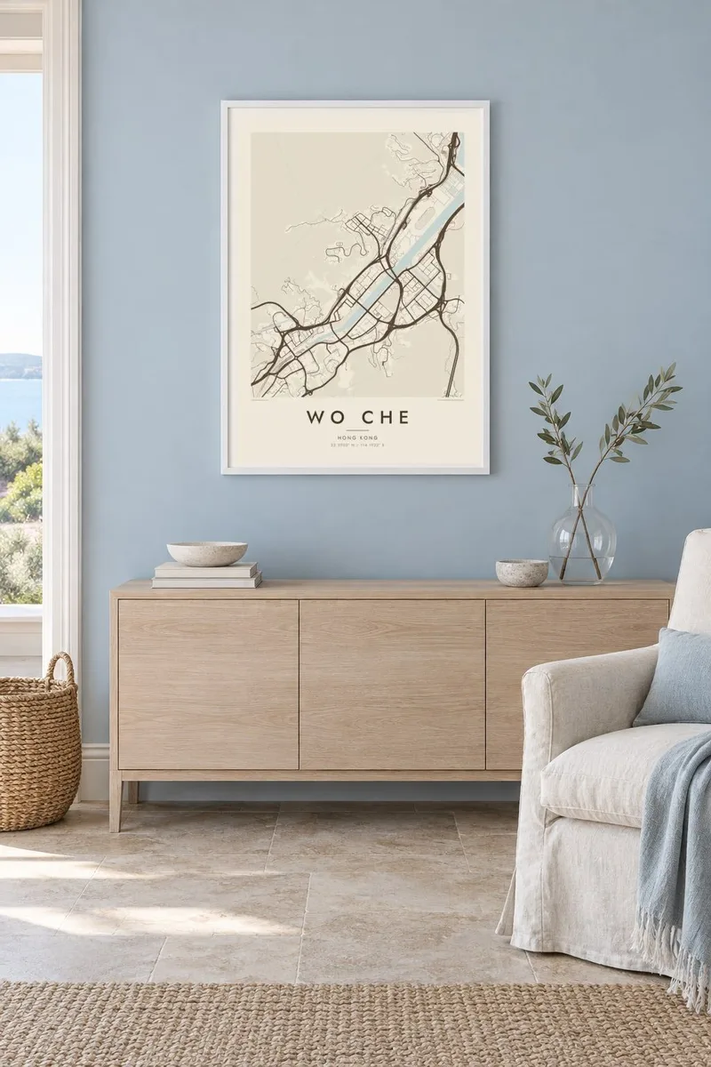

The map
Wo Che is a residential area in Sha Tin, in Hong Kong's New Territories, centred on one of the public housing estates built as the new town expanded in the 1970s. Sha Tin itself grew largely on land reclaimed from the shallow inlet of Tolo Harbour, and its planned layout shows clearly on a map: broad roads, a channelled river and neatly separated districts.
Around Wo Che, the tall residential blocks appear as distinct footprints set among podiums, playgrounds and walkways, with the wide channel of the Shing Mun River nearby. The hills that enclose the Sha Tin valley rise sharply beyond the built area, so the dense estates end abruptly against slopes of green, a contrast that defines this part of Hong Kong.
A Wo Che map poster captures the particular geometry of Hong Kong's new towns, where housing, transport and open space were planned together at scale. For residents past and present it records the daily routes between home, the railway, the river promenade and the shopping arcades, all within a short walk of each other.
The estate's tall residential towers appear as crisp, repeated footprints, arranged around open courtyards and linked by footpaths and covered walkways.
The river's wide, straightened channel runs through the heart of Sha Tin, a strong band of water that frames the surrounding estates on the map.
Steep hillsides surround the Sha Tin valley, and the built-up area stops sharply at their base, leaving large empty spaces at the edges of the frame.
Make it yours
Add a date, a name or a line of your own, switch style, size or orientation.
The free preview is low-resolution with a watermark. Prints and HD files are rendered at 300 DPI, up to 7,200 × 10,800 px, without a watermark.
Why Wo Che
Many people in Hong Kong grew up in a public estate, and the name of that estate carries real meaning. A map of Wo Che is a way to honour a childhood home, a first flat or a family's decades in Sha Tin.
Personalise the title and subtitle, perhaps with a block name or a year, and adjust the coordinates line. Noir suits the density of the towers, while Paper feels softer. The HD files include 18×24″ and 24×36″ as well as A3 and A2.
Order the Wo Che poster| Print size | Resolution | Files |
|---|---|---|
| 30 × 40 cm11.8 × 15.7″ | 3,543 × 4,724 px | PNG · PDF |
| 29.7 × 42 cm (A3)11.7 × 16.5″ | 3,508 × 4,961 px | PNG · PDF |
| 42 × 59.4 cm (A2)16.5 × 23.4″ | 4,961 × 7,016 px | PNG · PDF |
| 45.7 × 61 cm18 × 24″ | 5,400 × 7,200 px | PNG · PDF |
| 50 × 70 cm19.7 × 27.6″ | 5,906 × 8,268 px | PNG · PDF |
| 61 × 91.4 cm24 × 36″ | 7,200 × 10,800 px | PNG · PDF |
For comparison, the free preview is 900 px wide, watermarked and meant for screens. The HD files have up to 8× the resolution in each direction and print cleanly at full poster size.
Pick a style at the top of the page, then choose Printed Poster — a size and, if you like, a frame — or Digital HD Files. Checkout takes one step, and your order page updates as soon as the payment goes through.
It is printed on premium 200 gsm matte paper in one of six sizes, from 30 × 40 cm to 24 × 36″. Printed posters start at $39, shipping included.
Yes. Choose a solid wood frame in black, white, natural oak or dark wood. It comes with shatterproof glazing and is ready to hang. Framed posters start at $99, shipping included.
Shipping is free to 60+ countries. Each poster is printed by the nearest of our print partners in 30+ countries and usually arrives in 3–7 business days. You can follow the status and tracking under My Orders. A few countries take 2–5 weeks, and where we don't ship yet, the site tells you before you pay.
Send us a photo within 14 days of delivery and we will reprint it for free or refund you.
Yes. In the editor on this page, change the title, the subtitle and the coordinates line to anything you like, and pick a style and size. Printed, framed and digital orders all use exactly your design.
For $9 you get 300 DPI PNG and print-ready PDF files in all six sizes, without a watermark, to print anywhere. Not sure yet? Download a free watermarked preview first.
Nearby
