River confluence
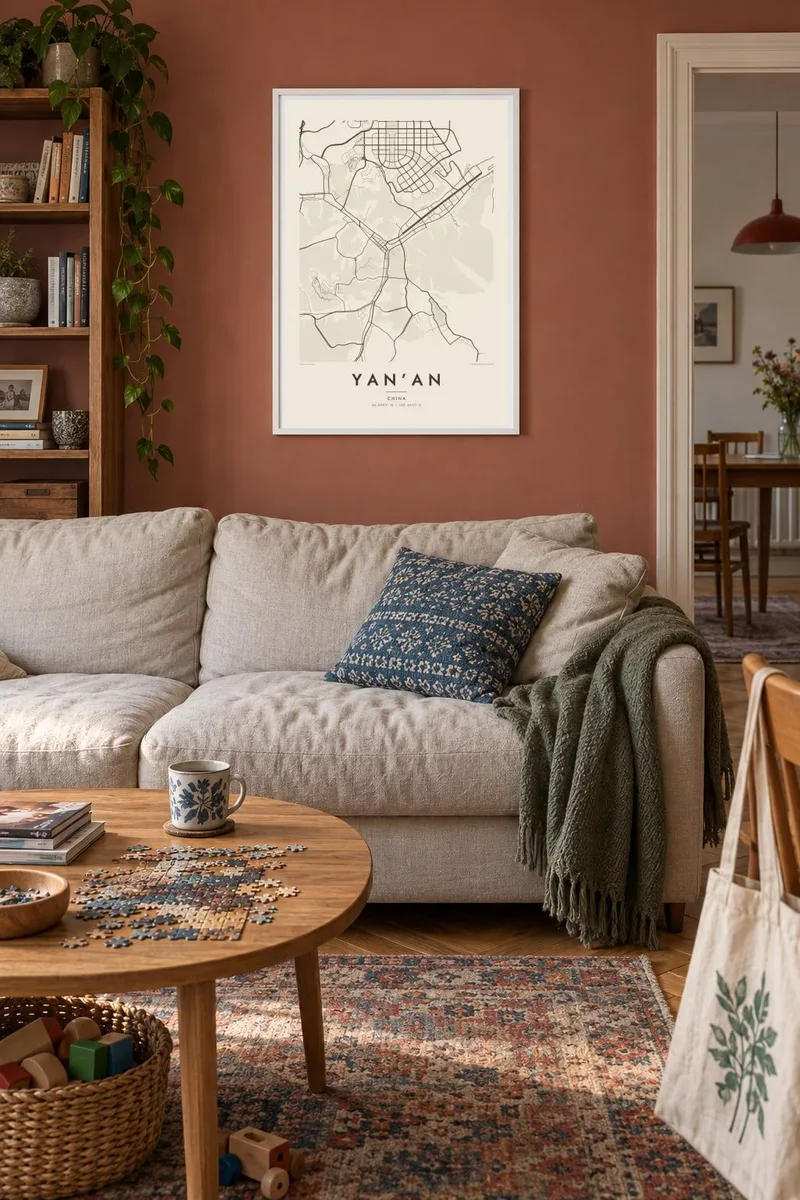
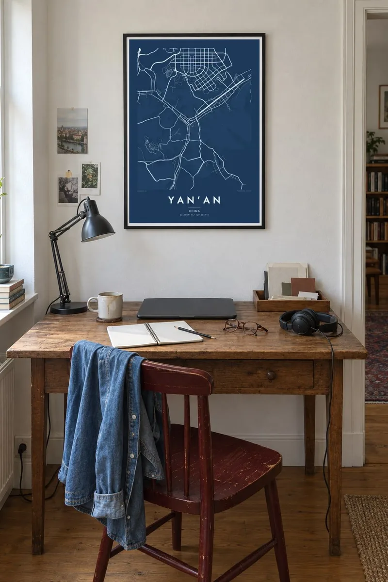
The Yan River meets a southern tributary near the centre, and the city arranges itself into a Y shape around the junction, with bridges gathering at the meeting point.
Minimalist map poster · China
36.5989° N / 109.4917° E
A city pulled into long river valleys, its streets tracing the Yan River between steep terraces of loess.

One city, five moods
Tap a style to see it on the wall. Every style costs the same — printed, framed or as HD files.
 Actual pixels · 24 × 36″ print file
Print-sharp
This is a 100% crop of the real print file. Every poster — printed, framed or downloaded — is rendered on our servers at 300 DPI, up to 7,200 × 10,800 pixels, so even the smallest lanes stay crisp on a 24 × 36″ print.
On the wall

The map
Yan’an does not spread out so much as follow its rivers. Seen from above, the city is a set of narrow strips squeezed into the valleys of the Yan River and its tributaries, with the loess plateau rising on every side. Roads run parallel to the water, bridges stitch the two banks together, and the built area thins into branching gullies wherever the hills close in.
Those hills give the map its texture. The loess of northern Shaanxi is cut into ridges, terraces and ravines, and for centuries people dug cave homes, known as yaodong, straight into the slopes. On a street map the effect is a city of thin, winding lines hemmed in by blank high ground, quite unlike the flat grids of eastern China.
Yan’an is best known as the base of the Chinese Communist Party from 1937 to 1947, following the Long March, and Pagoda Hill with its old pagoda above the river remains the city’s emblem. A Yan’an map poster captures that setting in black and white: the confluence, the valley roads and the hills that shaped both.
The Yan River meets a southern tributary near the centre, and the city arranges itself into a Y shape around the junction, with bridges gathering at the meeting point.
A steep hill crowned by an old brick pagoda, Baota Shan rises directly above the river and appears on the map as a pocket of open ground inside the city.
Beyond the main valleys, side streets climb into narrow ravines cut through the loess, ending abruptly where the slopes turn too steep to build on.
Make it yours
Add a date, a name or a line of your own, switch style, size or orientation.
The free preview is low-resolution with a watermark. Prints and HD files are rendered at 300 DPI, up to 7,200 × 10,800 px, without a watermark.
Why Yan’an
For many visitors Yan’an is a place of history, but the map tells a quieter story about a city that had to fit itself into its landscape. The branching valleys make a striking composition, clear enough to read at a glance and detailed enough to reward a closer look.
You can set your own title, subtitle and coordinates line, perhaps the date of a visit or a family connection, and choose from five styles, from Classic black & white to Blueprint and Sand. Download the $9 HD files in six sizes or order a matte print, framed if you like.
Order the Yan’an poster| Print size | Resolution | Files |
|---|---|---|
| 30 × 40 cm11.8 × 15.7″ | 3,543 × 4,724 px | PNG · PDF |
| 29.7 × 42 cm (A3)11.7 × 16.5″ | 3,508 × 4,961 px | PNG · PDF |
| 42 × 59.4 cm (A2)16.5 × 23.4″ | 4,961 × 7,016 px | PNG · PDF |
| 45.7 × 61 cm18 × 24″ | 5,400 × 7,200 px | PNG · PDF |
| 50 × 70 cm19.7 × 27.6″ | 5,906 × 8,268 px | PNG · PDF |
| 61 × 91.4 cm24 × 36″ | 7,200 × 10,800 px | PNG · PDF |
For comparison, the free preview is 900 px wide, watermarked and meant for screens. The HD files have up to 8× the resolution in each direction and print cleanly at full poster size.
Pick a style at the top of the page, then choose Printed Poster — a size and, if you like, a frame — or Digital HD Files. Checkout takes one step, and your order page updates as soon as the payment goes through.
It is printed on premium 200 gsm matte paper in one of six sizes, from 30 × 40 cm to 24 × 36″. Printed posters start at $39, shipping included.
Yes. Choose a solid wood frame in black, white, natural oak or dark wood. It comes with shatterproof glazing and is ready to hang. Framed posters start at $99, shipping included.
Shipping is free to 60+ countries. Each poster is printed by the nearest of our print partners in 30+ countries and usually arrives in 3–7 business days. You can follow the status and tracking under My Orders. A few countries take 2–5 weeks, and where we don't ship yet, the site tells you before you pay.
Send us a photo within 14 days of delivery and we will reprint it for free or refund you.
Yes. In the editor on this page, change the title, the subtitle and the coordinates line to anything you like, and pick a style and size. Printed, framed and digital orders all use exactly your design.
For $9 you get 300 DPI PNG and print-ready PDF files in all six sizes, without a watermark, to print anywhere. Not sure yet? Download a free watermarked preview first.
Nearby
