Plateau-top grid
Xifeng's streets spread across the level surface of the tableland, forming a compact grid bounded on several sides by suddenly steep ground.
Minimalist map poster · China
35.7098° N / 107.6445° E
A city on the loess tablelands of eastern Gansu, where flat plateau tops are carved by deep, branching gullies.

One city, five moods
Tap a style to see it on the wall. Every style costs the same — printed, framed or as HD files.
 Actual pixels · 24 × 36″ print file
Print-sharp
This is a 100% crop of the real print file. Every poster — printed, framed or downloaded — is rendered on our servers at 300 DPI, up to 7,200 × 10,800 pixels, so even the smallest lanes stay crisp on a 24 × 36″ print.
On the wall
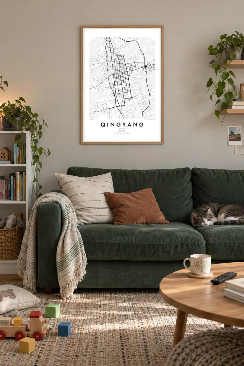


The map
Qingyang lies in the east of Gansu province on the Loess Plateau, one of the most distinctive landscapes in China. Wind-blown soil has built up here over very long periods and has been cut by water into flat-topped tablelands separated by steep ravines. The urban centre, Xifeng, occupies one of these high, level surfaces, so the city is shaped by the edges of the land itself.
The Dongzhi tableland on which Xifeng stands is often described as among the largest loess tablelands in the world. On a map the streets fill the flat plateau in a fairly regular grid, then stop where the ground drops away into gullies that branch like the veins of a leaf toward the river valleys below.
The region is associated with traditional crafts such as embroidered sachets and paper-cutting, and with a long farming history on the loess. A Qingyang map poster renders the city at the meeting point of a planned grid and a landscape of erosion, a contrast that gives the print an unusually organic outline.
Xifeng's streets spread across the level surface of the tableland, forming a compact grid bounded on several sides by suddenly steep ground.
Deep ravines cut into the edges of the plateau, drawing fine, tree-like patterns that frame the city more strikingly than any ring road could.
Below the tablelands, rivers follow narrow valleys where roads and villages line up along the water, a lower, linear layer of the map.
Make it yours
Add a date, a name or a line of your own, switch style, size or orientation.
The free preview is low-resolution with a watermark. Prints and HD files are rendered at 300 DPI, up to 7,200 × 10,800 px, without a watermark.
Why Qingyang
For people from eastern Gansu, the loess landscape is inseparable from home. This map shows why: the city sits on its plateau almost like an island, and the ravines around it make the print feel closer to a landscape drawing than a street plan.
Personalise the title and subtitle in your own words and keep the coordinates line or edit it. Choose Classic black & white, Noir, Paper, Blueprint or Sand, and order a printed poster on matte paper or download the HD files in six sizes.
Order the Qingyang poster| Print size | Resolution | Files |
|---|---|---|
| 30 × 40 cm11.8 × 15.7″ | 3,543 × 4,724 px | PNG · PDF |
| 29.7 × 42 cm (A3)11.7 × 16.5″ | 3,508 × 4,961 px | PNG · PDF |
| 42 × 59.4 cm (A2)16.5 × 23.4″ | 4,961 × 7,016 px | PNG · PDF |
| 45.7 × 61 cm18 × 24″ | 5,400 × 7,200 px | PNG · PDF |
| 50 × 70 cm19.7 × 27.6″ | 5,906 × 8,268 px | PNG · PDF |
| 61 × 91.4 cm24 × 36″ | 7,200 × 10,800 px | PNG · PDF |
For comparison, the free preview is 900 px wide, watermarked and meant for screens. The HD files have up to 8× the resolution in each direction and print cleanly at full poster size.
Pick a style at the top of the page, then choose Printed Poster — a size and, if you like, a frame — or Digital HD Files. Checkout takes one step, and your order page updates as soon as the payment goes through.
It is printed on premium 200 gsm matte paper in one of six sizes, from 30 × 40 cm to 24 × 36″. Printed posters start at $39, shipping included.
Yes. Choose a solid wood frame in black, white, natural oak or dark wood. It comes with shatterproof glazing and is ready to hang. Framed posters start at $99, shipping included.
Shipping is free to 60+ countries. Each poster is printed by the nearest of our print partners in 30+ countries and usually arrives in 3–7 business days. You can follow the status and tracking under My Orders. A few countries take 2–5 weeks, and where we don't ship yet, the site tells you before you pay.
Send us a photo within 14 days of delivery and we will reprint it for free or refund you.
Yes. In the editor on this page, change the title, the subtitle and the coordinates line to anything you like, and pick a style and size. Printed, framed and digital orders all use exactly your design.
For $9 you get 300 DPI PNG and print-ready PDF files in all six sizes, without a watermark, to print anywhere. Not sure yet? Download a free watermarked preview first.
Nearby
