Ville Haute
The upper town sits on its promontory as a compact cluster of narrow streets, one of the best-preserved Renaissance ensembles in eastern France and the clearest shape on the map.
Minimalist map poster · France
48.7728° N / 5.1611° E
A Lorraine town split between a Renaissance upper town on its ridge and a lower town along the Ornain and its canal.

One city, five moods
Tap a style to see it on the wall. Every style costs the same — printed, framed or as HD files.
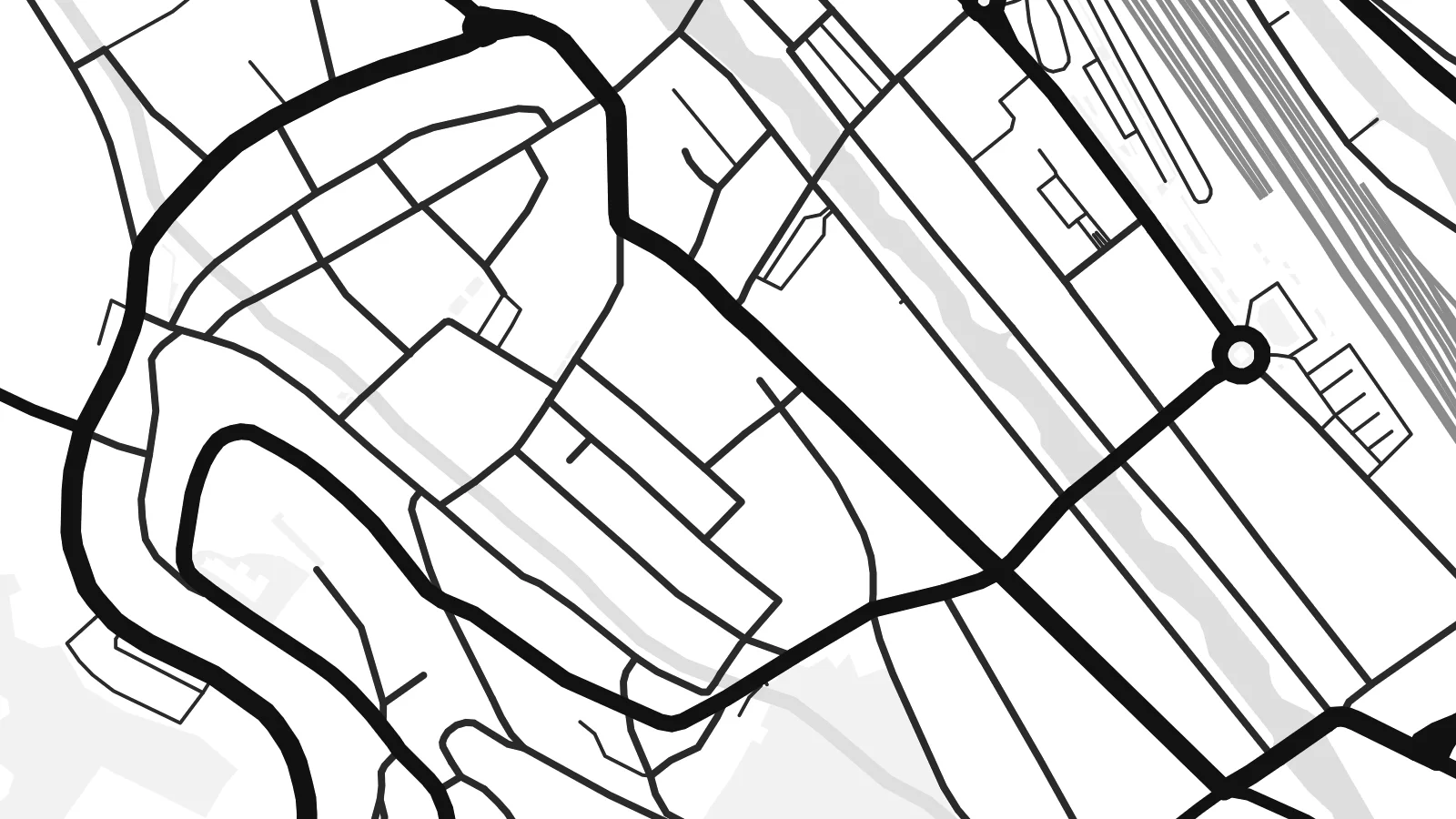 Actual pixels · 24 × 36″ print file
Print-sharp
This is a 100% crop of the real print file. Every poster — printed, framed or downloaded — is rendered on our servers at 300 DPI, up to 7,200 × 10,800 pixels, so even the smallest lanes stay crisp on a 24 × 36″ print.
On the wall


The map
Bar-le-Duc, prefecture of the Meuse department, is built on two levels. The Ville Haute occupies a promontory above the valley, with Renaissance mansions and the old castle quarter, while the Ville Basse spreads along the river Ornain below. The Marne–Rhine Canal runs through the lower town, so a map shows river and canal side by side, with the upper town perched above them.
Streets in the Ville Haute are narrow and closely packed, following the shape of the ridge, while the lower town has broader streets, squares and a railway along the valley. Bridges cross the Ornain at several points. Bar-le-Duc is where the Voie Sacrée began, the road that supplied Verdun during the First World War, and it is the birthplace of Raymond Poincaré.
A Bar-le-Duc map poster captures the contrast between those two towns, one tight and hilltop, the other linear and riverside, joined by steep lanes. The town is also known for its redcurrant jam, deseeded by hand with a goose quill in the traditional way, so it is remembered by food lovers as much as by historians.
The upper town sits on its promontory as a compact cluster of narrow streets, one of the best-preserved Renaissance ensembles in eastern France and the clearest shape on the map.
The river and the Marne–Rhine Canal run in parallel through the lower town, two long lines of water that give the valley its structure.
Several bridges cross the Ornain, connecting the neighbourhoods on each bank and drawing short strokes across the lower town's ribbon of streets.
Make it yours
Add a date, a name or a line of your own, switch style, size or orientation.
The free preview is low-resolution with a watermark. Prints and HD files are rendered at 300 DPI, up to 7,200 × 10,800 px, without a watermark.
Why Bar-le-Duc
Bar-le-Duc means different things to different people: family origins in the Meuse, a posting or study year, a link to Verdun and the First World War, or simply the view from the upper town. The map brings all of these together in one steady image.
Personalise the title and subtitle, perhaps with a street in the Ville Haute or a family date, and choose Classic black & white, Noir, Paper, Blueprint or Sand. HD files cost $9, and printed posters on matte paper ship from partners in more than 30 countries.
Order the Bar-le-Duc poster| Print size | Resolution | Files |
|---|---|---|
| 30 × 40 cm11.8 × 15.7″ | 3,543 × 4,724 px | PNG · PDF |
| 29.7 × 42 cm (A3)11.7 × 16.5″ | 3,508 × 4,961 px | PNG · PDF |
| 42 × 59.4 cm (A2)16.5 × 23.4″ | 4,961 × 7,016 px | PNG · PDF |
| 45.7 × 61 cm18 × 24″ | 5,400 × 7,200 px | PNG · PDF |
| 50 × 70 cm19.7 × 27.6″ | 5,906 × 8,268 px | PNG · PDF |
| 61 × 91.4 cm24 × 36″ | 7,200 × 10,800 px | PNG · PDF |
For comparison, the free preview is 900 px wide, watermarked and meant for screens. The HD files have up to 8× the resolution in each direction and print cleanly at full poster size.
Pick a style at the top of the page, then choose Printed Poster — a size and, if you like, a frame — or Digital HD Files. Checkout takes one step, and your order page updates as soon as the payment goes through.
It is printed on premium 200 gsm matte paper in one of six sizes, from 30 × 40 cm to 24 × 36″. Printed posters start at $39, shipping included.
Yes. Choose a solid wood frame in black, white, natural oak or dark wood. It comes with shatterproof glazing and is ready to hang. Framed posters start at $99, shipping included.
Shipping is free to 60+ countries. Each poster is printed by the nearest of our print partners in 30+ countries and usually arrives in 3–7 business days. You can follow the status and tracking under My Orders. A few countries take 2–5 weeks, and where we don't ship yet, the site tells you before you pay.
Send us a photo within 14 days of delivery and we will reprint it for free or refund you.
Yes. In the editor on this page, change the title, the subtitle and the coordinates line to anything you like, and pick a style and size. Printed, framed and digital orders all use exactly your design.
For $9 you get 300 DPI PNG and print-ready PDF files in all six sizes, without a watermark, to print anywhere. Not sure yet? Download a free watermarked preview first.
Nearby
