Planned superblocks
Housing estates are organised into large, orderly blocks separated by wide avenues. On the map they form a rhythmic pattern of rectangles and courtyards, very different from Istanbul's older neighbourhoods.
Minimalist map poster · Turkey
41.1060° N / 28.7910° E
A planned district of wide boulevards, apartment towers and new parks rising on open land at Istanbul's north-western edge.

One city, five moods
Tap a style to see it on the wall. Every style costs the same — printed, framed or as HD files.
 Actual pixels · 24 × 36″ print file
Print-sharp
This is a 100% crop of the real print file. Every poster — printed, framed or downloaded — is rendered on our servers at 300 DPI, up to 7,200 × 10,800 pixels, so even the smallest lanes stay crisp on a 24 × 36″ print.
On the wall


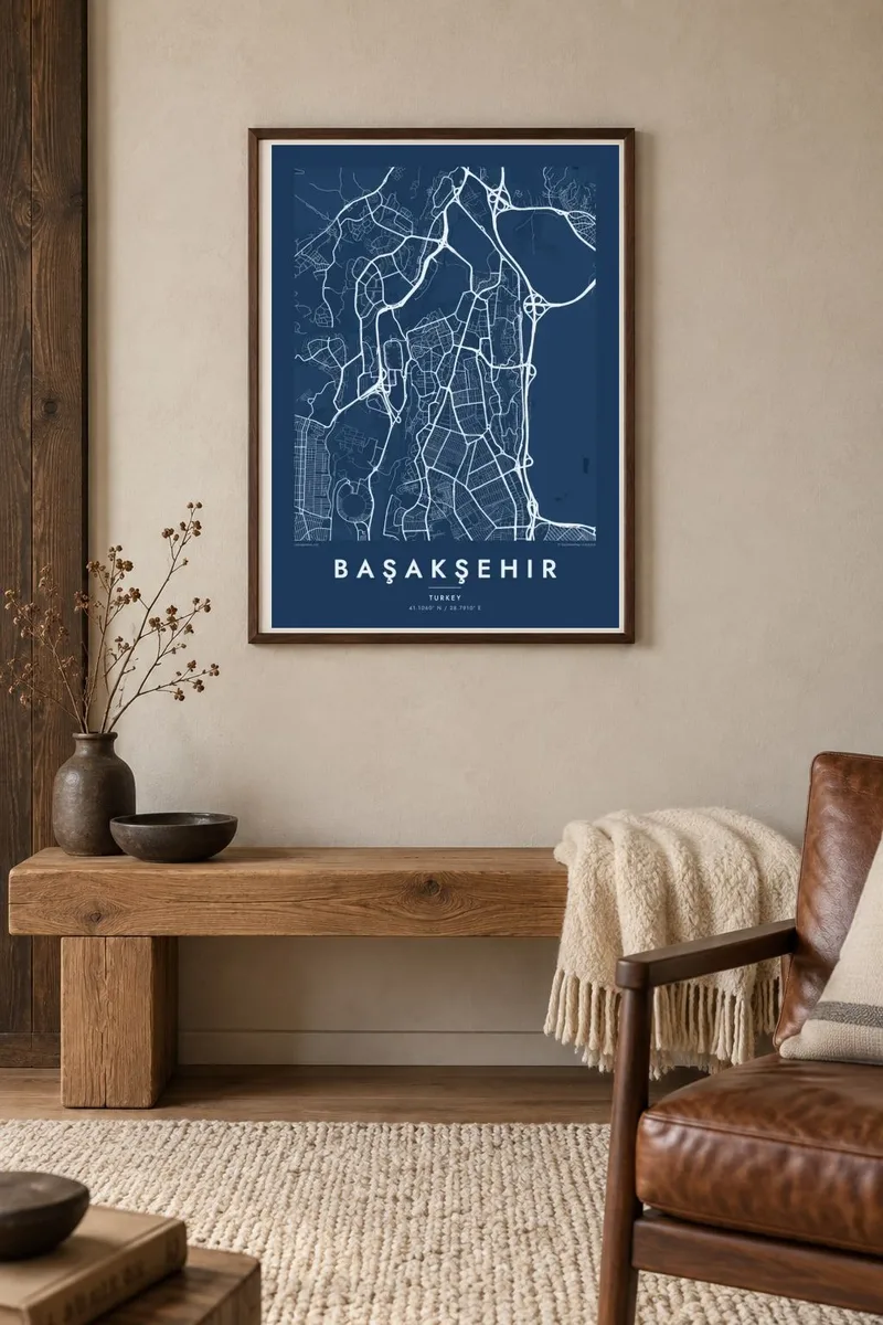
The map
Başakşehir lies on the European side of Istanbul, well inland from the Bosphorus and the Sea of Marmara, on rolling ground that was largely open land a generation ago. From above it looks very different from the old city: long, straight avenues, large superblocks of housing estates and generous green spaces laid out in a single planning effort. Motorways frame the district and link it to the rest of the metropolis.
Başakşehir became a separate district in 2008 and grew rapidly around mass housing projects. It now contains one of the largest hospital complexes in Turkey, the Başakşehir City Hospital, and its football club plays at the Fatih Terim Stadium. To the north, the reservoir of the Sazlıdere Dam adds a large body of water to an otherwise urban map.
A Başakşehir map poster captures a district designed on the drawing board: regular grids of towers, curved access roads, large parks and the sweep of motorway interchanges. Printed in black and white, its clean geometry makes a striking, modern composition that is quite unlike the maze of historic Istanbul.
Housing estates are organised into large, orderly blocks separated by wide avenues. On the map they form a rhythmic pattern of rectangles and courtyards, very different from Istanbul's older neighbourhoods.
The dam reservoir to the north spreads its branching arms across the landscape. It gives the poster a strong, organic shape beside the district's straight lines.
Major highways loop around the district, their curved ramps and junctions drawn as sweeping lines. They show how Başakşehir is stitched into the rest of Istanbul.
Make it yours
Add a date, a name or a line of your own, switch style, size or orientation.
The free preview is low-resolution with a watermark. Prints and HD files are rendered at 300 DPI, up to 7,200 × 10,800 px, without a watermark.
Why Başakşehir
Many families moved to Başakşehir for a new home, a first apartment or a job at the hospital, and the district is still young enough that its map feels personal. It makes a clean, contemporary print that matches modern interiors.
Add a title, subtitle and coordinates line to mark a specific street or the year you moved in, and choose one of five styles: Classic black & white, Noir, Paper, Blueprint or Sand. Blueprint emphasises the planned geometry especially well.
Order the Başakşehir poster| Print size | Resolution | Files |
|---|---|---|
| 30 × 40 cm11.8 × 15.7″ | 3,543 × 4,724 px | PNG · PDF |
| 29.7 × 42 cm (A3)11.7 × 16.5″ | 3,508 × 4,961 px | PNG · PDF |
| 42 × 59.4 cm (A2)16.5 × 23.4″ | 4,961 × 7,016 px | PNG · PDF |
| 45.7 × 61 cm18 × 24″ | 5,400 × 7,200 px | PNG · PDF |
| 50 × 70 cm19.7 × 27.6″ | 5,906 × 8,268 px | PNG · PDF |
| 61 × 91.4 cm24 × 36″ | 7,200 × 10,800 px | PNG · PDF |
For comparison, the free preview is 900 px wide, watermarked and meant for screens. The HD files have up to 8× the resolution in each direction and print cleanly at full poster size.
Pick a style at the top of the page, then choose Printed Poster — a size and, if you like, a frame — or Digital HD Files. Checkout takes one step, and your order page updates as soon as the payment goes through.
It is printed on premium 200 gsm matte paper in one of six sizes, from 30 × 40 cm to 24 × 36″. Printed posters start at $39, shipping included.
Yes. Choose a solid wood frame in black, white, natural oak or dark wood. It comes with shatterproof glazing and is ready to hang. Framed posters start at $99, shipping included.
Shipping is free to 60+ countries. Each poster is printed by the nearest of our print partners in 30+ countries and usually arrives in 3–7 business days. You can follow the status and tracking under My Orders. A few countries take 2–5 weeks, and where we don't ship yet, the site tells you before you pay.
Send us a photo within 14 days of delivery and we will reprint it for free or refund you.
Yes. In the editor on this page, change the title, the subtitle and the coordinates line to anything you like, and pick a style and size. Printed, framed and digital orders all use exactly your design.
For $9 you get 300 DPI PNG and print-ready PDF files in all six sizes, without a watermark, to print anywhere. Not sure yet? Download a free watermarked preview first.
Nearby
