Braided river channels
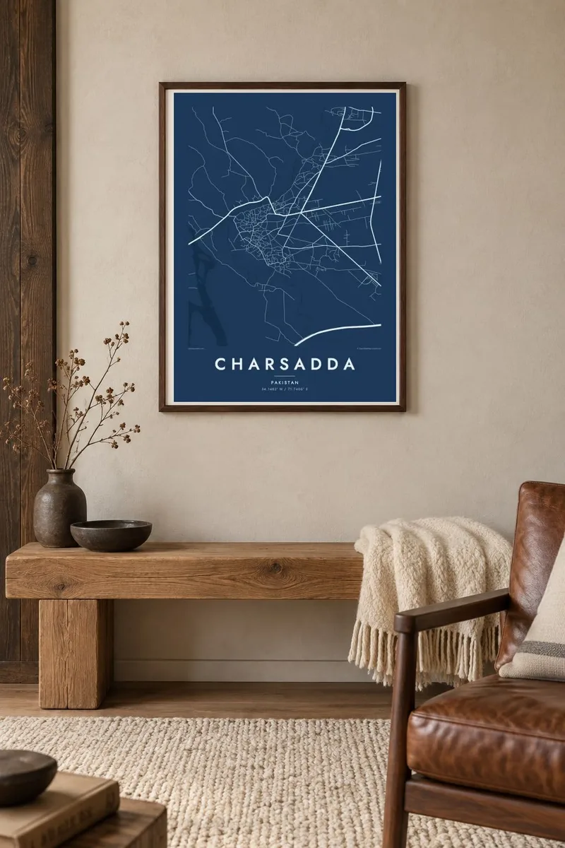
The Swat River and its branches wander across the plain in loose, parallel curves. They give the map a sense of movement that contrasts with the dense centre of the town.
Minimalist map poster · Pakistan
34.1482° N / 71.7406° E
A market town on the fertile Peshawar valley floor, crossed by irrigation channels and the braided arms of the Swat River

One city, five moods
Tap a style to see it on the wall. Every style costs the same — printed, framed or as HD files.
 Actual pixels · 24 × 36″ print file
Print-sharp
This is a 100% crop of the real print file. Every poster — printed, framed or downloaded — is rendered on our servers at 300 DPI, up to 7,200 × 10,800 pixels, so even the smallest lanes stay crisp on a 24 × 36″ print.
On the wall


The map
Charsadda lies northeast of Peshawar on the broad alluvial plain where the Swat and Kabul rivers split into several channels before they join. On a map the town is a compact core of close-packed streets surrounded by fields, canals and clusters of villages. This is some of the most productive farmland in the province, and its irrigated plots give the edges of the map a finely divided texture.
The area is very old. Just outside the modern town are the mounds of Pushkalavati, an ancient capital of Gandhara that appears in classical sources and was excavated during the twentieth century. Roads and markets shaped the present town more than any plan did. Its main streets converge on a central bazaar and branch outward toward nearby villages and the route to Peshawar.
A Charsadda map poster is less about monuments than about how a town relates to its rivers. The water channels curve in wide arcs, the roads run straight across the plain, and the settlement sits where the two systems meet. In a minimalist print, that interplay of straight lines and curves becomes the main subject, calm and easy to read on the wall.
The Swat River and its branches wander across the plain in loose, parallel curves. They give the map a sense of movement that contrasts with the dense centre of the town.
The oldest part of town reads as a tight knot of short, irregular streets where the main roads meet. It is the densest patch of line on the whole sheet.
The Bala Hisar mound of Pushkalavati lies near the town, a reminder that people have lived here for more than two thousand years, back to the Gandhara period.
Make it yours
Add a date, a name or a line of your own, switch style, size or orientation.
The free preview is low-resolution with a watermark. Prints and HD files are rendered at 300 DPI, up to 7,200 × 10,800 px, without a watermark.
Why Charsadda
Many people with roots in Charsadda now live far from it, and a map keeps its streets and rivers in view. It suits a family home or an office, or makes a gift for someone who grew up among these fields and canals.
Each poster can carry a personal title, subtitle and coordinates, such as a family name or a meaningful year. Choose Classic black & white, Noir, Paper, Blueprint or Sand, then download 300 DPI files for $9 or order a printed poster on matte paper.
Order the Charsadda poster| Print size | Resolution | Files |
|---|---|---|
| 30 × 40 cm11.8 × 15.7″ | 3,543 × 4,724 px | PNG · PDF |
| 29.7 × 42 cm (A3)11.7 × 16.5″ | 3,508 × 4,961 px | PNG · PDF |
| 42 × 59.4 cm (A2)16.5 × 23.4″ | 4,961 × 7,016 px | PNG · PDF |
| 45.7 × 61 cm18 × 24″ | 5,400 × 7,200 px | PNG · PDF |
| 50 × 70 cm19.7 × 27.6″ | 5,906 × 8,268 px | PNG · PDF |
| 61 × 91.4 cm24 × 36″ | 7,200 × 10,800 px | PNG · PDF |
For comparison, the free preview is 900 px wide, watermarked and meant for screens. The HD files have up to 8× the resolution in each direction and print cleanly at full poster size.
Pick a style at the top of the page, then choose Printed Poster — a size and, if you like, a frame — or Digital HD Files. Checkout takes one step, and your order page updates as soon as the payment goes through.
It is printed on premium 200 gsm matte paper in one of six sizes, from 30 × 40 cm to 24 × 36″. Printed posters start at $39, shipping included.
Yes. Choose a solid wood frame in black, white, natural oak or dark wood. It comes with shatterproof glazing and is ready to hang. Framed posters start at $99, shipping included.
Shipping is free to 60+ countries. Each poster is printed by the nearest of our print partners in 30+ countries and usually arrives in 3–7 business days. You can follow the status and tracking under My Orders. A few countries take 2–5 weeks, and where we don't ship yet, the site tells you before you pay.
Send us a photo within 14 days of delivery and we will reprint it for free or refund you.
Yes. In the editor on this page, change the title, the subtitle and the coordinates line to anything you like, and pick a style and size. Printed, framed and digital orders all use exactly your design.
For $9 you get 300 DPI PNG and print-ready PDF files in all six sizes, without a watermark, to print anywhere. Not sure yet? Download a free watermarked preview first.
Nearby
