The hill fort
The fort's walls climb the boulder-covered hill in successive rings. On the poster the hill is a broad open shape with only a few paths, which sets it clearly apart from the town below.
Minimalist map poster · India
A town wrapped around a granite hill fort, where boulder-strewn slopes and rings of stone walls push the streets outward.
14.2226° N / 76.4004° E




One city, five moods
Tap a style to see it on the wall. Every style is included in the same $9 price.
 Actual pixels · 24 × 36″ HD file
Print-sharp
This is a crop of the real HD file at 100%. The paid download is rendered on our servers at 300 DPI, up to 7,200 × 10,800 pixels, so even the smallest lanes stay crisp on a 24 × 36″ print.
The map
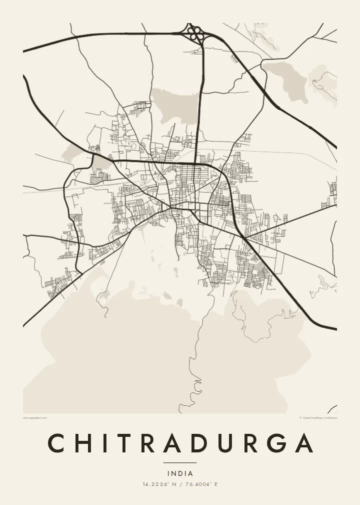
Chitradurga, a district headquarters in central Karnataka, grew at the foot of a rocky hill covered in enormous granite boulders. Crowning it is Chitradurga Fort, a stone fortress built up over several centuries and strengthened by the Nayaka rulers of the region. On a map the fort shows as a large, nearly empty area of hillside, with the town's streets crowded tightly around its lower edge.
The fort is known locally as Elu Suttina Kote, the fort of seven rounds, after its concentric lines of walls. One of the town's best-known stories concerns Onake Obavva, a woman remembered for defending a gap in the walls with a wooden pestle during a siege in the eighteenth century. The national highway between Bengaluru and Pune passes close to the town.
A Chitradurga map poster brings out an unusual composition. Where most towns have a dense centre, this one has a hollow of rock and ramparts surrounded by streets. In black and white the contrast is sharp: dense lanes on one side, the pale mass of the hill on the other, and the lines of fortification between them.
The fort's walls climb the boulder-covered hill in successive rings. On the poster the hill is a broad open shape with only a few paths, which sets it clearly apart from the town below.
The streets closest to the fort are narrow and irregular, following the curve of the hill's base. They are the most densely drawn part of the map.
The main highway runs past the town as a long, straight line. Its rigid course contrasts with the curving streets and the rough outline of the hill.
Make it yours
Add a date, a name or a line of your own, switch style, size or orientation.
Free preview is low-resolution with a watermark. The HD version is 7,200 × 10,800 px, 300 DPI, no watermark.
Why Chitradurga
Chitradurga is a strong choice for anyone with roots in the district, or for travellers who climbed the fort and remember the view over the rooftops. It reads well at larger sizes, where the rings of walls and the dense old streets have room to show.
The title, subtitle and coordinates line can all be changed, so the poster can name a family home, a college year or a special date. Choose one of five styles: Classic black & white, Noir, Paper, Blueprint or Sand. Noir makes the pale hill stand out especially clearly.
Get the Chitradurga poster — $9| Print size | Resolution | Files |
|---|---|---|
| 30 × 40 cm | 3,543 × 4,724 px | PNG · PDF |
| 50 × 70 cm | 5,906 × 8,268 px | PNG · PDF |
| A3 · 29.7 × 42 cm | 3,508 × 4,961 px | PNG · PDF |
| A2 · 42 × 59.4 cm | 4,961 × 7,016 px | PNG · PDF |
| 18 × 24" | 5,400 × 7,200 px | PNG · PDF |
| 24 × 36" | 7,200 × 10,800 px | PNG · PDF |
For comparison, the free preview is 900 px wide, watermarked and meant for screens. The HD files have up to 8× the resolution in each direction and print cleanly at full poster size.
Yes. Drag and zoom the map in the editor — centre it on your neighbourhood, the old town or the whole metro area. The text updates independently.
The HD purchase includes 30×40 cm, 50×70 cm, A3, A2, 18×24″ and 24×36″, each as a 300 DPI PNG and a print-ready PDF.
You can download a free 900 px preview with a watermark. The paid HD files have no watermark and are sharp enough for large prints.
Send the PDF to any local print shop or online printing service and ask for the matching paper size. Matte paper and a thin black or oak frame suit this style best.
Nearby
