Castle on the hill
The fortress sits on a rise at the northeast edge of the old town. Its irregular walls and bastions draw a strong, angular outline above the smaller-grained streets below.
Minimalist map poster · Hungary
47.9027° N / 20.3733° E
A castle hill, a creek threading a baroque centre, and vineyard slopes folding into the Bükk foothills on every side.

One city, five moods
Tap a style to see it on the wall. Every style costs the same — printed, framed or as HD files.
 Actual pixels · 24 × 36″ print file
Print-sharp
This is a 100% crop of the real print file. Every poster — printed, framed or downloaded — is rendered on our servers at 300 DPI, up to 7,200 × 10,800 pixels, so even the smallest lanes stay crisp on a 24 × 36″ print.
On the wall
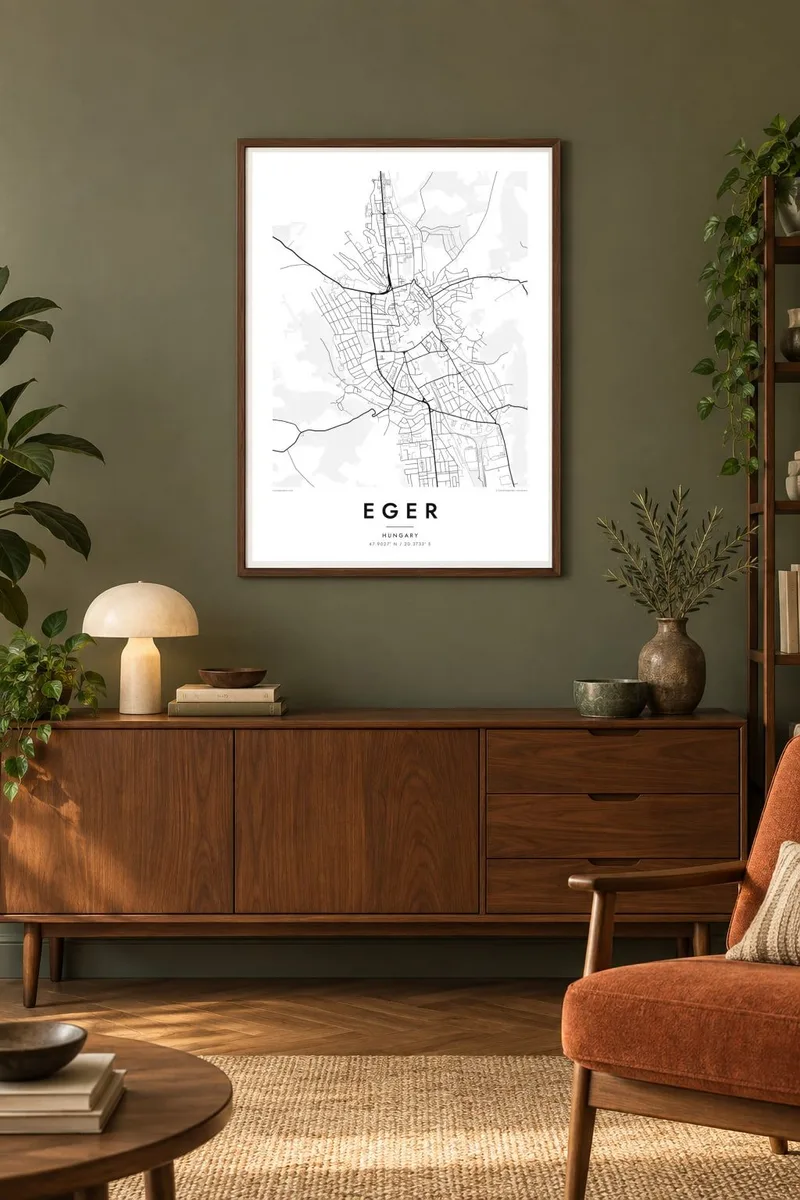


The map
Eger sits where the southern edge of the Bükk hills meets the Great Plain, and the map shows that meeting clearly. The Eger Creek runs north to south through the town, and the old centre is packed along its banks. Streets climb away from the water toward the castle on one side and the cathedral quarter on the other.
The castle is the town's best-known story. In 1552 István Dobó and a small garrison held it against a much larger Ottoman army, a siege that every Hungarian schoolchild learns about. Later the Ottomans did take the town, and a slender minaret from that period still stands, the northernmost surviving one in Europe. On paper the castle shows up as a compact walled mass above the rooftops.
An Eger map poster also picks up the wine country at the town's edge. To the southwest, the Valley of the Beautiful Women is lined with cellars cut into the soft tuff hillside, where the red blend known as Bull's Blood is poured. Beyond it, the lanes run out into vineyards, and the tight grid of the town gives way to the looser lines of the hills.
The fortress sits on a rise at the northeast edge of the old town. Its irregular walls and bastions draw a strong, angular outline above the smaller-grained streets below.
A narrow watercourse runs north to south through the centre. Most of the historic streets and squares line up along it, so it works as the spine of the whole map.
Southwest of the centre, a short valley is lined with wine cellars dug into the hillside. On the map it reads as a small, curving pocket of lanes set apart from the town grid.
Make it yours
Add a date, a name or a line of your own, switch style, size or orientation.
The free preview is low-resolution with a watermark. Prints and HD files are rendered at 300 DPI, up to 7,200 × 10,800 px, without a watermark.
Why Eger
People hang Eger for a student year, a wine trip or a family link to northern Hungary. The castle, the creek and the vineyard edge give the frame a clear focal point and a quiet sense of depth.
You can personalise the title, subtitle and coordinates line, for example with a date or a family name. Then choose one of five styles: Classic black & white, Noir, Paper, Blueprint or Sand. HD files cost $9, and printed posters ship from partners in more than 30 countries.
Order the Eger poster| Print size | Resolution | Files |
|---|---|---|
| 30 × 40 cm11.8 × 15.7″ | 3,543 × 4,724 px | PNG · PDF |
| 29.7 × 42 cm (A3)11.7 × 16.5″ | 3,508 × 4,961 px | PNG · PDF |
| 42 × 59.4 cm (A2)16.5 × 23.4″ | 4,961 × 7,016 px | PNG · PDF |
| 45.7 × 61 cm18 × 24″ | 5,400 × 7,200 px | PNG · PDF |
| 50 × 70 cm19.7 × 27.6″ | 5,906 × 8,268 px | PNG · PDF |
| 61 × 91.4 cm24 × 36″ | 7,200 × 10,800 px | PNG · PDF |
For comparison, the free preview is 900 px wide, watermarked and meant for screens. The HD files have up to 8× the resolution in each direction and print cleanly at full poster size.
Pick a style at the top of the page, then choose Printed Poster — a size and, if you like, a frame — or Digital HD Files. Checkout takes one step, and your order page updates as soon as the payment goes through.
It is printed on premium 200 gsm matte paper in one of six sizes, from 30 × 40 cm to 24 × 36″. Printed posters start at $39, shipping included.
Yes. Choose a solid wood frame in black, white, natural oak or dark wood. It comes with shatterproof glazing and is ready to hang. Framed posters start at $99, shipping included.
Shipping is free to 60+ countries. Each poster is printed by the nearest of our print partners in 30+ countries and usually arrives in 3–7 business days. You can follow the status and tracking under My Orders. A few countries take 2–5 weeks, and where we don't ship yet, the site tells you before you pay.
Send us a photo within 14 days of delivery and we will reprint it for free or refund you.
Yes. In the editor on this page, change the title, the subtitle and the coordinates line to anything you like, and pick a style and size. Printed, framed and digital orders all use exactly your design.
For $9 you get 300 DPI PNG and print-ready PDF files in all six sizes, without a watermark, to print anywhere. Not sure yet? Download a free watermarked preview first.
Nearby
