Harbour basins
Rectangular docks and long quays cut into the coast north of the centre, forming bold geometric shapes that dominate the upper part of the map.
Minimalist map poster · Poland
54.5189° N / 18.5319° E
A modernist port city on the Baltic, with long harbour basins, a seafront pier and wooded moraine hills rising behind it.

One city, five moods
Tap a style to see it on the wall. Every style costs the same — printed, framed or as HD files.
 Actual pixels · 24 × 36″ print file
Print-sharp
This is a 100% crop of the real print file. Every poster — printed, framed or downloaded — is rendered on our servers at 300 DPI, up to 7,200 × 10,800 pixels, so even the smallest lanes stay crisp on a 24 × 36″ print.
On the wall

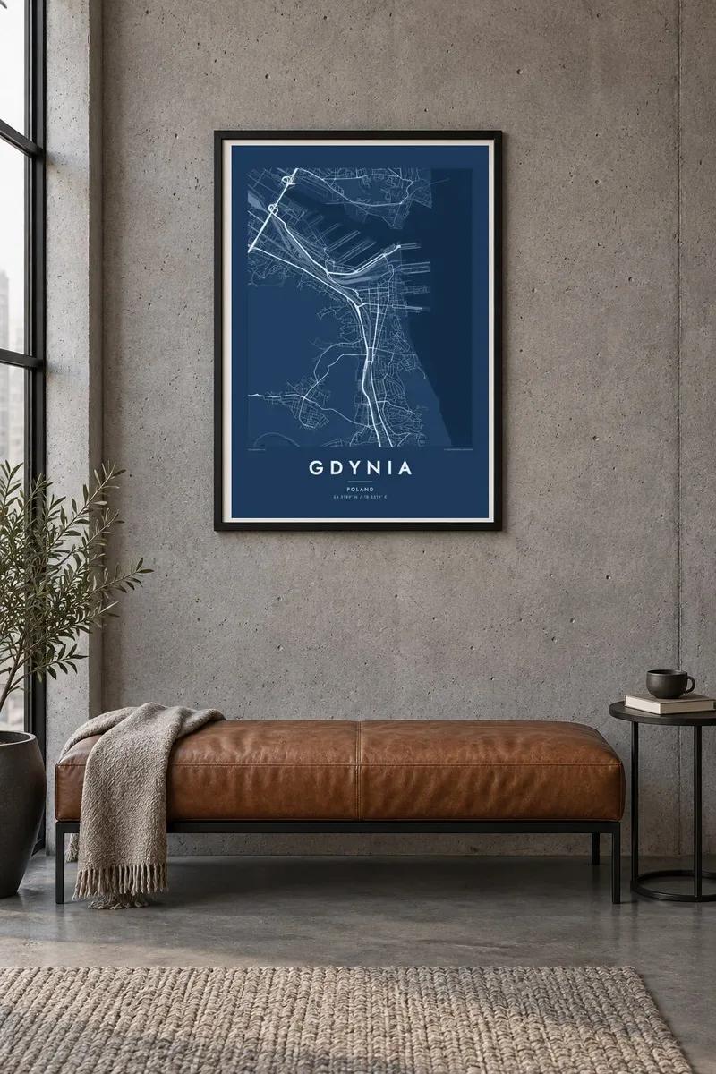
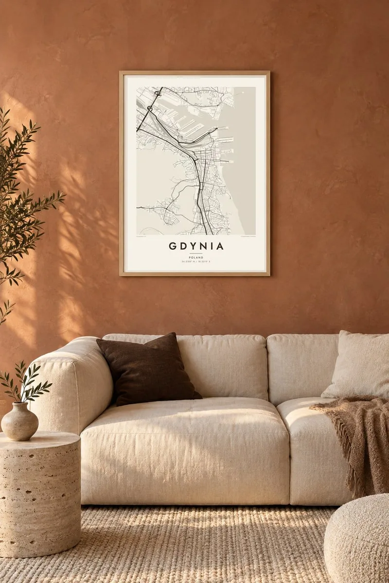
The map
Gdynia grew from a fishing village into Poland's main seaport in little more than a decade, after the government chose the site for a new harbour in the 1920s. That speed left a remarkably coherent modernist centre, with streets of white functionalist buildings set out between the railway station and the sea. It forms the Tricity with Sopot and Gdańsk on the Gulf of Gdańsk.
The port dominates the northern part of the map: long, straight basins and quays cut deep into the shore, producing some of the most geometric shapes on any Gdynia map poster. From the centre, Skwer Kościuszki leads out to a pier where the museum ships Dar Pomorza and Błyskawica are moored.
Behind the city, forested moraine hills rise steeply, and neighbourhoods such as Kamienna Góra climb their slopes. Much of the higher ground belongs to the Tricity Landscape Park, which appears as a large empty area on the map. The contrast between the flat, ordered port district and the wooded hills gives the city a strong double character.
Rectangular docks and long quays cut into the coast north of the centre, forming bold geometric shapes that dominate the upper part of the map.
The interwar downtown between the station and the sea follows a clear, planned street pattern, reflecting the city's rapid growth as a new port.
Skwer Kościuszki runs straight toward the water and continues onto a pier, a strong axis ending at the museum ships and open Baltic.
Make it yours
Add a date, a name or a line of your own, switch style, size or orientation.
The free preview is low-resolution with a watermark. Prints and HD files are rendered at 300 DPI, up to 7,200 × 10,800 px, without a watermark.
Why Gdynia
Gdynia is a symbol of interwar Poland and a place that many sailors, shipbuilders and families call home. Its map combines precise harbour geometry with green hills, making a crisp poster for anyone who loves the sea.
Personalise the title, subtitle and coordinates line, for example with a ship name or a family date, and pick one of five styles, with Blueprint suiting a port especially well. Choose the $9 digital files or a printed poster with an optional wooden frame.
Order the Gdynia poster| Print size | Resolution | Files |
|---|---|---|
| 30 × 40 cm11.8 × 15.7″ | 3,543 × 4,724 px | PNG · PDF |
| 29.7 × 42 cm (A3)11.7 × 16.5″ | 3,508 × 4,961 px | PNG · PDF |
| 42 × 59.4 cm (A2)16.5 × 23.4″ | 4,961 × 7,016 px | PNG · PDF |
| 45.7 × 61 cm18 × 24″ | 5,400 × 7,200 px | PNG · PDF |
| 50 × 70 cm19.7 × 27.6″ | 5,906 × 8,268 px | PNG · PDF |
| 61 × 91.4 cm24 × 36″ | 7,200 × 10,800 px | PNG · PDF |
For comparison, the free preview is 900 px wide, watermarked and meant for screens. The HD files have up to 8× the resolution in each direction and print cleanly at full poster size.
Pick a style at the top of the page, then choose Printed Poster — a size and, if you like, a frame — or Digital HD Files. Checkout takes one step, and your order page updates as soon as the payment goes through.
It is printed on premium 200 gsm matte paper in one of six sizes, from 30 × 40 cm to 24 × 36″. Printed posters start at $39, shipping included.
Yes. Choose a solid wood frame in black, white, natural oak or dark wood. It comes with shatterproof glazing and is ready to hang. Framed posters start at $99, shipping included.
Shipping is free to 60+ countries. Each poster is printed by the nearest of our print partners in 30+ countries and usually arrives in 3–7 business days. You can follow the status and tracking under My Orders. A few countries take 2–5 weeks, and where we don't ship yet, the site tells you before you pay.
Send us a photo within 14 days of delivery and we will reprint it for free or refund you.
Yes. In the editor on this page, change the title, the subtitle and the coordinates line to anything you like, and pick a style and size. Printed, framed and digital orders all use exactly your design.
For $9 you get 300 DPI PNG and print-ready PDF files in all six sizes, without a watermark, to print anywhere. Not sure yet? Download a free watermarked preview first.
Nearby
